
Good Morning! Two big stories –HEAT ADVISORY and GULF Tropical concerns highlight this Blog update. Dangerous Heat indices through least 105-110 again. Meanwhile, PM storms will be few and far between at least through today. The Future of INVEST 97-L is very much an open question. That’s because we don’t have a well defined system yet. We’ll likely see a Tropical Depression or Tropical storm in the Gulf by the weekend. Possibly as early as Saturday. Much more details in the Blog, Here’s my brief forecast discussion.
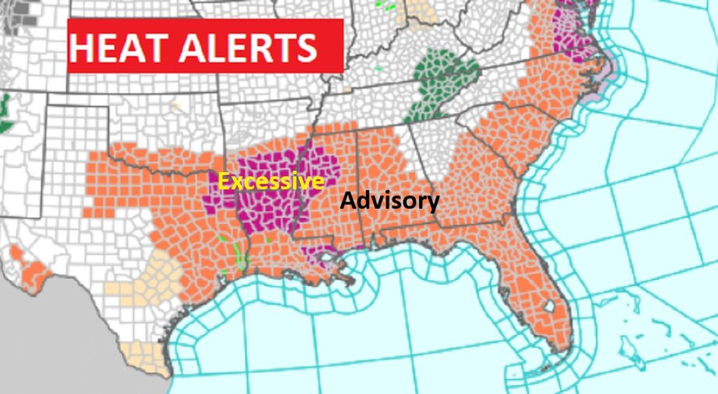
TODAY: HEAT ADVISORY, again. Mostly sunny. Random storms will be few and far between. Isolated. High today 98. Heat index 105 to 110. Light wind. Very muddy and warm tonight. Low 77
.
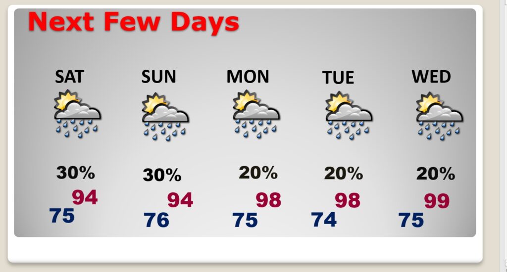
NEXT FEW DAYS: Extreme heat continues. Highs in the mid to upper 90’s will continue. Even lows at night will be in oppressive mid and upper 70.s. Meanwhile, PM storms will be widely scattered. Not much change in the extreme heat through Tuesday. PLUS, we’ll be watching the Gulf. BUT, hopefully Invest 97-L , future Debby will likely curve away from us after it gets in the Gulf. But that’s not a done deal, Stay tuned Mofe below,
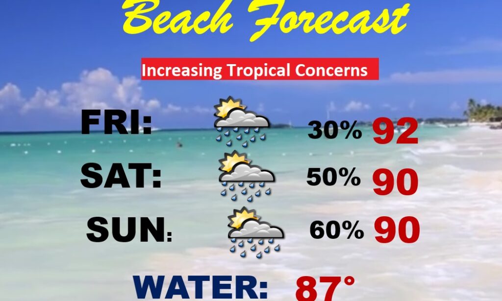
BEACH OUTLOOK: Looking fairly routine. Spotty random mainly PM storms. Highs 90-92. Lows at night near 80. However, watching the Gulf more closely starting Monday and through next week. Stay tuned.
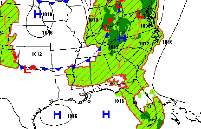
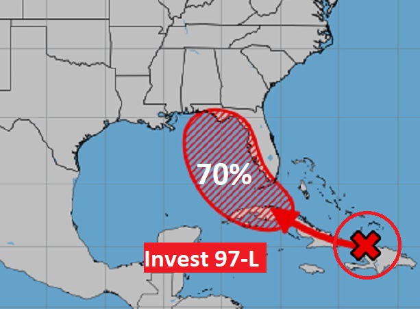
TROPICAL: All eyes onINVEST 97-L (Future Debby)., now located between Hispaniola and Cuba. Computer model tracks take this system to the Gulf where it could be a Depression or Tropical Storm as early as Saturday. The first Air Force and NOAA Recon aircraft will be in the system today. NHC now giving this system a 70-80% chance of development.
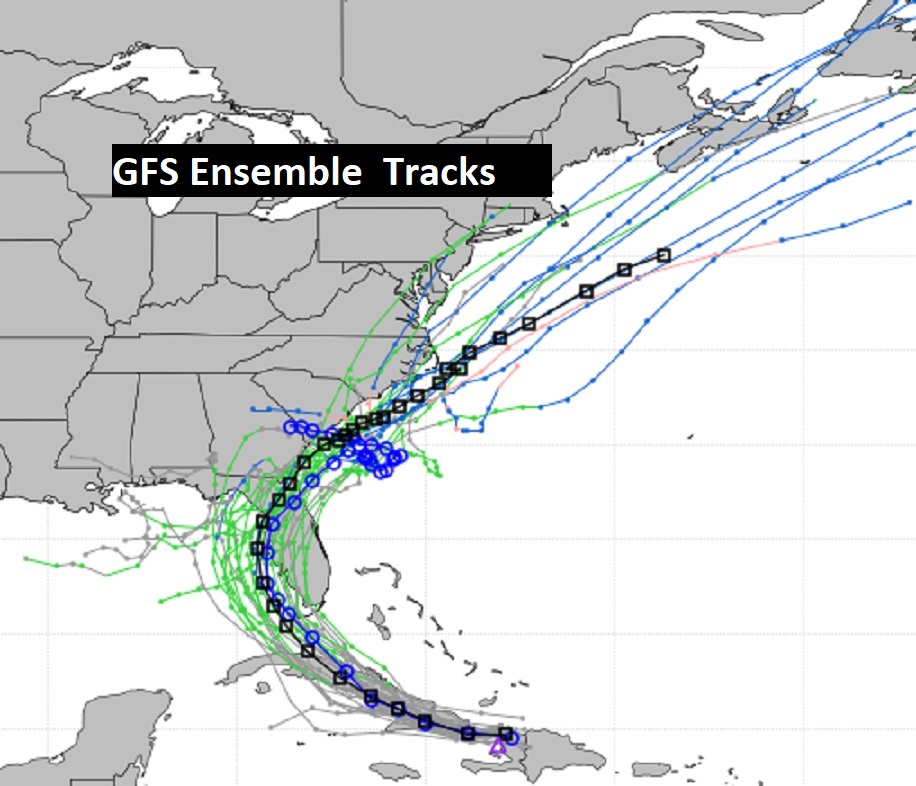
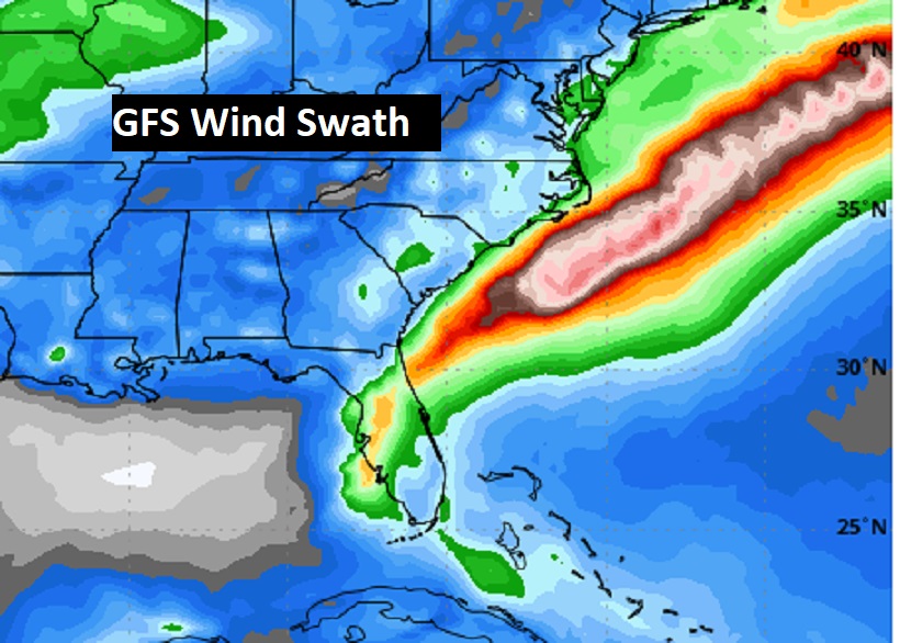
Then what? This system will be entering warm bath water (88 to 90 degrees), where upper level winds are light and favorable for a quickly developing system. As you can see from the GFS Ensembles, Future Debby SHOULD make a curve across north Florida and along the East US coast where it is likely to be a hurricane. Perhaps a major hurricane.
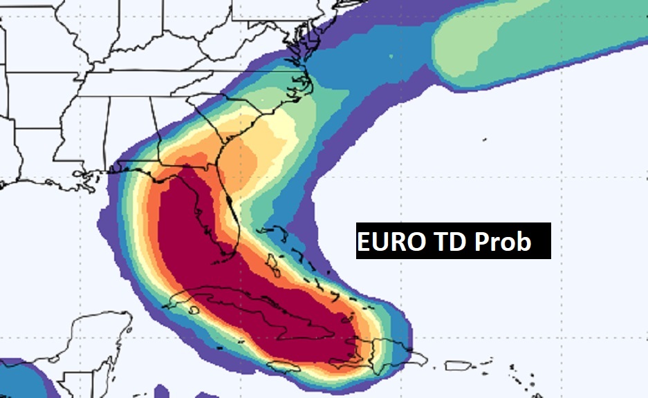
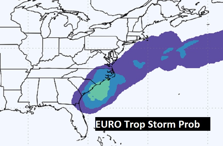
Here’s two maps from the EURO, One showing the probability of at least a depression. The other showing Tropical Storm potential development. But, Tropical Storm status could occur much quicker.
There are so many unknowns until we get more data from RECON missions. The Air Force will depart Biloxi at 9:30 AM this morning. Here is the GFS wind swath.
Thanks for reading the blog. There will be another Blog update in the tomorrow morning. Due to health issues, I’m still on the sidelines COVID quarantine, Have a nice day!
–Rich