
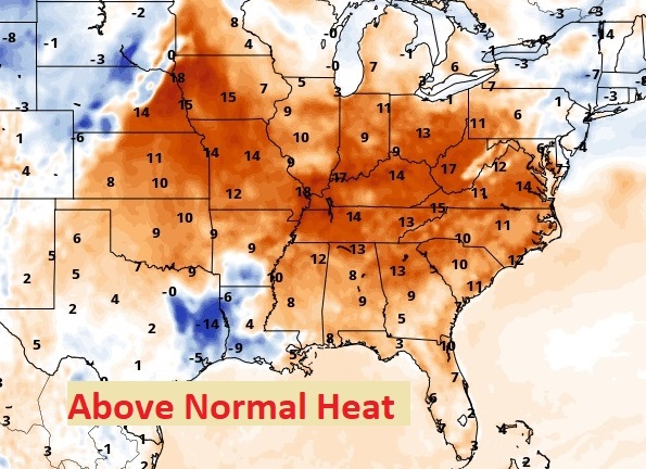
Good Morning! Mid-summer heat and humidity dominates the forecast through the Labor Day weekend. Yesterday’s high was 100 with a heat Index of 105. Today will be similar. Meanwhile, spotty, scattered random PM storms will be back on the radar each day through the weekend. Storms will be few and far between today, but perhaps a little more numerous by Monday & Tuesday. Here’s my brief forecast discussion.
TODAY: Mostly sunny, hot and humid. High near 98. Heat index 102-105. Scattered random pop-up storms in the afternoon & evening. Light wind. Mostly clear. Low tonight 74.
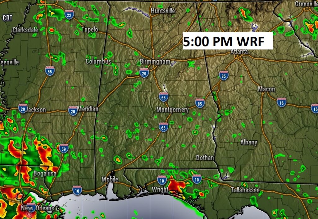
FUTURE RADAR suggests a few isolated to widely scattered showers and storms may finally populate the radar today,
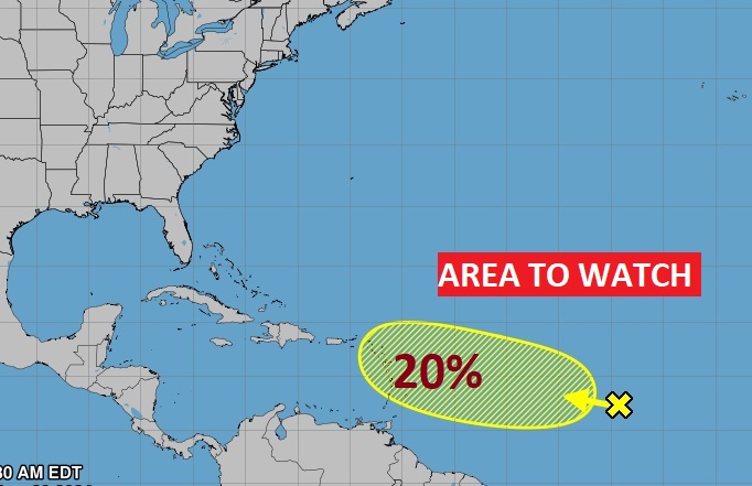
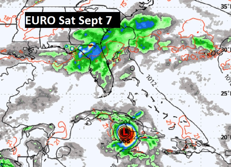
. TROPICAL: NHC is still tracking that Area to Watch in the tropical Allantoic, with a low chance of development in the next 7 days.
Here’s the EURO Probabilities through Day 10 for Tropical Development. We’ll be watching to Caribbean.

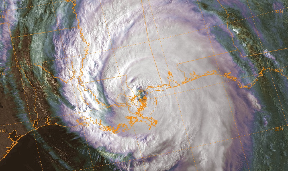
ON THIS DATE: This is the day that large Cat 3 Hurricane Katrina came ashore on the Louisiana Gulf coast 19 years ago. At 6:10 a.m. Central Daylight Time (CDT), the center of Katrina made landfall in Plaquemines Parish, LA, just south of Buras, as a Category 3 hurricane with estimated maximum sustained winds near 125 mph and a minimum central pressure of 6 Page 16 920 mb. It was the next day the levees in New Orleans failed causing extreme flooding. Hurricane Katrina resulted in over 1,390 deaths, making it one of the deadliest hurricanes in U.S. history. Hundreds of thousands of people were displaced from their homes due to the hurricane and subsequent flooding, leading to one of the largest internal displacements in U.S. history.
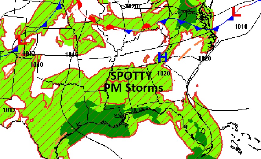
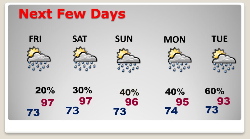
NEXT FEW DAYS: Hot and Humid through the Labor Day weekend. The Heat index will be in the 100 to 105 range for the rest of the week. Spotty random, scattered storms are back in the forecast through the Holiday weekend. The best chance of random storms will be Labor Day Monday and Tuesday.
=
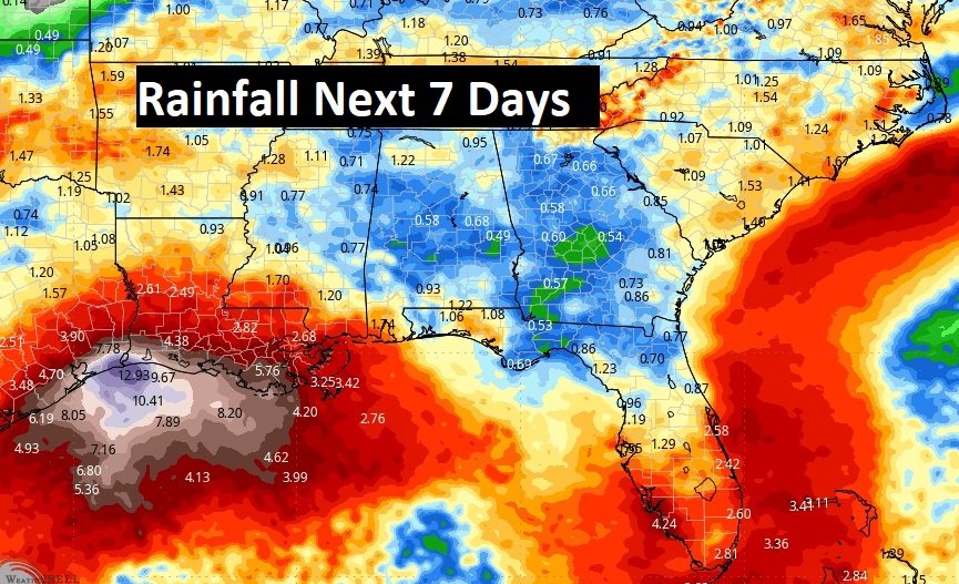
Unfortunately, expected rainfall amounts in our state over the next 7 days are not great at all.
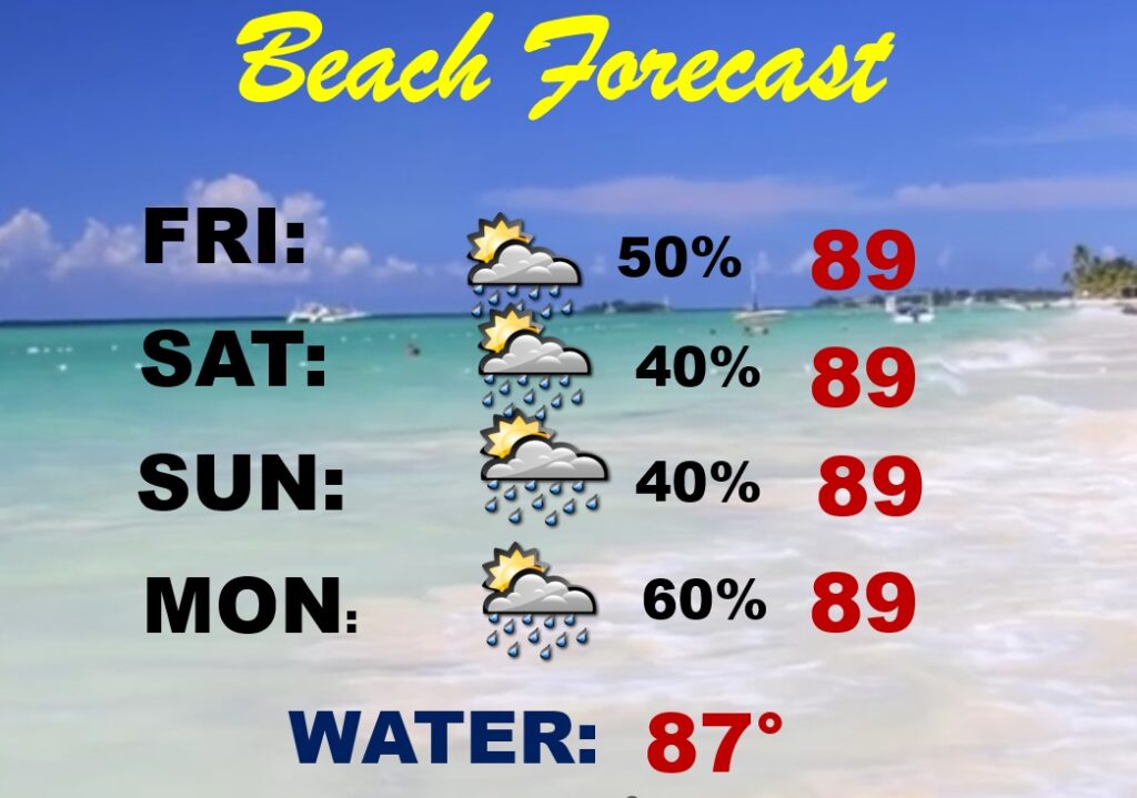
BEACH OUTLOOK: Scattered random storms. Watch out for lightning Medium Rip Current Risk. Gulf water 87.
Thanks for reading the blog. There will be another complete Blog update and video forecast discussion tomorrow morning. This morning, everything is normal including LIVE on the Radio from 6 to 9AM on NewsTalk 93.1 – WACV. Have a nice day!
–Rich