
Good Morning! Heat, humidity and widely scattered random storms will dominate a fairly routine Labor Day forecast. Heat indices will reach triple digit levels today, but changes are on the way. The rain chances will be getting a lot better in the week ahead, We need the rain. Not only that. Temperatures will be coming down, In fact, by Wednesday through Saturday, highs will only be in the 80’s.
TODAY: Sun/cloud mix. Hot and humid. High near 96. Heat index 100+. Widely Scattered random pop-up storms in the afternoon & evening. Light wind. Muggy tonight. Low 75.
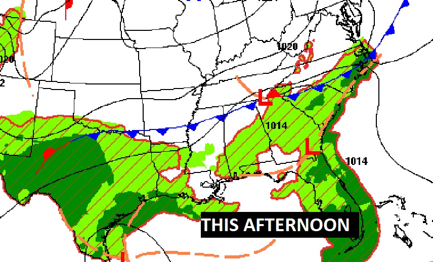
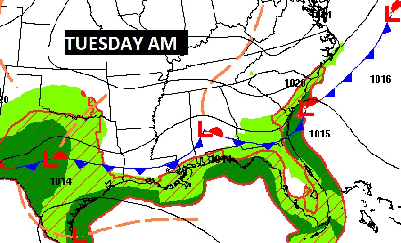
A southward moving front will be a big player in our forecast today and Tuesday.
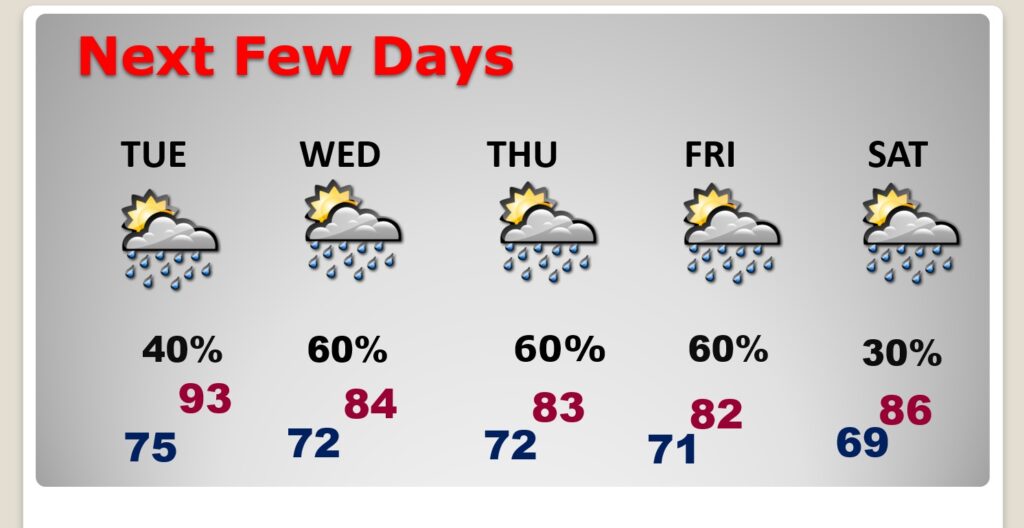
NEXT FEW DAYS: Storms will be widely scattered Tuesday. But, rain chances get a lot better Wednesday through Friday. Storms will be more numerous. PLUS: Temperatures will be coming down, In fact, by Wednesday through Saturday, highs will only be in the 80’s
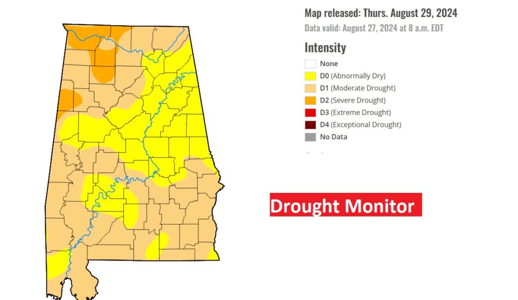
The latest Drought Monitor map shows ALL of the state is in some stage of Drought. 63% of the state are in a Moderate Drought.
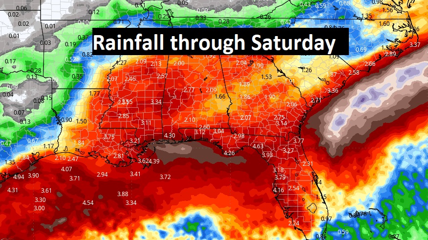
Expect MUCH needed rain in the week ahead.
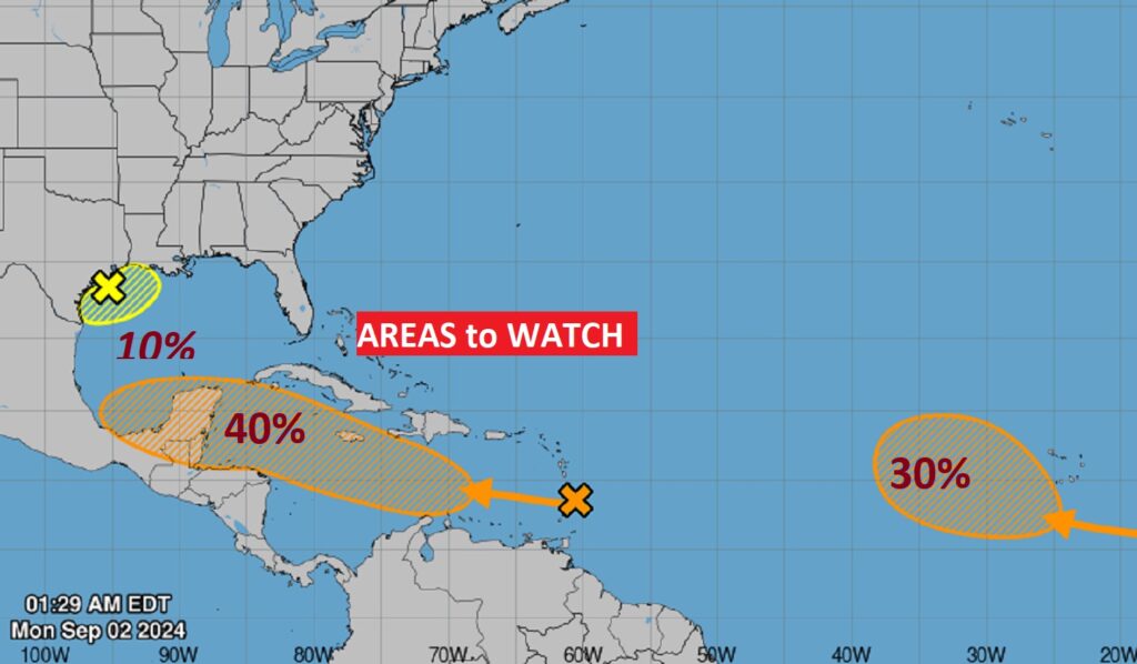
. TROPICAL: NHC is now tracking three Areas to Watch, . There is a small area being monitored in the NW Gulf. The lead area in the Tropical Atlantic, heading towards the Caribbean now has a medium 40% chance of development. And there’s a third in the far east tropical Atlantic.
.
Thanks for reading the blog. The next scheduled blog will be tomorrow morning, Have a nice Labor day!
–Rich