
Good Morning! We’re for headed for the 90’s one more time today. But, stand by. Weather changes are on the way. The rain chances will be getting better in the week ahead, especially Thursday & Friday as a somewhat tropical disturbance moves eastward from Texas, We need the rain. Not only that. Temperatures will be coming down, In fact, by Wednesday through Sunday, highs will only be in the 80’s. Here’s my brief forecast discussion.
CLIMATE: Our high on Labor Day Monday was a record high of 99. Previous record 98 in 1987. Morning low 74. Normals: 92/70. No rain,
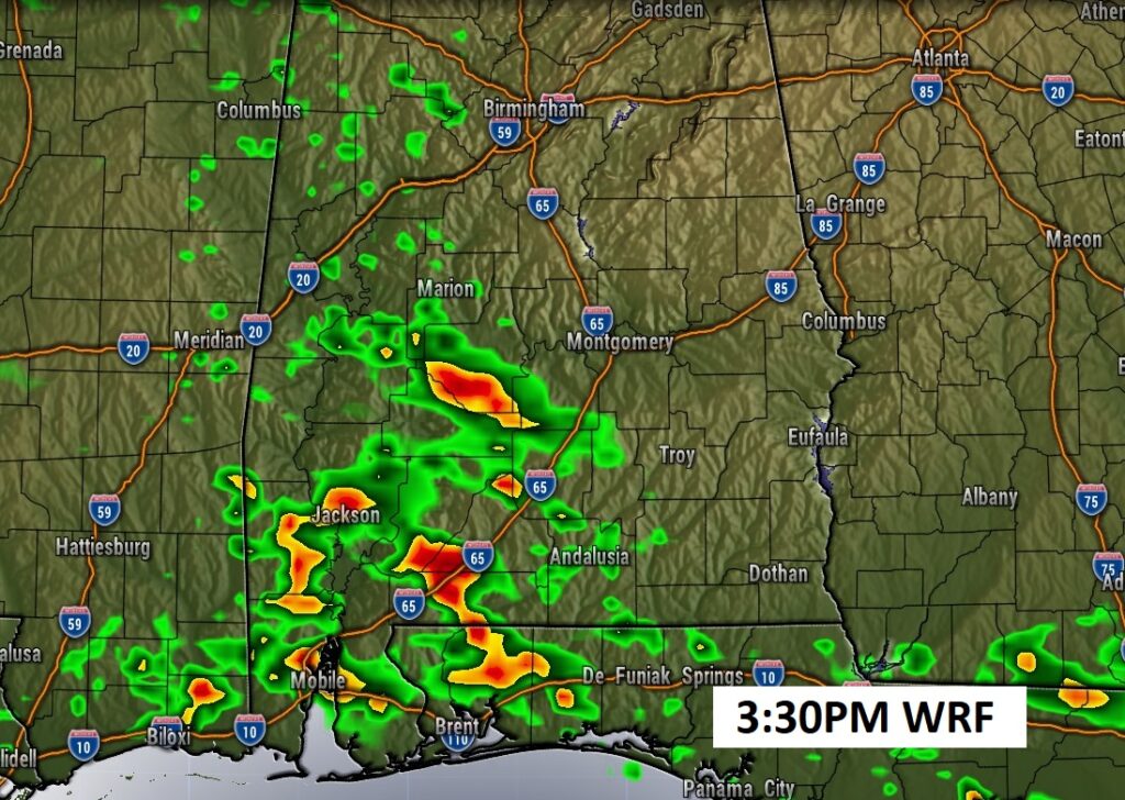
TODAY: Sun/cloud mix. One more day in the 90’s. High near 93. Widely Scattered random pop-up storms in the afternoon & evening. Nice East breeze 10 to 15, Low 74.
The best rainfall probabilities today will be west of I-65.
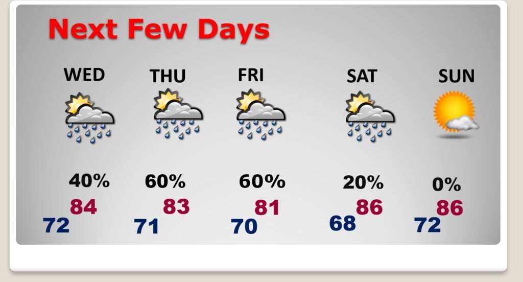
NEXT FEW DAYS: Showers and storms will be widely scattered Wednesday. But, temperatures will be noticeably cooler in the 80’s. The best chance of rain this week will be Thursday and Friday. Highs will be only in the lower 80’s Thursday and Friday and perhaps upper 80’s Saturday and Sunday.
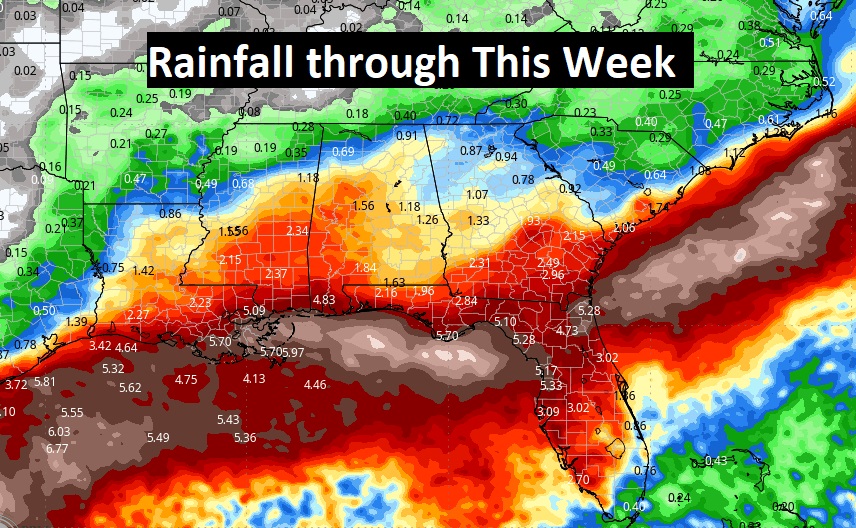
We need some rain. Rain chances get a lot better. Especially Thursday and Friday. Look at all that rain in the Gulf.
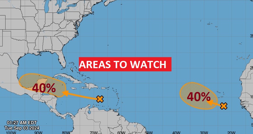
. TROPICAL: NHC is tracking The lead area in the Caribbean heading towards the Gulf, now has a medium 40% chance of development. And there’s a second in the far east tropical Atlantic with a 40% chance of development.
Thanks for reading the blog. There will be another complete Blog update and video forecast discussion tomorrow morning. This morning, everything is normal including LIVE on the Radio from 6 to 9AM on NewsTalk 93.1 – WACV. Have a nice day!
–Rich