
Good Morning! There’s some much needed rain back in our forecast today, tonight and Friday as a disturbance slides across the Gulf Coast. Plus, get ready for a big cooldown. Highs today will struggle to reach 80, and we’ll only be in the 70’s on Friday. The weekend ahead looks spectacular. A cool front will deliver the first Fall-like air of the season. Lows will be in the lower 60’s by Sunday morning. Here’s my brief forecast discussion.
TODAY: Scattered showers and thunderstorms especially by this afternoon and tonight. Cloudy and breezy. East wind 10 to 18 mph. High near 80. Low tonight in the upper 60’s.
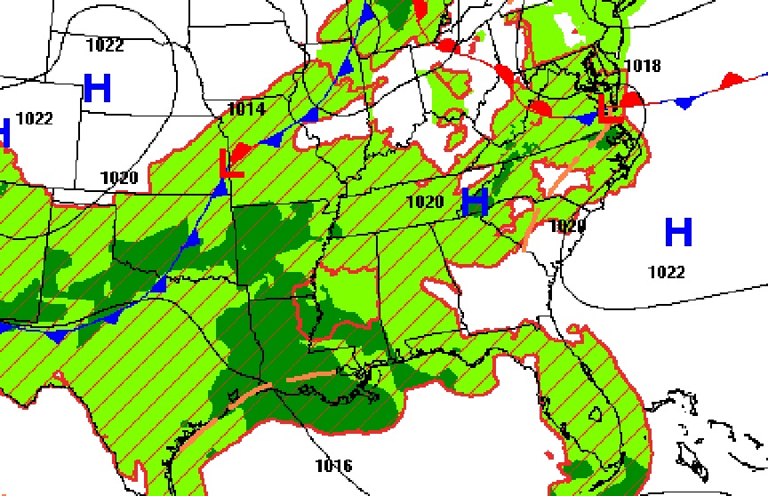
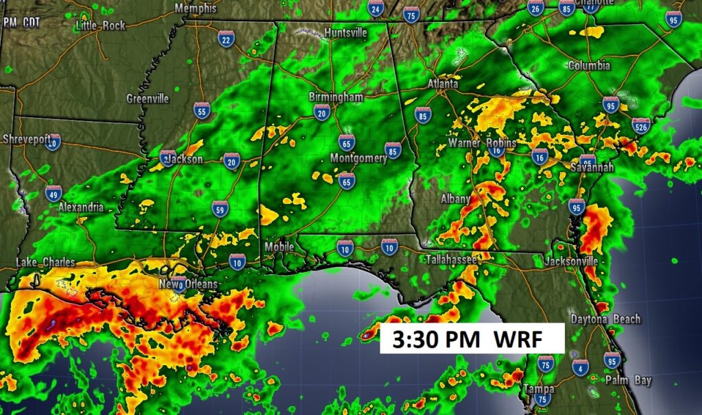
Rain will be widespread across the Gulf states today, tonight and Friday.
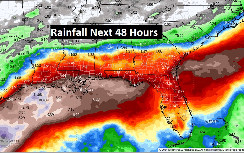
Rainfall amounts will be especially heavy near the coast.
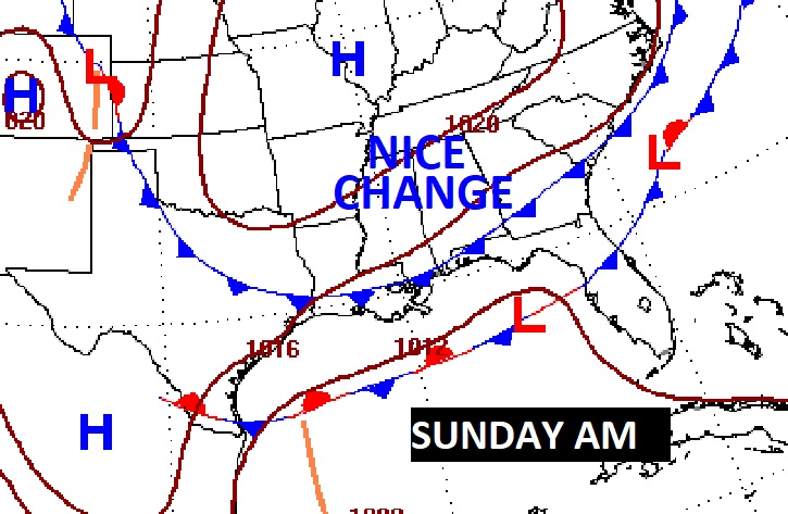
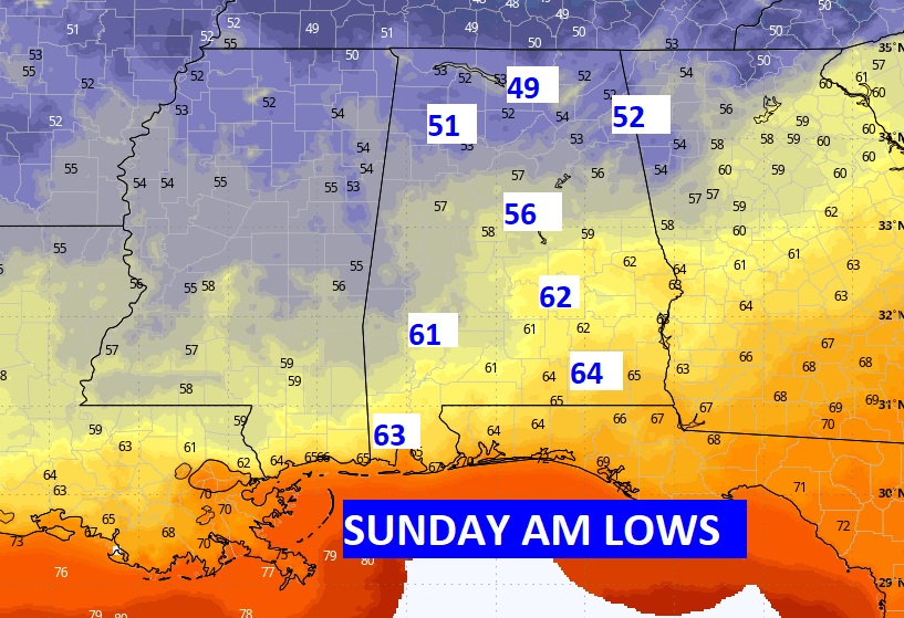
NEXT FEW DAYS: The best chance of the much needed rain will be this afternoon, tonight and Friday. Friday’s high will only in the 70’s, perhaps just the low 70’s. Then, get ready for some much cooler, less humid air over the weekend. Highs will be in the low 80’s, but lows at night will fall to the lower 60’s by Sunday morning.

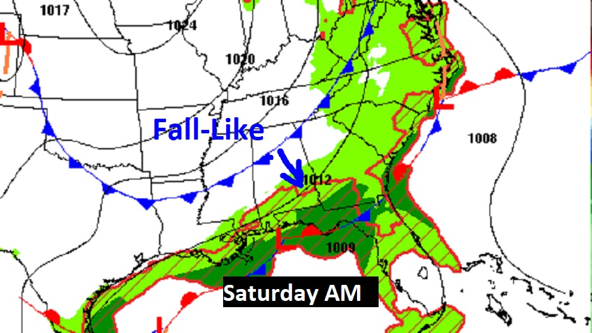
A southward moving cold front will move through the state Saturday. It will deliver a true taste of fall. Nights and mornings, especially, will be very fall-like. Sunny, comfortable days, Clear, cool nights,
The Tennessee valley region may fall to the upper 40’s by Sunday morning.
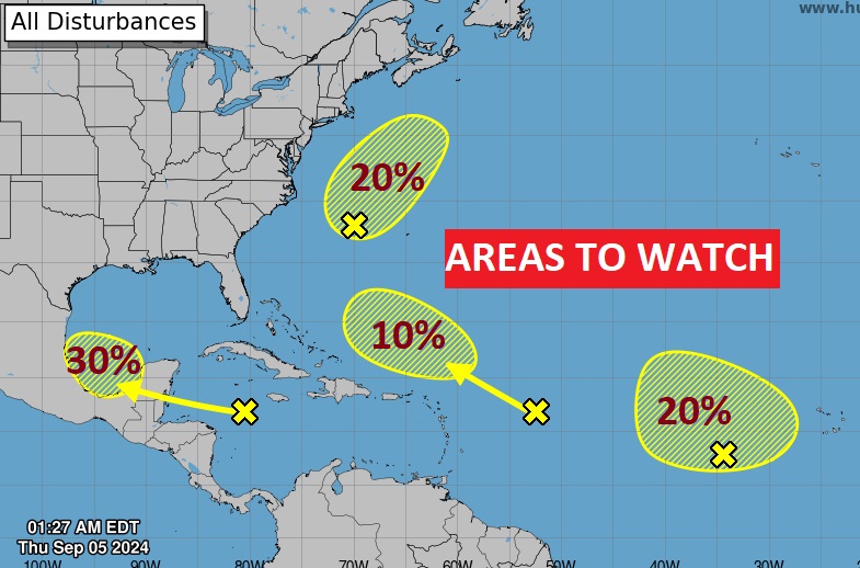
. TROPICAL: NHC is tracking four Areas to Watch. The lead disturbance in the west Caribbean and the heading southern Gulf of Mexico has the best chance of future development. There’s also a new area being monitored off the southeast coast.
Thanks for reading the blog. There will be another complete Blog update and video forecast discussion tomorrow morning. This morning, everything is normal including LIVE on the Radio from 6 to 9AM on NewsTalk 93.1 – WACV. Have a nice day!