
Good Morning! Welcome rain is back on the radar. The best chance of accumulating rain today and tonight will be across the southern half of the state. Highs today will only be in the 70’s. A southward moving cold front will move through the state Saturday. There could be some leftover showers early in the day. Look for some cooler nights ahead. Lows will be in the lower 60’s by Sunday morning. Sunday will be the nicest day of the weekend behind the front. No video today.
TODAY: Periods of showers and thunderstorms today and tonight. Cloudy and breezy. East wind 10 to 18 mph. High near 75. Low tonight 65.
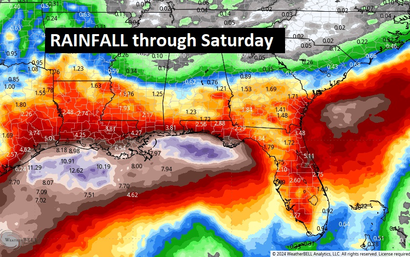
Rain will be widespread across the Gulf states today, tonight and Friday.
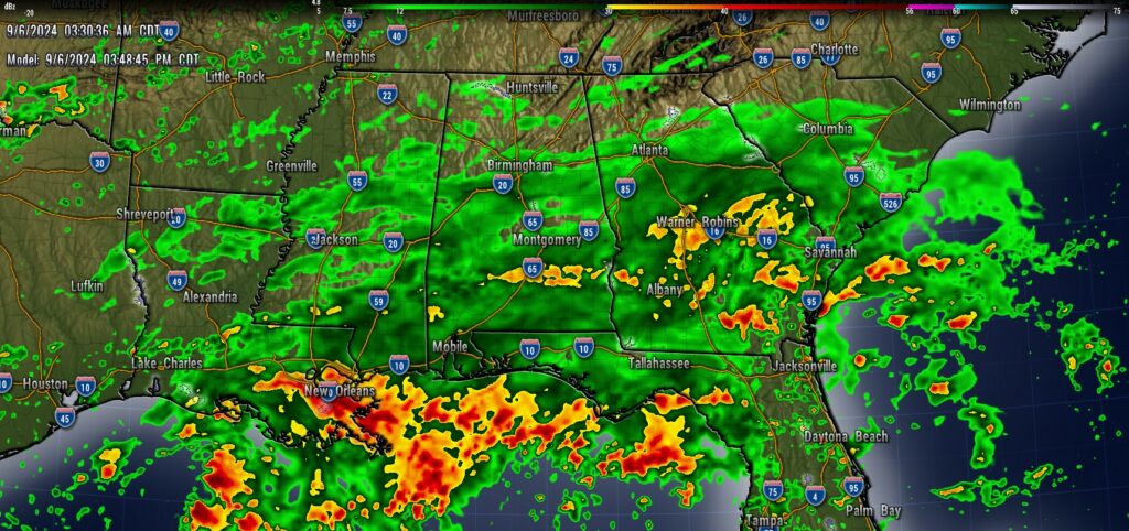
Rainfall amounts will be especially heavy near the Gulf coast.
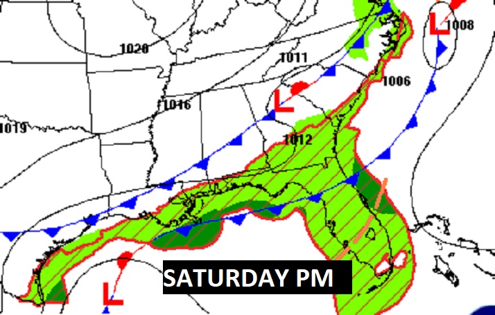
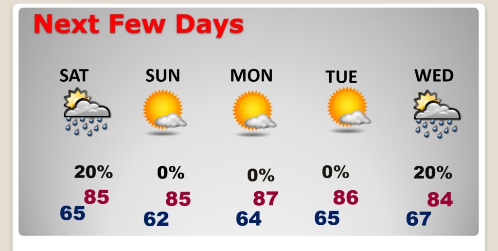
SATURDAY: A southward moving cold front will move through the state Saturday. There could be some leftover showers early in the day.
NEXT FEW DAYS: Look for some cooler nights ahead. Lows will be in the lower 60’s by Sunday morning. Sunday will be the nicest day of the weekend behind the front. The nice weather will continue early next week. Widely scattered showers return Wednesday.
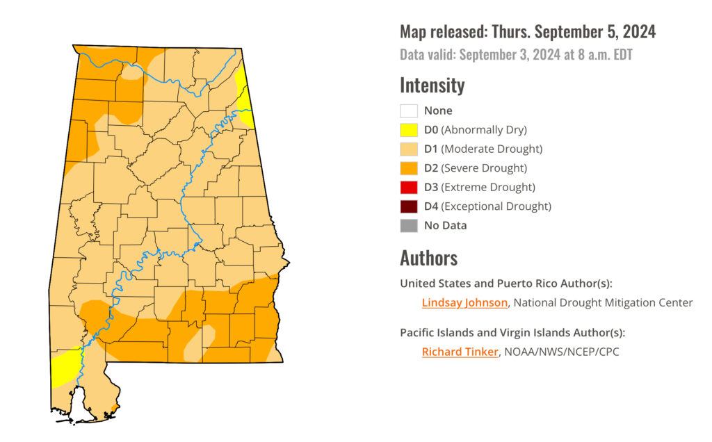
DROUGHT MONITOR:
The brand new Drought Monitor map shows a major escalation in the drought. At least 97% of the state is at least in a Medium drought and now 26% in a SEVERE Drought. Rain and today and tomorrow is obviously good news!
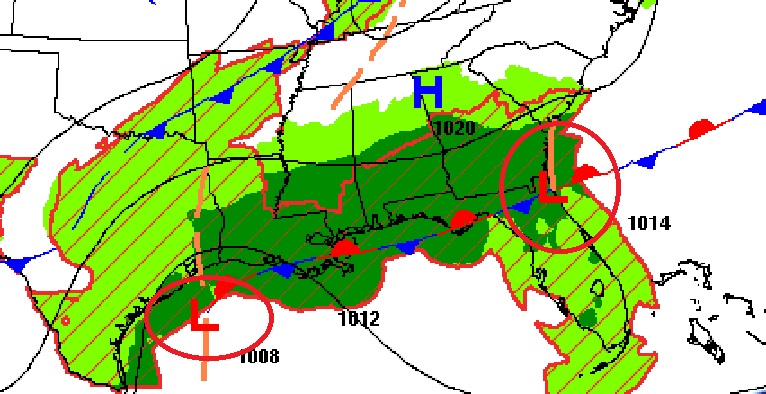
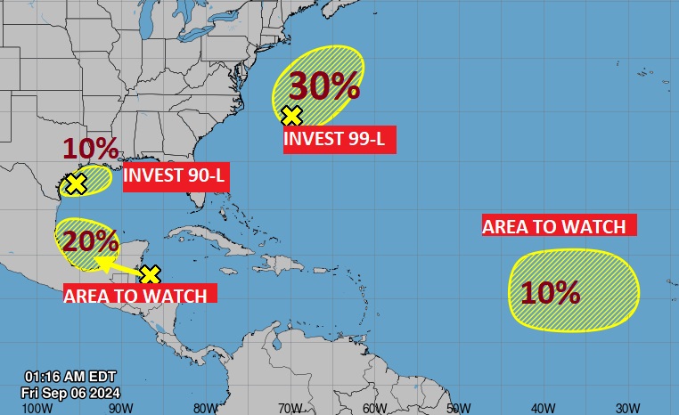
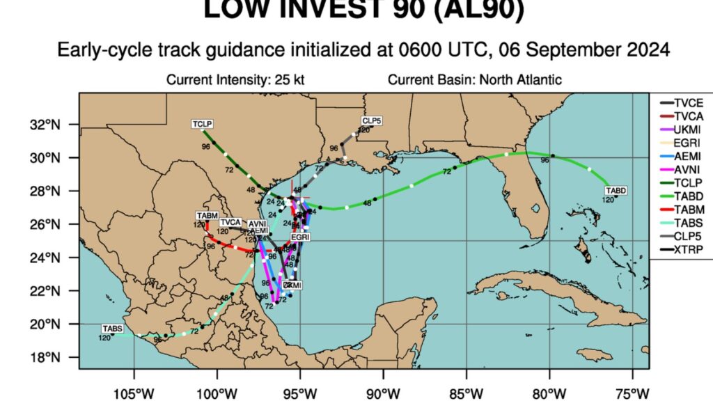
. TROPICAL: NHC is five systems, including two Invests. That system in the NW Gulf will meander in the same neighborhood for a few days and may even migrate southward. The system near the Yucatan is headed into the southern Gulf. Invest 99-L in the Atlantic is not a threat to the US.
Thanks for reading the blog. There will be another complete Blog update and video forecast discussion tomorrow morning. This morning, everything is normal including LIVE on the Radio from 6 to 9AM on NewsTalk 93.1 – WACV. Have a nice day!
–Rich