
Good morning! A southward moving cold front will bring a few leftover scattered showers, here and there. Expect cooler air by tonight with low to mid 60’s. Sunday will be a nice day, behind the front will be a nice day with lots of sun and lower humidity. Monday looks nice too. The risk of showers returns to the forecast by mid and late week.
CLIMATE: Pretty amazing. Yesterday’s high was only 78 after a morning low of 70. Normal hi/lo 91/69. Finally there was some rain at the airport: .74”.
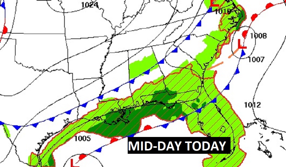
TODAY: Widely scattered leftover showers are possible today and this evening. Cloudy. North wind at 5 to 10. High near 85. Low tonight 63.
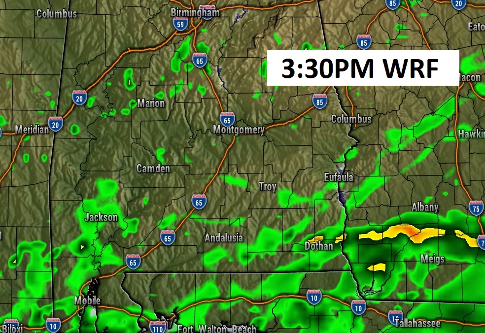
Here’s Future Radar at mid afternoon. Widely scattered showers. More concentrated rain on the coast
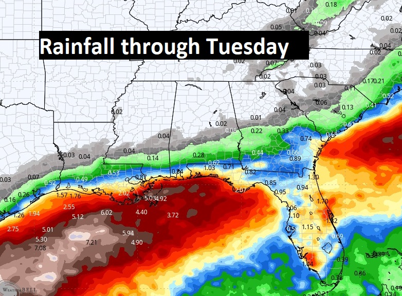
Rainfall amounts will be especially heavy near the Gulf coast through the next few days.
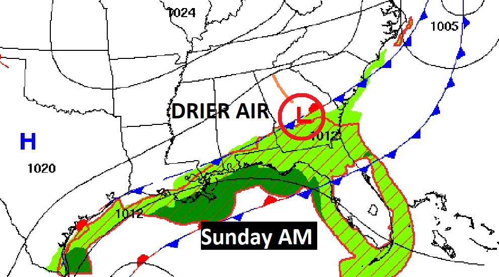
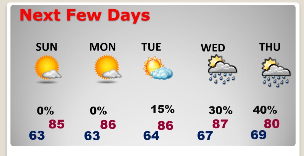
NEXT FEW DAYS: Sunday will be the nicest day of the weekend behind the front. The nice weather will continue early next week. Widely scattered showers return Wednesday. Highs in the 80’s. Lows in the 60’s.
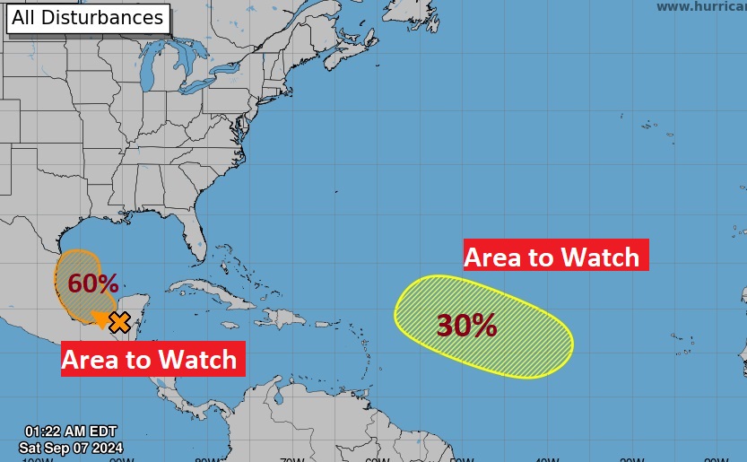
. TROPICAL: NHC is keeping a close eye on that Area to Watch in the SW Gulf where there is now a 60% chance of development. Could we see a named storm in a few days? Francine is the next name. There’s another Area to Watch in the Tropical Atlantic.
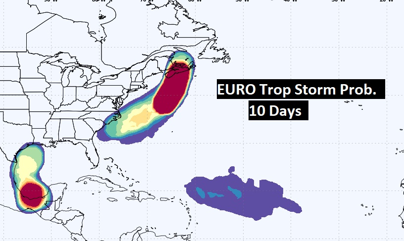
Here’s the EURO’s Tropical Storm Probability outlook for the next 10 days. A few areas to watch.
Thanks for reading the blog. The next scheduled blog will be Monday morning, Have a nice weekend!
–Rich