
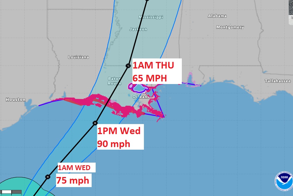
4PM NHC UPDATE: Francine still a 65 mph Tropical Storm, mooing northeast at 10. Pressure 987 mbs. Cone shifted slightly east. Hurricane watch now covers New Orleans. Upgrade to Tropical Storm Warning on the Alabama coast. Expected to be a hurricane tonight. Landfall on LA coast Wed. PM.
FRANCINE UPDATE: Tropical Storm Watch on the Alabama Coast
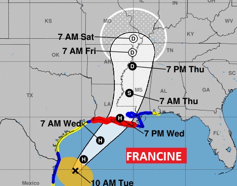
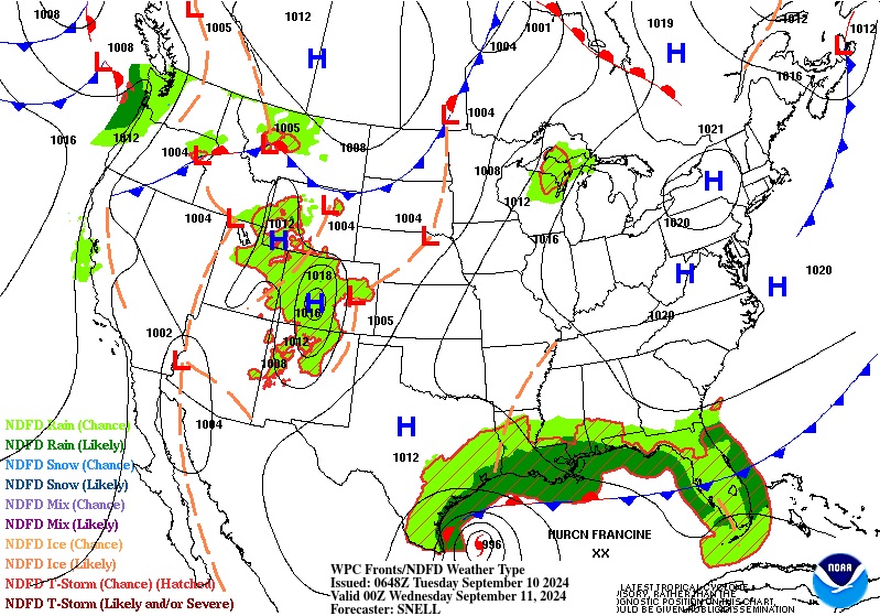
(10:00 AM 9/8/24) Highlights on the10AM NHC Francine Advisory: Still a Tropical Storm with 65 mph winds, moving NNE at 8 mph. Expected to become a Hurricane today, The forecast cone has jogged eastward and a Tropical Storm Watch and Storm Surge Watch has been extended to the Alabama coast. Tropical Storm warning as far east as the MS/AL line. Expected landfall on the LA coast on Wednesday.
EARLY MORNING UPDATE:
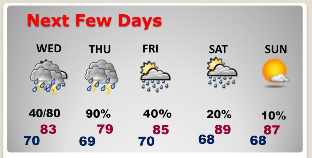
Good morning! Our weather is quiet today. But, Francine is likely to have a significant impact on our weather, beginning Wednesday night and especially Thursday. We will be on the active right side of the Francine track. Expect some torrential downpours, gusty winds and a low end, marginal, tornado threat. The rain risk continues through Friday. There even could be a leftover shower or two Saturday. For us the rainfall will be beneficial. Here’s my brief forecast discussion.
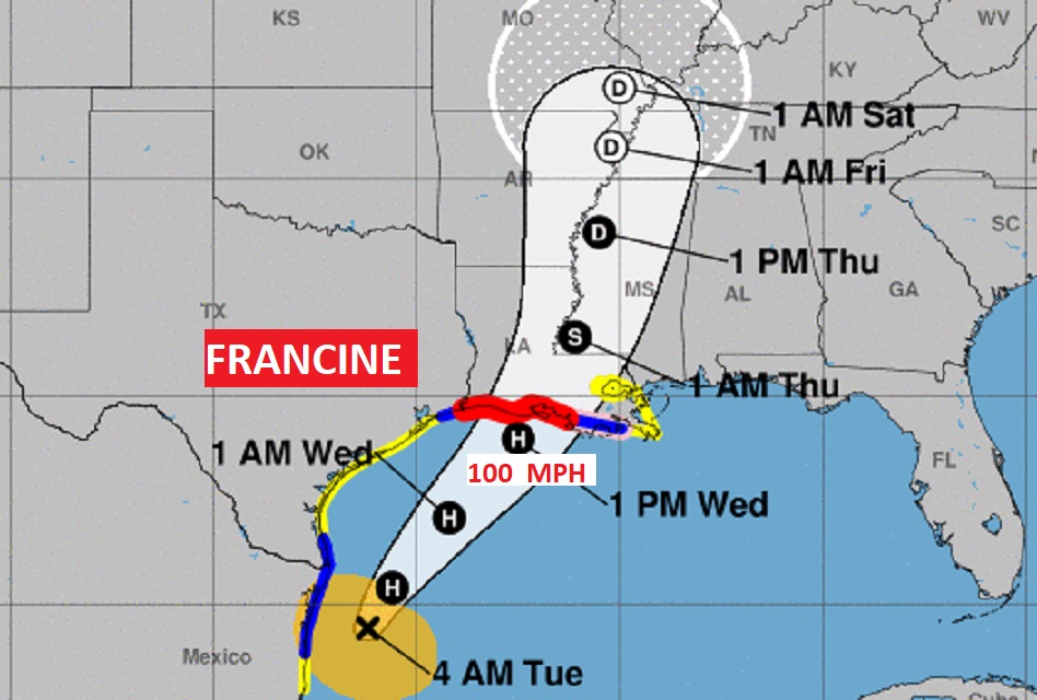
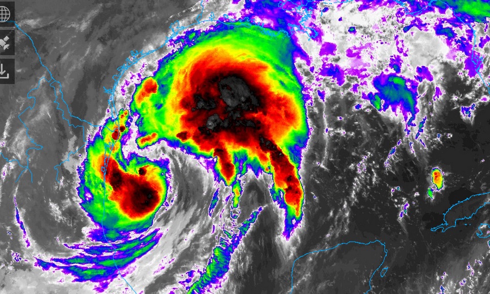
FRANCINE: Francine is still a 65 MPH Tropical storm this morning, MOVING NNW AT 5 MPH, but is expected to become a Hurricane by later today. Francine could come ashore as a Cat 2 hurricane by Wednesday evening along the Louisiana coast. A hurricane warning is in effect on the coast. We’ll be on the right side of the track. Expect some torrential downpours, gusty winds and a low end, marginal, tornado threat.
TECHNICAL FORECAST DISCUSSION: For more of the meat an potatoes of the forecast, here’s the technical Forecast Discussion from the NWS in Birmingham.
https://forecast.weather.gov/product.php?site=NWS&product=AFD&issuedby=BMX
TODAY: Limited sunshine. High near 90. Breezy. East wind 5 to 15+. Mostly cloudy tonight. Low near 70.
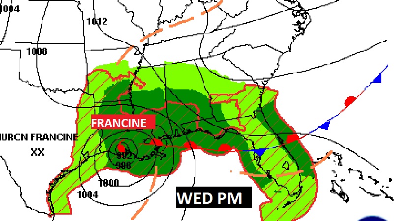
NEXT FEW DAYS: We will be on the active right side of the Francine track. Our rain chance begins Wednesday afternoon with an escalating chance Wednesday night and especially Thursday. Expect some torrential downpours, gusty winds and a low end, marginal, tornado threat. The rain risk continues through Friday. There even could be a leftover shower or two Saturday. For us the rainfall will be beneficial. Dry weather returns Sunday.
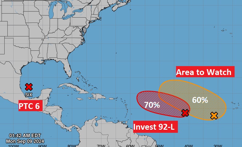
. ELSEWHERE IN THE TROPICS: NHC is tracking two important systems in the Tropical Atlantic including Invest 92-L and a Area to Watch. Neither one of these is expected to impact the United States. After Francine, the next two names on the list are Gordon and Helene..
Thanks for reading the blog. There will be another complete Blog update and video forecast discussion tomorrow morning. This morning, everything is normal including LIVE on the Radio from 6 to 9AM on NewsTalk 93.1 – WACV. Have a nice day!
–Rich