
Good morning! The risk of residual effects from the leftover Francine moisture continues today. In fact, there may even be a few stronger storms today according to SPC. A brief tornado is possible. A very disturbed pattern will continue across the Southeast states with scattered random storms most likely in the afternoon & evening hours. Highs will be in the mid 80’s over the weekend. Not much change early next week. Meanwhile, the tropics continue quite active. Here’s my brief forecast discussion.
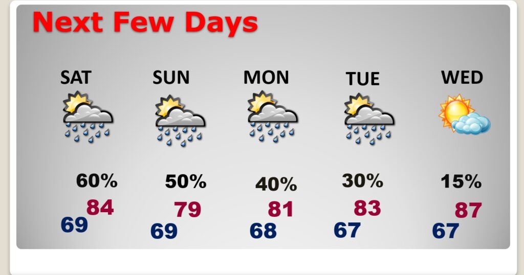
TODAY: Limited sunshine. Scattered showers and thunderstorms most numerous in the afternoon and evening hours.A few stronger storms are possible, High mid 80’s. SE wind 6 to 12 mph. Low tonight near 70.
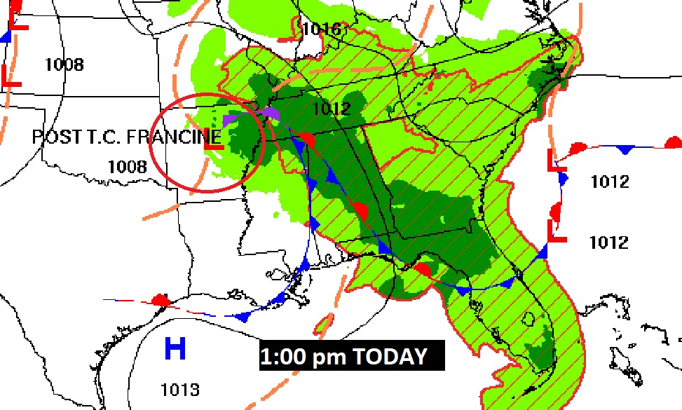
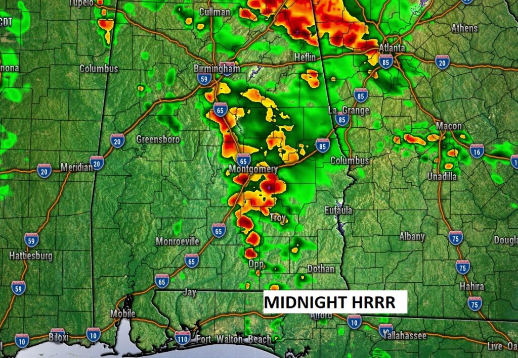
SPC has a Marginal Severe Risk across much of the area today. A brief tornado can’t be ruled out, especially in the 1PM to 11PM time frame.
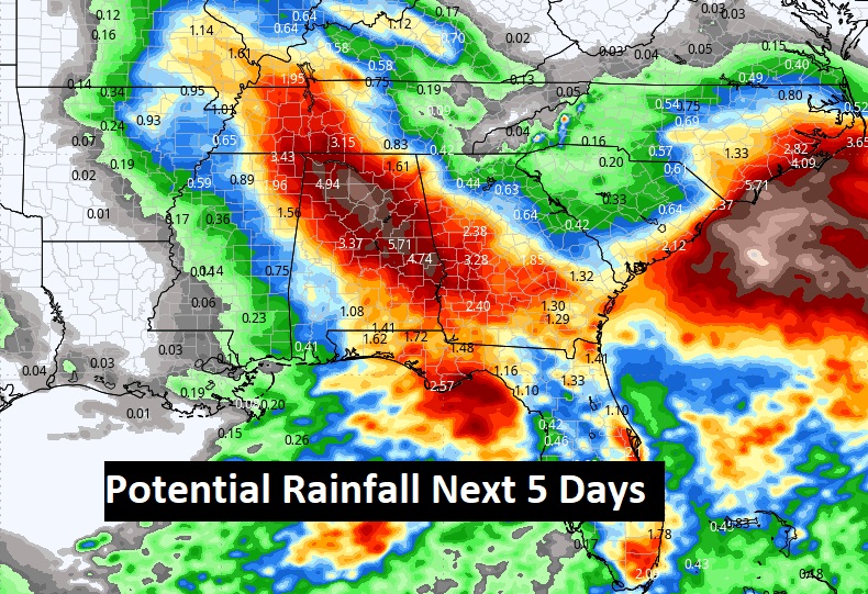
Expect Tropical Downpours at times today, tonight and over the weekend.
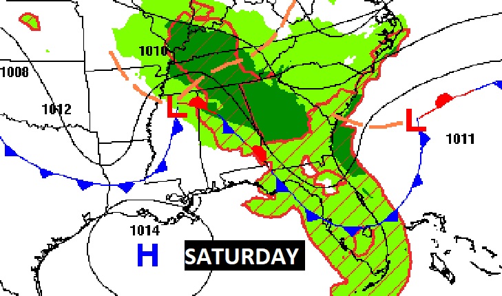
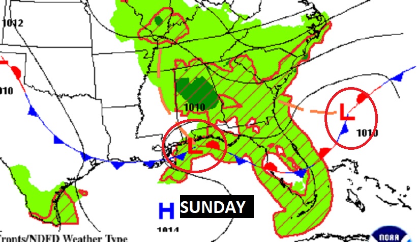
NEXT FEW DAYS: A very disturbed pattern will continue across the Southeast states with scattered random storms most likely in the afternoon & evening hours. Highs will be in the mid 80’s over the weekend. Not much change early next week.
Much of the state has seen soaking beneficial rain in the last 36 hours. I’m optimistic about more tropical downpours today and over the weekend.
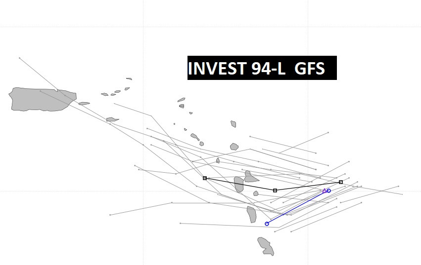
. ELSEWHERE IN THE TROPICS: NHC is tracking several other systems in the Atlantic basin including Tropical Depression 7 (Future Gordon. Also a small Invest 94-L and an interesting Area to Watch off the SE US coastline that needs to be monitored as a future Low pressure system drifts toward the coastline.
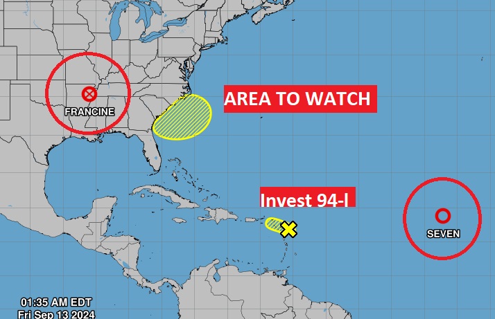
94-L could effect the Islands in a few days.
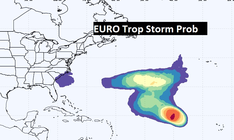
Here’s the EURO Tropical Storm probability.
Thanks for reading the Blog this morning. Today is a travel day for me. I’ll be flying out to the Dallas area (Irving) for the National Weather Association annual conference. There will be a weekend Blog update in the morning.
–Rich