
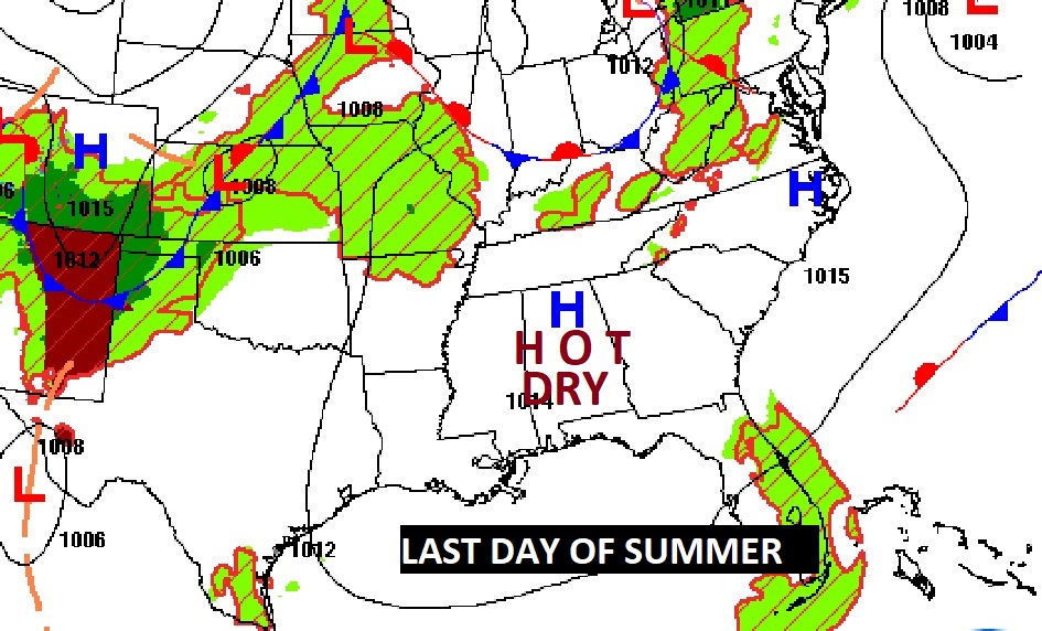
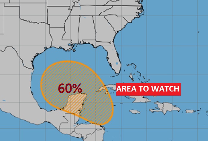
Good morning! On this last Day of Summer, it’s going to be very HOT. So, is the First Day of Fall tomorrow. Mid 90’s through Monday. If you’re going to be Football Game tailgating, please stay hydrated. We’re dry though Tuesday. Widely scattered showers enter the forecast starting Wednesday and Thursday. Late week and next weekend is problematic. There is a growing threat of a tropical system developing in the Gulf. Maybe a Tropical Storm, maybe a hurricane, There’s now a 60% chance of a Low forming in the Caribbean and heading for the southern Gulf. After that, the models are all over the place, but there are too many models indicating the northern Gulf coast could be a potential target. Don’t take that to the bank yet. Just be very aware and check my updates through the next several days. Could be a big deal for somebody. Hopefully not us. Stay tuned
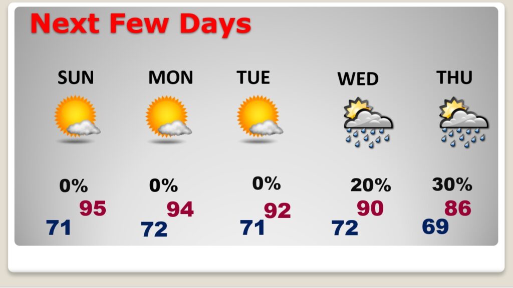
TODAY: Sunshine. Hot and dry. High 95. Clear tonight. Low tonight 71. Light wind, becoming South at 5 to 10.
NEXT FEW DAYS: Hot and dry through at least Tuesday. Fall officially begins this Sunday. We’ll be in the low to mid 90’s through Monday. Lows at night near 70. We’ll introduce the chance of widely scattered showers Wednesday.
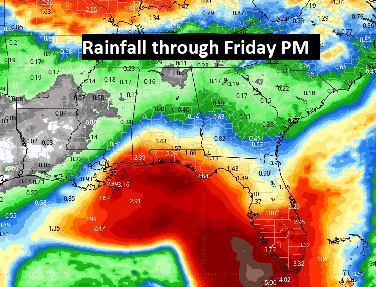
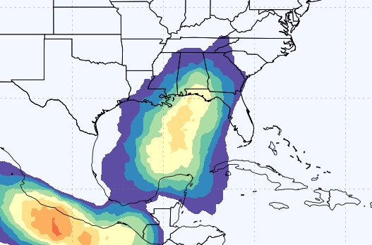
UH OH. The Model Blend Expected Rainfall outlook hints that Tropical Trouble in the Gulf could reach the northern Gulf coast by Friday night. This is NOT the way we want to get rain.
TROPICAL UPDATE: Cut and paste from above: There is a growing threat of a tropical system developing in the Gulf. Maybe a Tropical Storm, maybe a hurricane, There’s now a 60% chance of a Low forming in the Caribbean and heading for the southern Gulf. After that, the models are all over the place, but there are too many models indicating the northern Gulf coast could be a potential target. Don’t take that to the bank yet. Just be very aware and check my updates through the next several days. Could be a big deal for somebody. Hopefully not us. Stay tuned
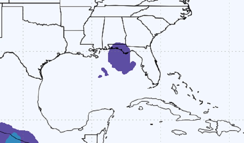
Here’s the EURO Tropical Storm Probability for the next 10 days. And, to the right, the Euro now has an added probability of a Hurricane.
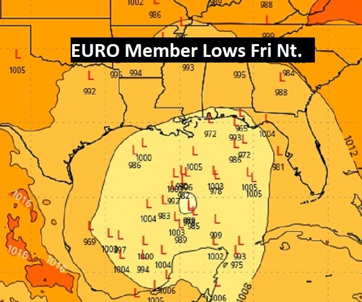
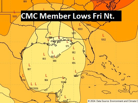
Now the Global Ensemble models member Lows. Each model is run several times, giving various solutions. So, what youre seeing are the various possible Low pressure positions on each model run. I selected next Friday night, Sept. 27th. Too me, the Euro (ECMWF) concerns me the most. It seems to target the northern Gulf coast.
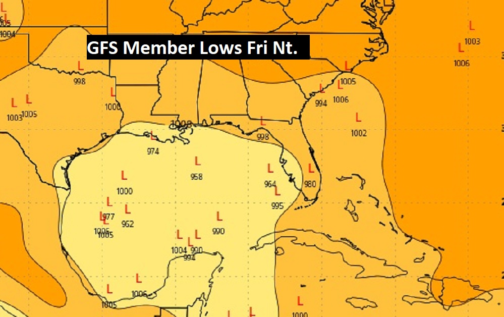
The GFS and Canadian CMC positions are all over the place as the models struggle with a solution,
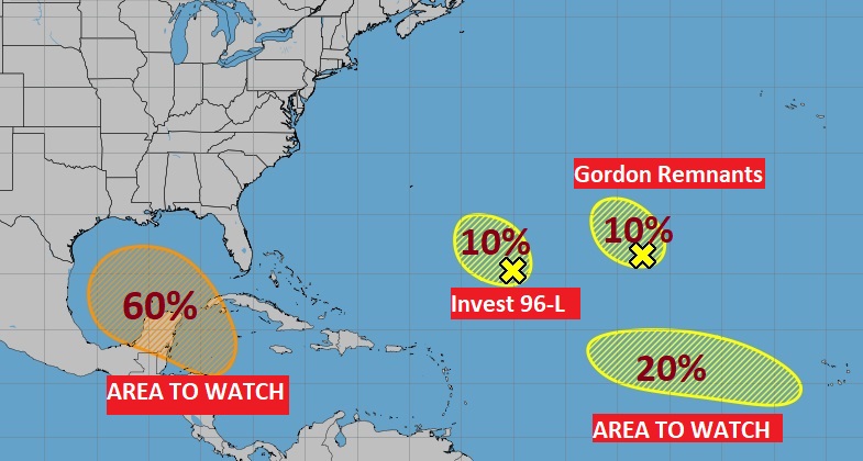
Elsewhere in the Tropics, NHC is monitoring, Invest 96-, an Area to Watch in the Atlantic and the Remnants of Gordon. We don’t care about any of these, except that far eastern Aea which might have a future down the road.
FALL BEGINS SUNDAY: Today is the last official day of Sumner. Sunday is the Autumnal Equinox. Fall officially begins at 7:44 AM CDT.

Thanks for reading the blog. Usually, the next scheduled blog would be Monday morning. But, because of this growing tropical concern, I’m sure I’ll have something for you sometime tomorrow. Have a nice, HOT weekend, as Summer Ends and Fall begins.
–Rich