
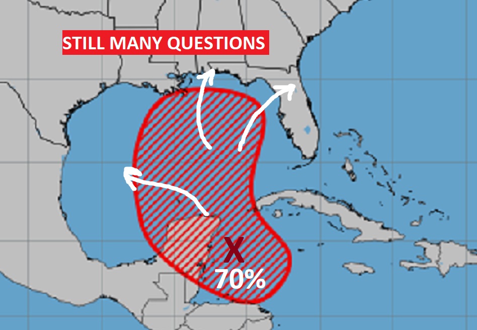
That Area to Watch in the west Caribbean is just abroad area of low pressure at the moment. NHC now gives this system a 70% chance of future development into a tropical cyclone. (Depression, Tropical Storm, Hurricane?) Look at the area outlined which now extends well into the Gulf and even into the northern Gulf. Slow development is expected. But, the major global models take this to the northern Gulf Coast, maybe as early as Friday or Saturday. But where? How strong? Since we don’t have a low to track, we don’t have much confidence in any particular model. There’s so much uncertainty. But, here’s some model ideas below.
AREA TO WATCH: 70% chance of development now in the next 7 days.
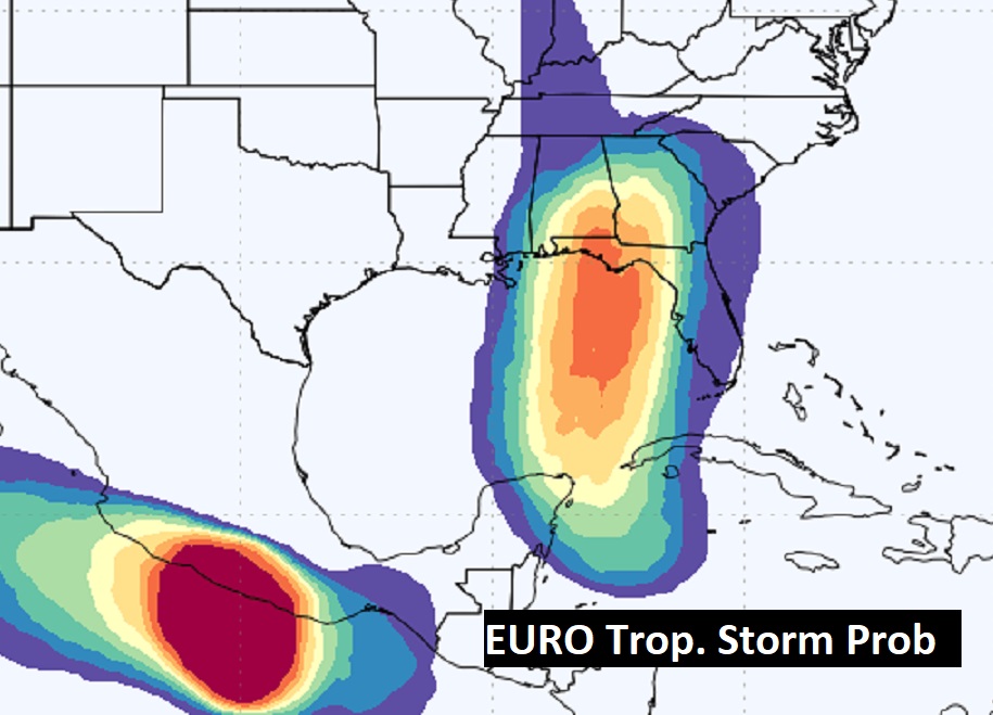
Here’s the EURO Probability of a tropical storm shows a path to the northern Gulf coast. By the way, the EURO has backed off on the probability of a Hurricane.
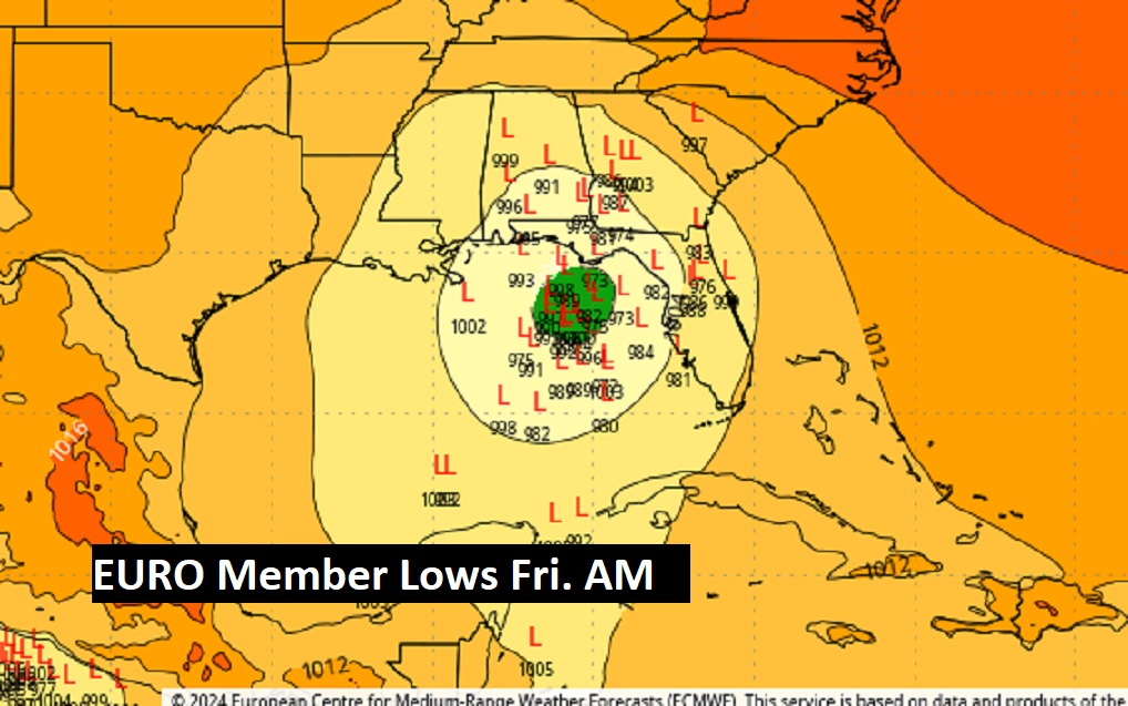
As far as the ENSEMBLE Member Lows, we’ll start with the EURO.
And, the American GFS….
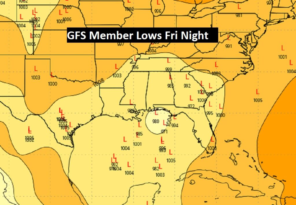
And, the Canadian CMC. All the major global models seem to favor landfall along the northern Gulf coast.
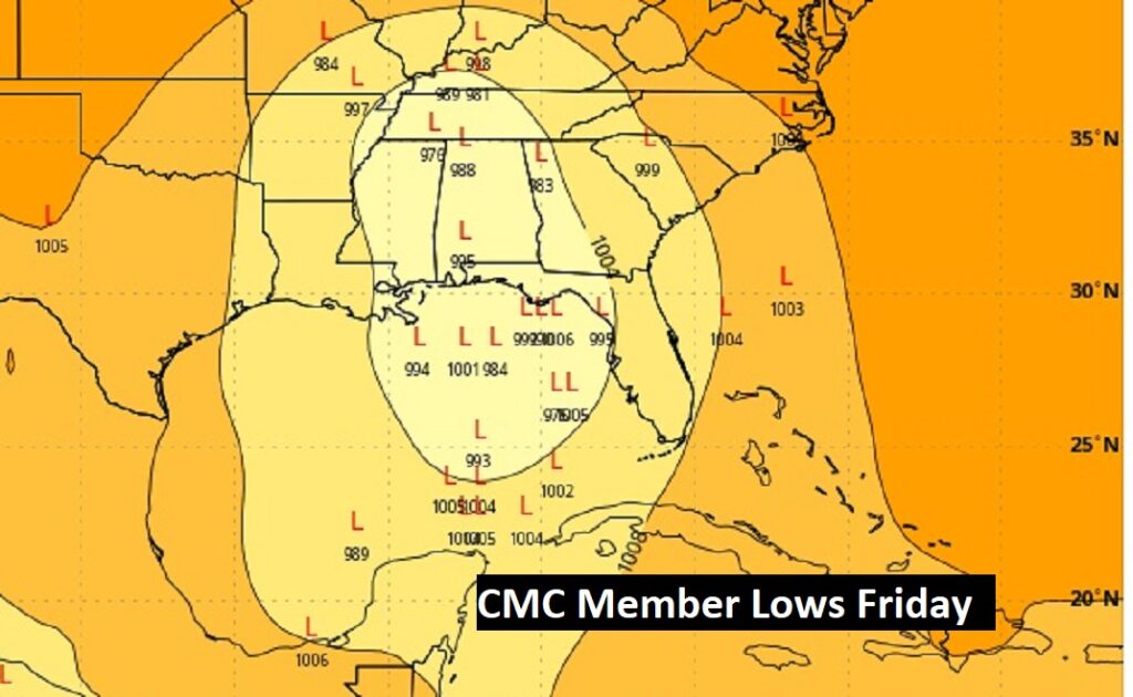
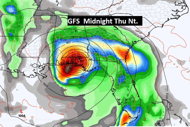
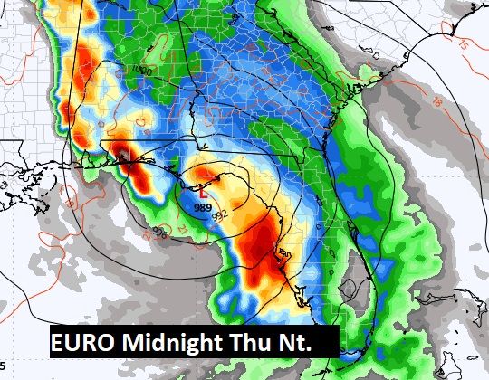
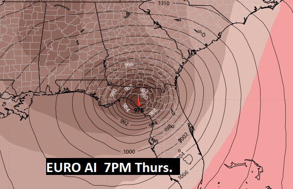
We don’t know where or when, or how string this future Tropical system in the Gulf will be. But, we can show you where some of the models are taking this system. The GFS is most impressive showing what appears to be a Hurricane near Panama City Thurs. Night. The EURO has a somewhat weaker system up into the Florida Big Bend area Thurs. PM. The Euro AI model is stronger with a Big Bend landfall Thurs. afternoon. But, remember the model tracks will get much better once a Low actually forms early to mid week, probably in the southern Gulf. Stay tuned. Helene is the next available name.
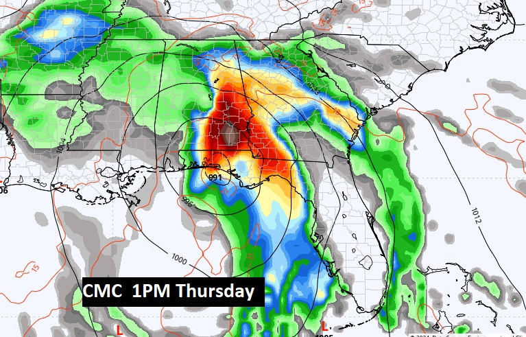
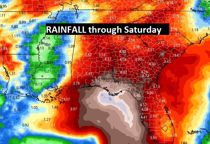
Here’s the model blend Rainfall Outlook (QPF) through Saturday. Again you get the idea on potential clues. We’ll see how this all plays out.
Look, I’ll have a complete Blog update and Video forecast discussion in the morning. Have a NICE first day of Fall. We’ll be in the mid 90’s after 94 yesterday. Fall begins at 7”44 AM.
–Rich
. .