
4:00 PM UPDATE:
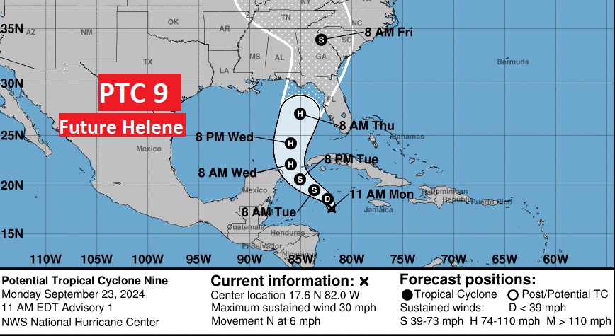
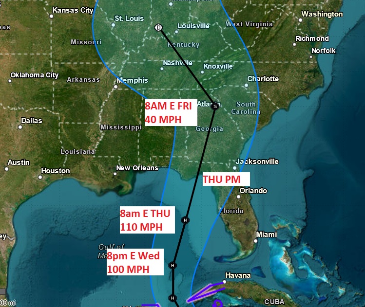
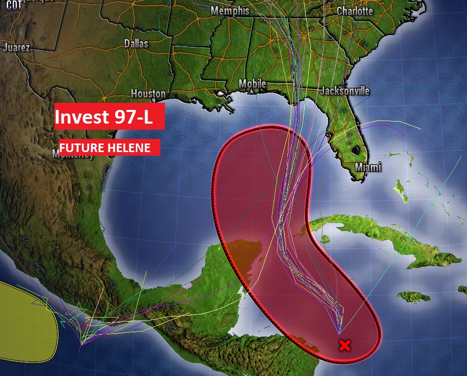
PTC 9 will probably become Tropical Storm Helene tonight as it heads for the Yucatan channel and the southern Gulf of Mexico. Currently, it’s just a disorganized area of low pressure in the west Caribbean, 315 miles SE of the west tip of Cuba, with 35 mph winds, moving NNW at 7. Looks like this system will reach Hurricane intensity tomorrow, as it moves through the eastern Gulf. Potential landfall as a 115 mph Cat 3 Major Hurricane Thursday afternoon, somewhere, likely along the northeast Gulf coast. Helene is not only expected to be a powerful hurricane, but also a rather large hurricane in size. A potentially disastrous situation with the exact landfall location unknown at this time. The timetable to take action is rather short
The model consensus center line of the spaghetti model has nudged westward closer to the AL/GA line this afternoon. Let’s hope that trend changes.
11:00 AM UPDATE:
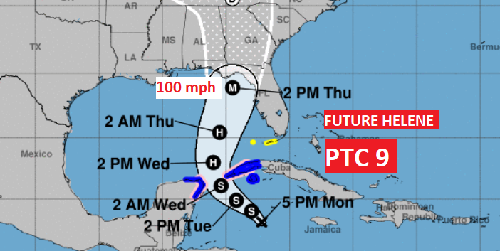
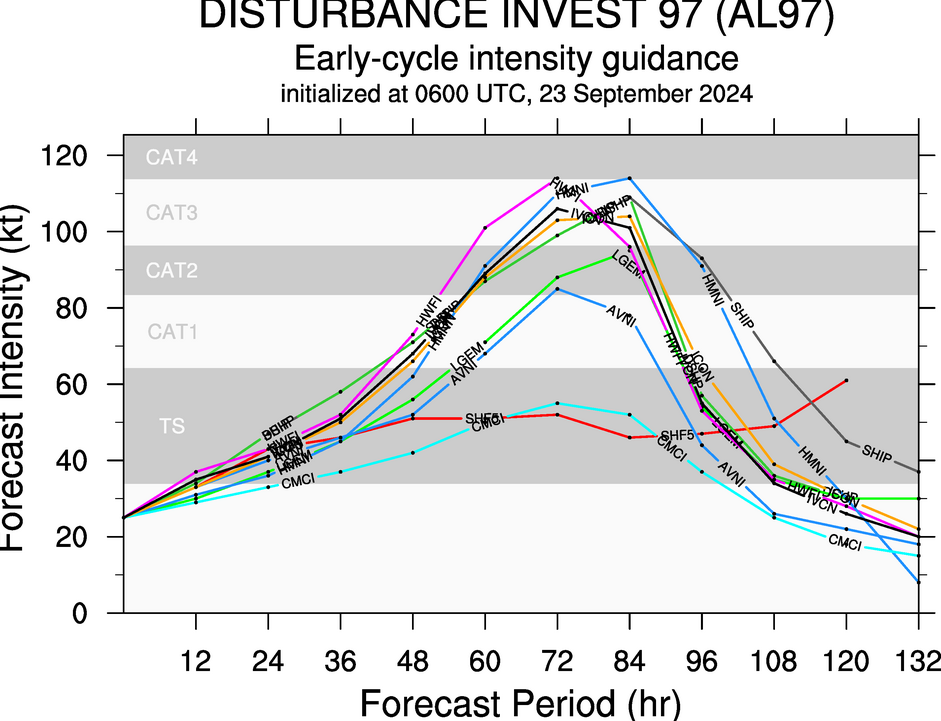
NHC has opted to promote Invest 97-L to PTC 9, There is now a Hurricane Watch for portions of Cuba and portion of the Yucatan Peninsula. (Future Hurricane Helene) The first Cone goes up through the east Gulf and in the general direction of the Big Bend area with a Max wind forecast of 110 mph, Close to major Cat 3 level on Thursday AM. NHC mentions that some models actually bring the strength in the Cat 4 range. One other major point. Helene will be a very LARGE storm with wide ranging severe impacts for a rather huge area.
EARLY MORNING UPDATE:
Good morning! On this first full day of Fall, it’s going to be very hot, again. We will be hot and dry through Tuesday. Showers and storms return to the forecast Wednesday. But now, All eyes are on the Gulf of Mexico. A disturbance in the Caribbean (Invest 97-L), will move into the Gulf. Most Global models take this system, Future Helene, to the northern Gulf coast, perhaps by Thursday. Some models take this system to major hurricane status. Obviously, the future track on Future Helene will have a huge impact on our forecast. Here’s my brief forecast discussion.
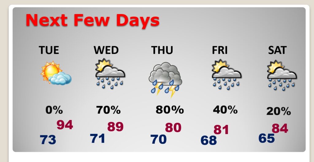
TODAY: Sunshine. Hot and dry. High 95. Low tonight 72. West wind 5 to 10 mph.
NEXT FEW DAYS: Hot and dry through at least Tuesday. Showers and thunderstorms become likely Wednesday and Thursday ahead of the landfall of Future Helene. The shower risk continues Friday and even a small chance Saturday. Obviously, the forecast details of the forecast are highly dependent on the exact track of the storm.
TROPICAL UPDATE: A disturbance in the Caribbean (Invest 97-L) will move into the Gulf. Most Global models take this system, Future Helene, into the northern Gulf coast, perhaps by Thursday. Some models take this system to major hurricane status.
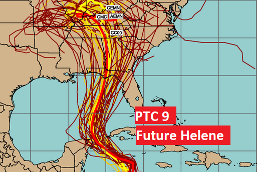
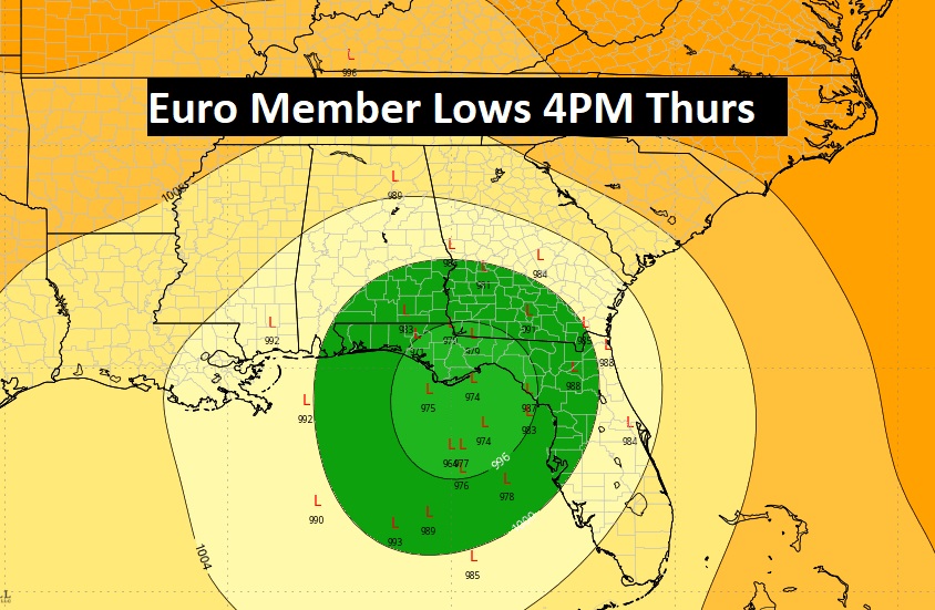
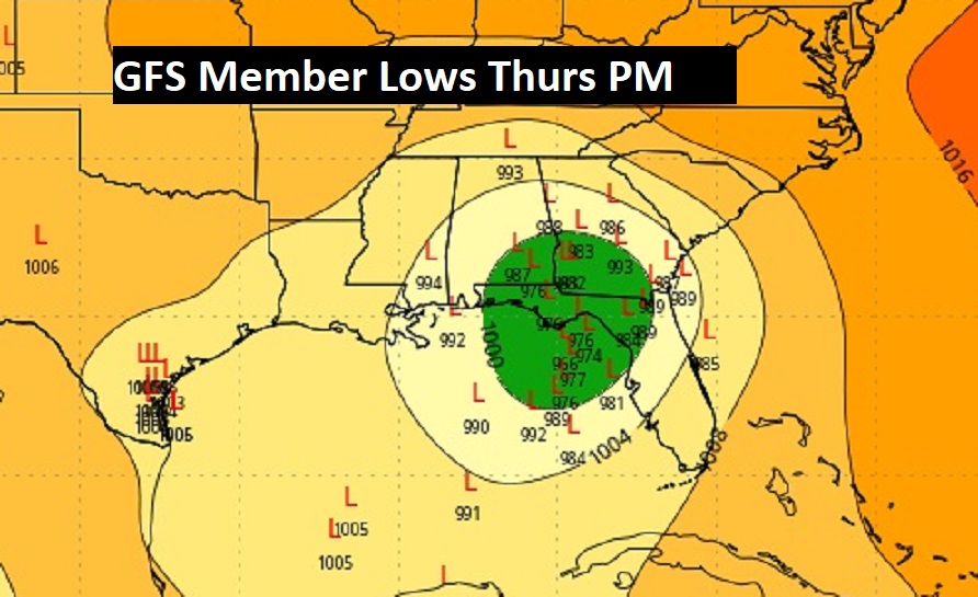
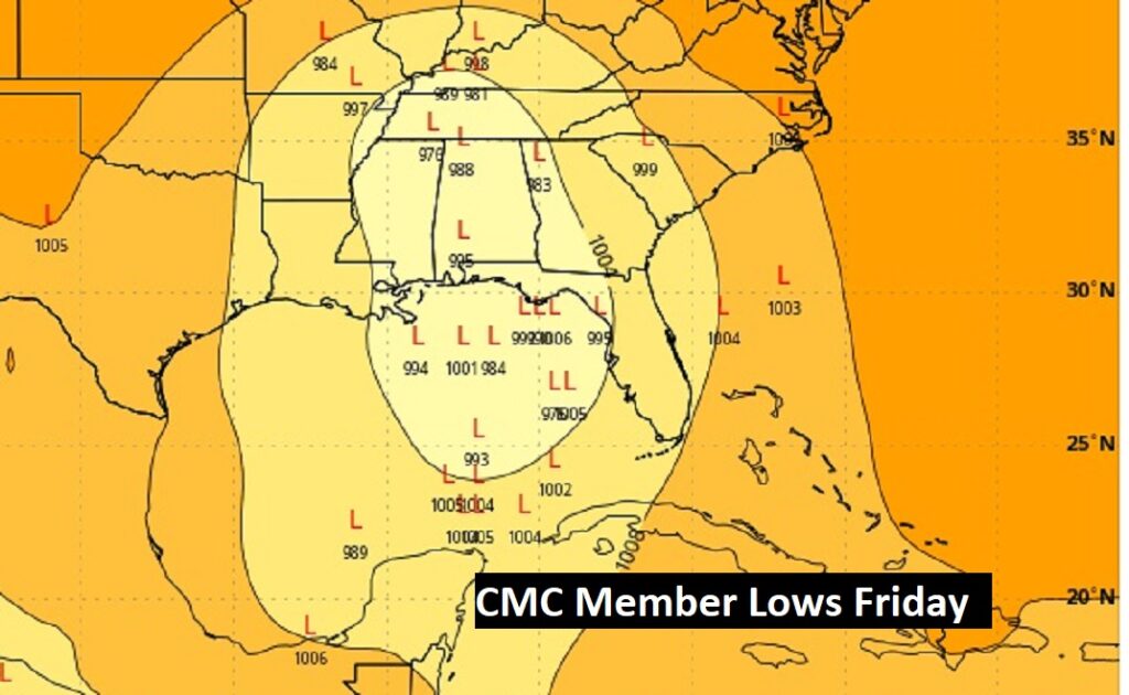
Now, the Global Ensemble models member Lows. Each model is run several times, giving various solutions. So, what you’re seeing are the various possible low pressure positions on each model run. The models are coming much closer together on targeting the northeastern Gulf of Mexico coast by Thursday. We’ll see.
First, here’s the EURO Ensembles.
Below are the GFS and the Canadian CMC member low positions. By the way, the GFS has been the most consistent model.
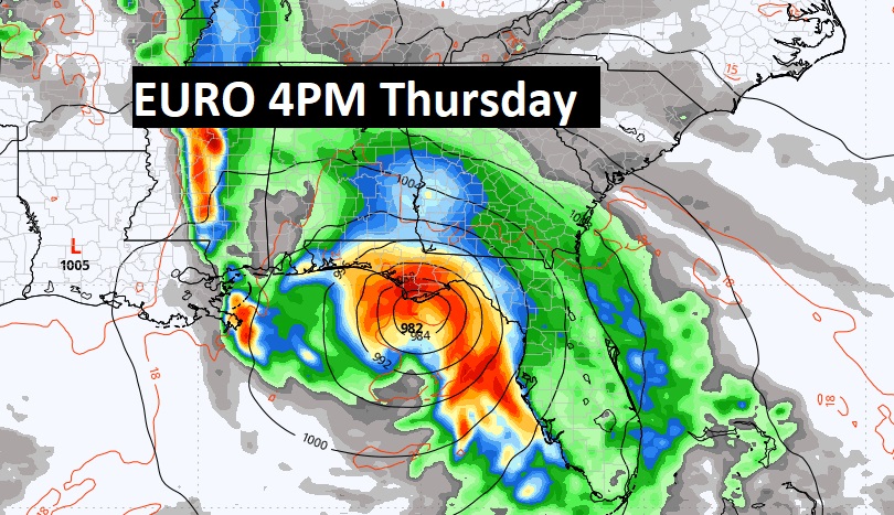
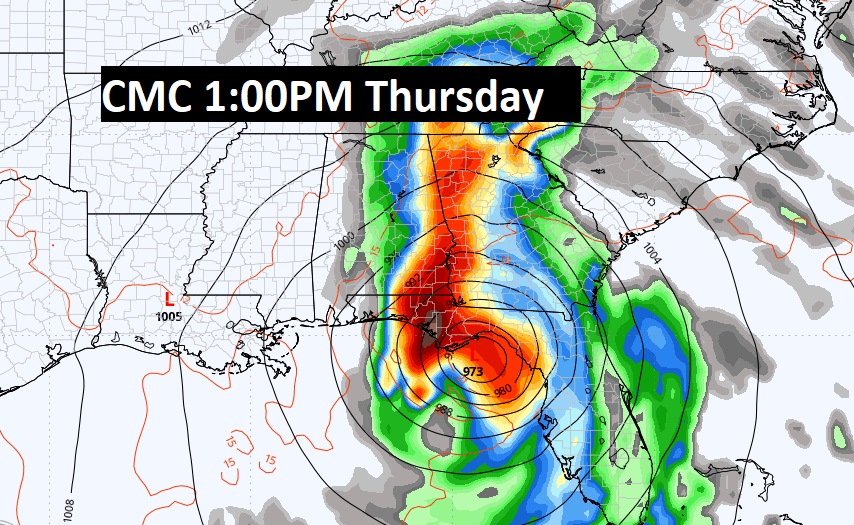
Now, here’s the actual operational run of the Global models. They are close. The GFS is the most disturbing on intensity.
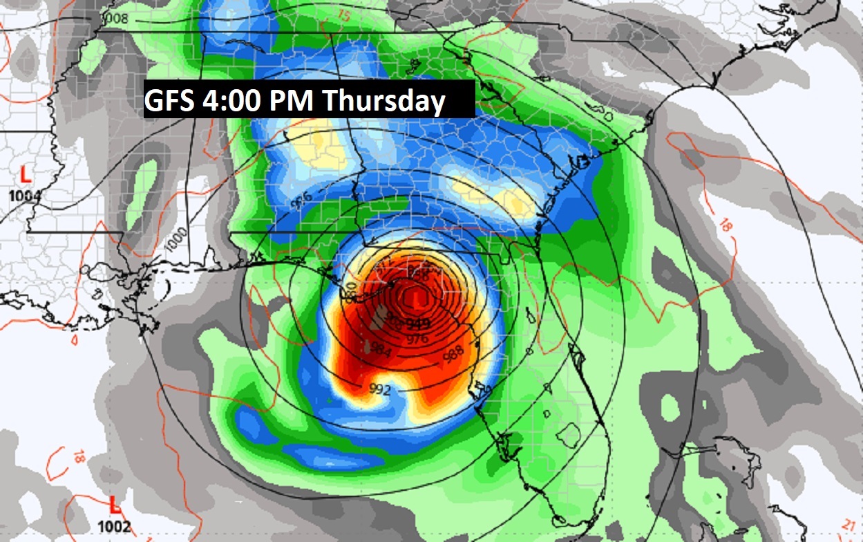
Here’s the EURO…4PM Thursday.
And the Canadian CMC at 1:00 PM Thursday.
Some of the models take Future Helene to MAJOR Hurricane Status. (over 111 mph)
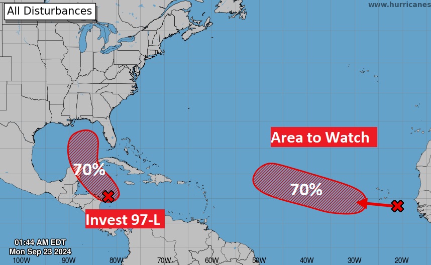
Elsewhere in the Tropics, NHC is monitoring an Area to Watch in the far east Tropical Atlantic.
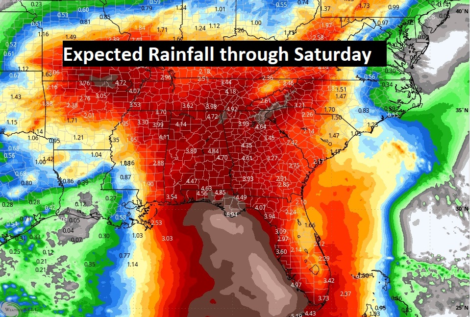
Here’s the Model Blend Expected Rainfall through Saturday. Obviously, prolific rainfall.
Thanks for reading the Blog . This morning, everything is normal including LIVE on the Radio from 6 to 9AM on NewsTalk 93.1 – WACV. Have a nice day!
–Rich