
10:00am:
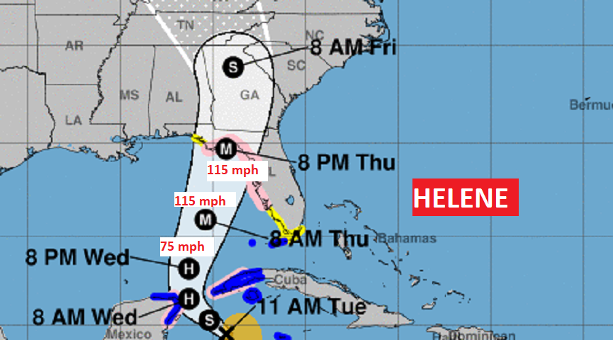
PCT9 is now, finally Tropical storm Helene. Expected to become a Hurricane by tomorrow morning. And, forecast to become a Major 115 mph Cat 3 hurricane by sometime Thursday evening with up to an incredible 15 foot storms surge. A Hurricane Warning is in effect from near Port St. Joe down along the west coast to near Ft. Myers, including Tampa Bay. New Hurricane Warning in the Florida Keys. Helene is expected to be a particularly large hurricane.
AERLY MORNING UPDATE:
Good morning! Today will be mostly hot and dry, but obviously Future Helene (PTC 9) will dominate our forecast. Expected to become Tropical Storm Helene this morning and Hurricane Helene this afternoon. So far, we are still on the left side of Helene’s projected path, as it moves northward in the eastern Gulf. Landfall, as a potentially Major hurricane, is expected along the northeast gulf coast Thursday or more likely Thursday night. Even on the west side of the track, rainfall amounts here in Alabama could be prolific with amounts of 4 to 5”+. Storms will thin out by Friday. Here’s my brief forecast discussion.
TODAY: Mostly sunny. Hot and dry, again. High 94. Increasing clouds tonight. Afternoon rain chance 20% or less. Risk of a few showers in the overnight hours. (30 to 40%) Low tonight 72.
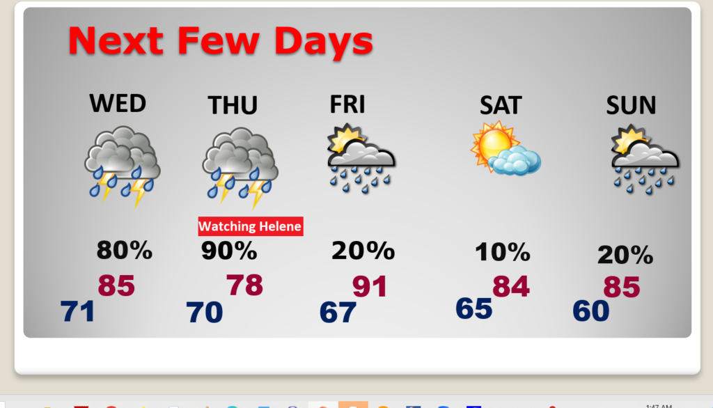
NEXT FEW DAYS: Showers and thunderstorms become much more likely Wednesday and Thursday ahead of Helene’s landfall. Rainfall will be locally heavy Thursday. The shower risk will thin out Friday, with widely scattered showers & storms. Obviously, the forecast details of the forecast are highly dependent on the exact track of the storm.
TROPICAL UPDATE: Potential Tropical Storm nine. is in the west Caribbean 315 miles from the west tip of Cuba moving NNW at 8, winds 35 mph. Two RECON flights are investigating right now. Expected to become Tropical Storm Helene this morning, a hurricane with afternoon and make land fall as a Major Cat 3 Hurricane Thursday night on the NE Florida coast near the Big Bend.
.
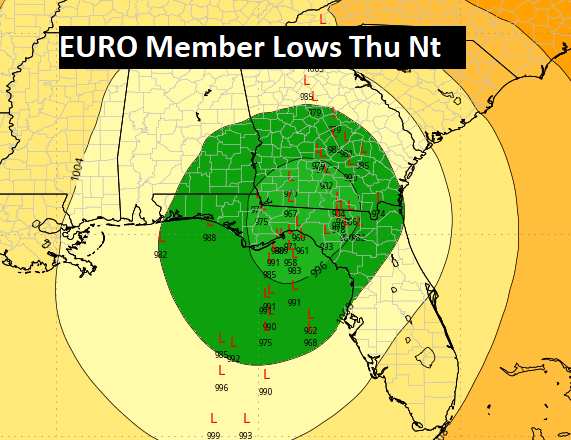
Here’s the EURO Ensemble Member Lows, which are clustered in the northeast Gulf.
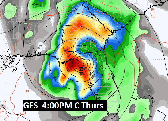
Now, here’s the actual operational run of the Global models. They are close. The GFS has been most confident. Here’s 4:00PM CDT Thursday.
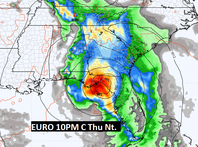
Here’s the EURO…Not as intense as the GFS, Similar landfall location. 10PM CDT Thursday night.
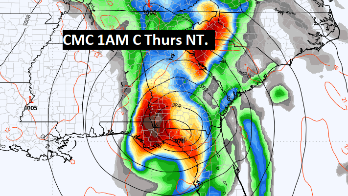
And the Canadian CMC at 1:00 AM CDT late Thursday night. Similar landfall spot along the NE Gulf Coast.
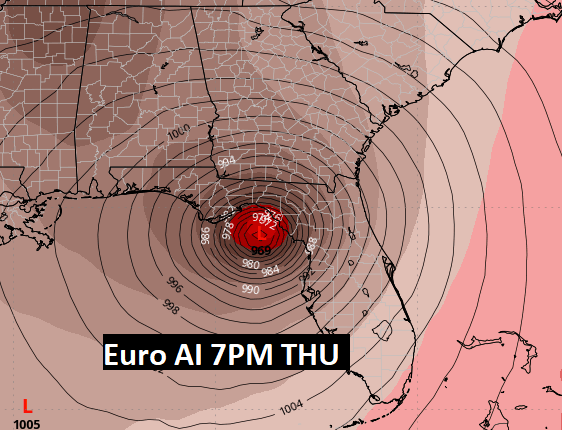
One more. Here’s the EURO Artificial Intelligence solution, Again the Big Bend area, 7PM CDT Thursday night..
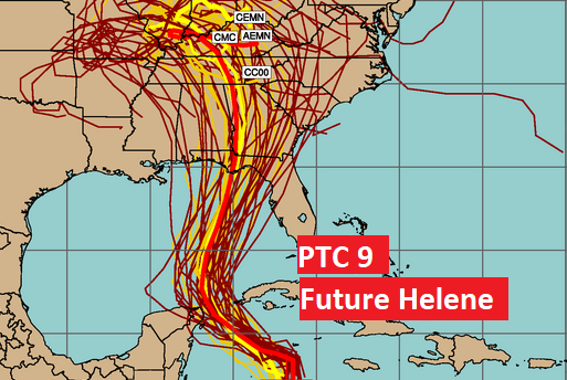
Spaghetti models. The consensus center line is not too far from the GA/AL border. Too close for comfort.
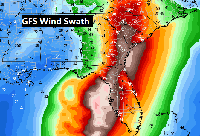
This is an interesting the graphic. Here’s the GFS peak with swatch forecast, Helene will remain very strong on it’s trek through Georgia. Many trees will comedown. Power failures will be monumental.
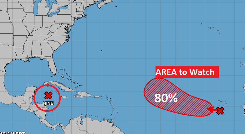
Elsewhere in the Tropics, NHC is monitoring an Area to Watch in the far east Tropical Atlantic, with an 80% chance of development. (Future Isaac)
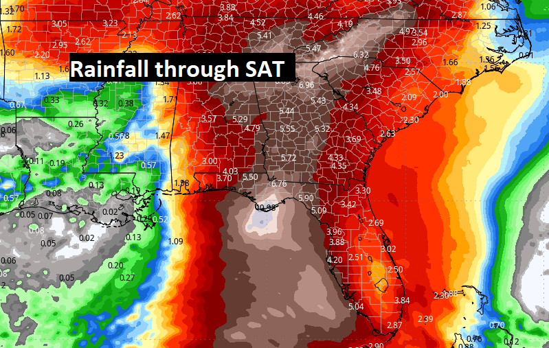
Here’s the Model Blend Expected Rainfall through Saturday. Even on the west side of the track, rainfall amounts here in Alabama could be prolific with amounts of 4 to 5”+. Storms will thin out by Friday.
Thanks for reading the Blog . This morning, everything is normal including LIVE on the Radio from 6 to 9AM on NewsTalk 93.1 – WACV. Have a nice day!
–Rich