
(10:00 AM 9/25/24)
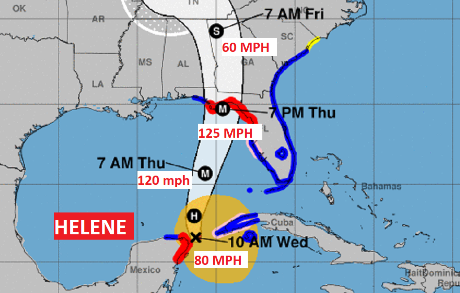
Helene is now officially a Hurricane, in the Gulf 500 miles SSW of Tampa. Winds have increased to 80 MPH. Moving NNW at 10 mph. Pressure 979 mbs. Helene is expected to undergo rapid intensification in the warm water of the eastern Gulf of Mexico. Forecast two become a Category 3 Major Hurricane by late tonight. Landfall is expected along the northeast Florida Gulf coast Thursday evening.
EARLY MORNING UPDATE:
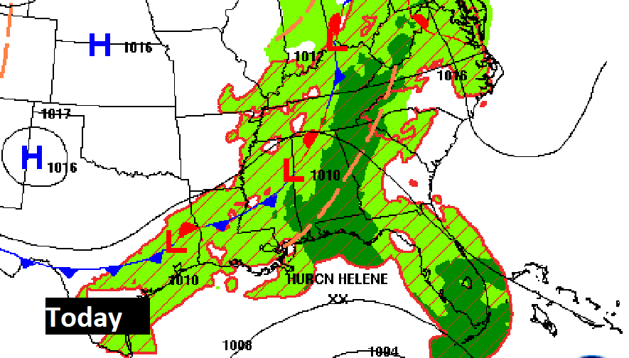
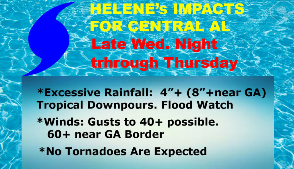
Good morning! The models are now in excellent agreement on the future track of Tropical Storm Helene. Helene is expected to become a Hurricane today and a Major Category 3 hurricane (or higher) with landfall expected along the northeast Florida Gulf Coast Thursday evening. For us, Local effects: Flood Watch for rainfall 4”+ near I-65 to 8”+ near the Georgia border, Wind gusts 40+ mph as far west as I-65. 50-60+ mph near the Georgia border. Occasional showers today. Rainfall will increase tonight and through Thursday. Locally heavy Thursday. No tornadoes area expected. Rain will taper off Friday morning. The weekend looks sunny & dry. Here’s my brief forecast discussion.
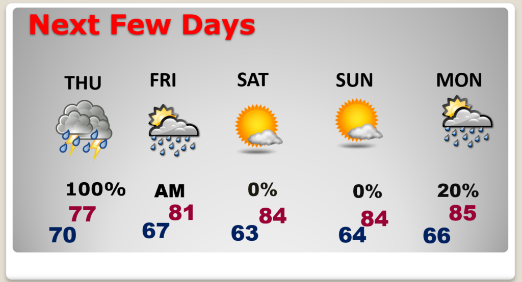
TODAY: Periods of showers, maybe some thunderstorms. High 84. East wind 8 to 12, increasing tonight. Rain and maybe some storms increase tonight. Flood Watch begins. Low tonight 70.
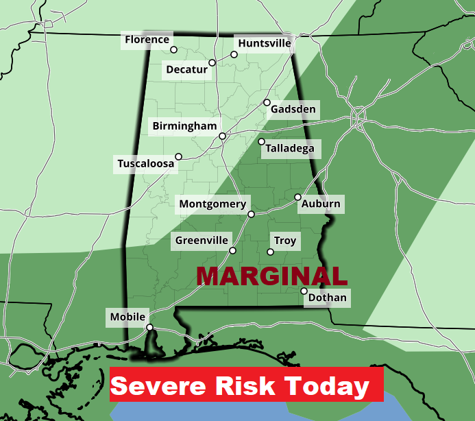
Some of the storms could reach Severe Limits today. Marginal Risk.
HELENE UPDATE: Tropical Storm Helene is becoming stronger and better organized. It will reach Hurricane status today. Currently winds (4:00 AM CDT) 65 mph winds nearing the Yucatan Channel moving NW at 9 MPH. Pressure 985 mbs.
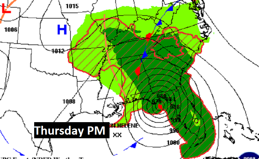
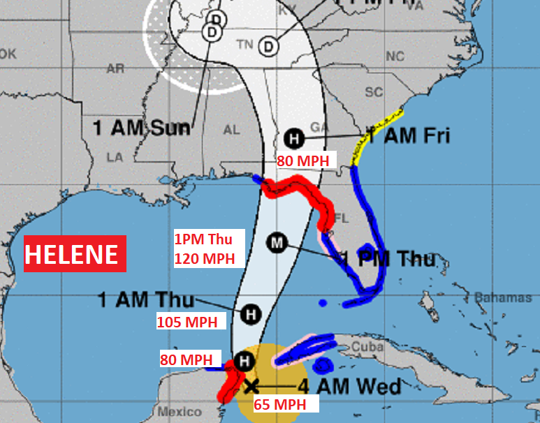
The models are very much in agreement on the timing and the track at landfall. It’s now looking more and more like a landfall as a Major Cat 3 hurricane (or stronger) along the northeast Florida coast Thursday night, and then quickly move northward through Georgia, still as a powerful storm. Helene is likely to be a Historic Hurricane. Storm surge with Helene will be prolific (10 to 15 feet near Landfall), perhaps to record levels on the part of the coast.
.
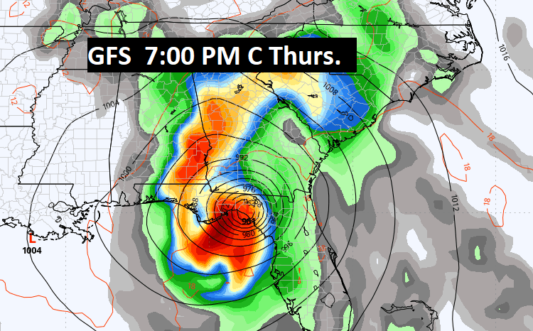
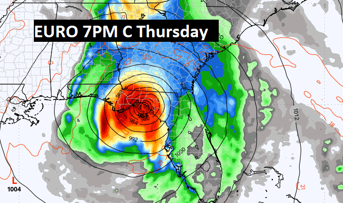
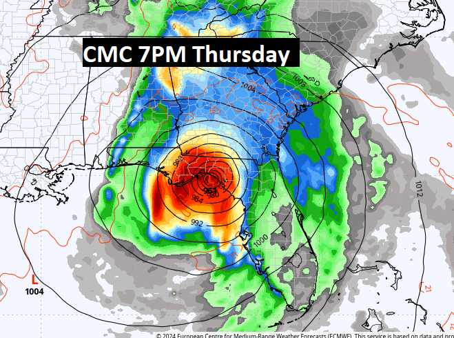
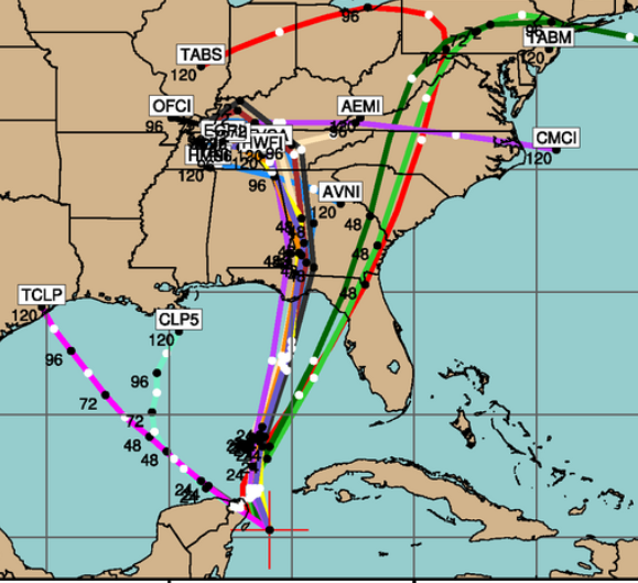
Let’s check out the Global Model landfall positions and times. They are amazingly similar. The GFS, Euro ECMWF, and The Canadian CMC.
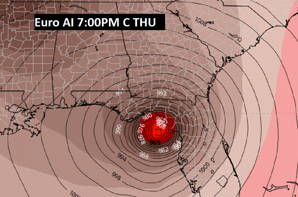
Even the Euro Artificial Indigence model is in amazing agreement.
The Spaghetti models. The consensus center line is not too far from the GA/AL border.
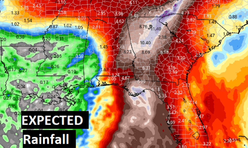
Local effects from Helene are mainly excessive rainfall totals over the eastern half of the state. Flood Watch. And wind gusts to 40+ mph from I-65 eastward. Perhaps as high at 60+ mph near the Georgia border.
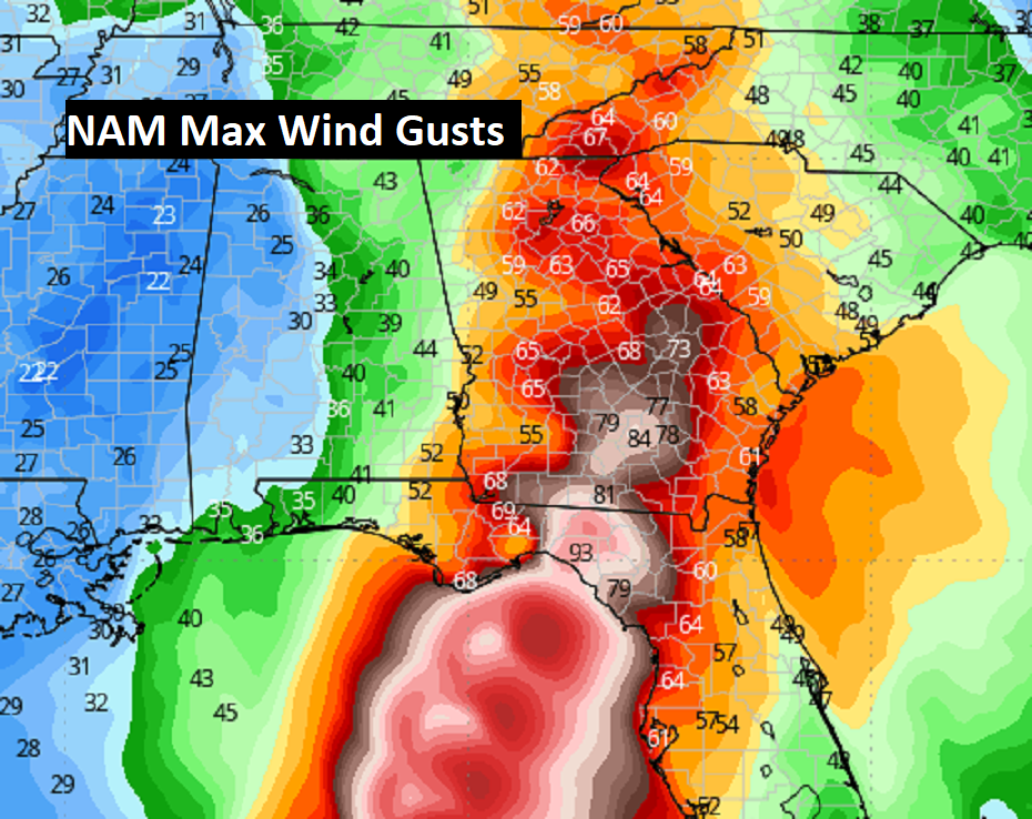
From the NAM model – here are some projected wind gusts.
My gosh take a look at some of the projected rainfall totals with Helene!
NEXT FEW DAYS: Rainfall tapers off Friday morning, and then it should become Mostly sunny in the wake of Helene, Right now, the weekend looks sunny and dry Highs in the mid 80’s and 60’s at night. Small chance of showers Monday.
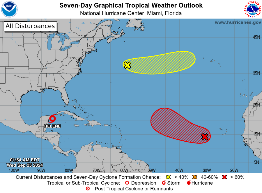
Elsewhere in the Tropics: NHC is monitoring an Area to Watch in the far east Tropical Atlantic, with an 80% chance of development. (Future Isaac) And, another small Area to Watch in the central Atlantic.
Thanks for reading the Blog . This morning, everything is normal including LIVE on the Radio from 6 to 9AM on NewsTalk 93.1 – WACV. Have a nice day!
–Rich