
Good morning! Helene made landfall last night, over the Florida Big Bend, not too far from Perry as a Cat 4 140 mph Hurricane with a catastrophic storm surge. This morning Helene is terrorizing Georgia as moves quickly to the north. Helene’s out effects continue in eastern Alabama this morning with gusty winds and locally heavy rain. The storm effects will start to quickly fade particularly by this afternoon and tonight, In the wake of Helene, get ready for a really nice weekend with plenty of sunshine and lower humidity. Highs in the 80’s. Lows in the 60’s. Meanwhile, we’re not done with the tropics yet. There’s a new Area to Watch from the west Caribbean into the southern Gulf. Here’s my brief forecast discussion.
TODAY: Risk of leftover rain primarily in the morning. Windy this morning. Winds gusting as high as 30+MPH. Partly cloudy tonight. Low mid 60’s
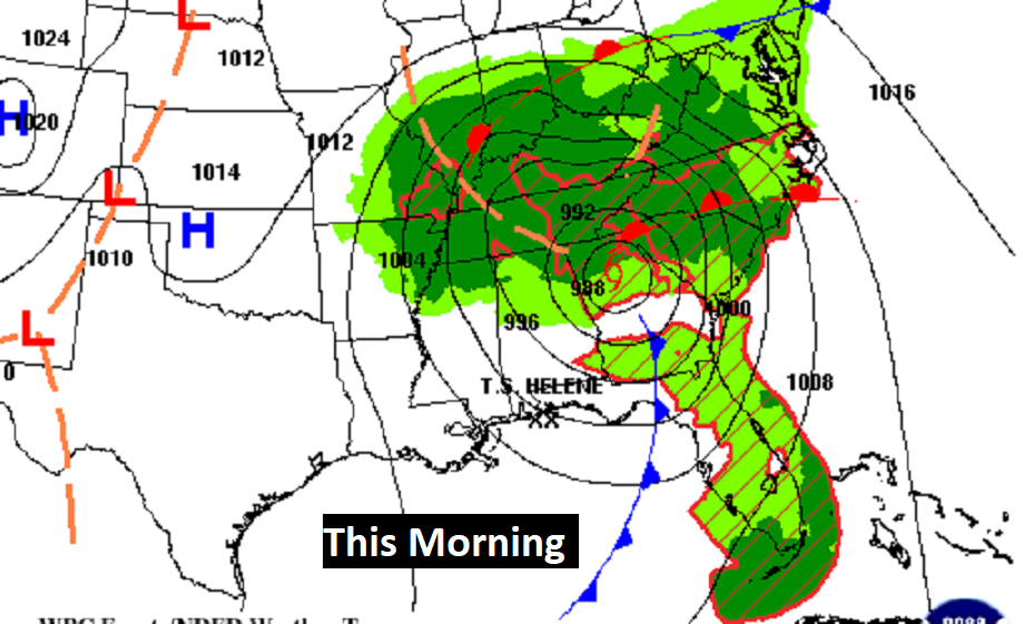
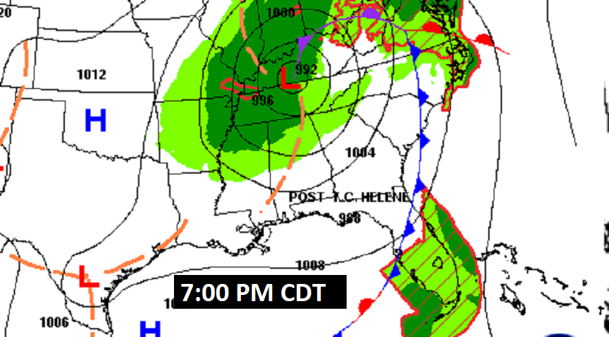
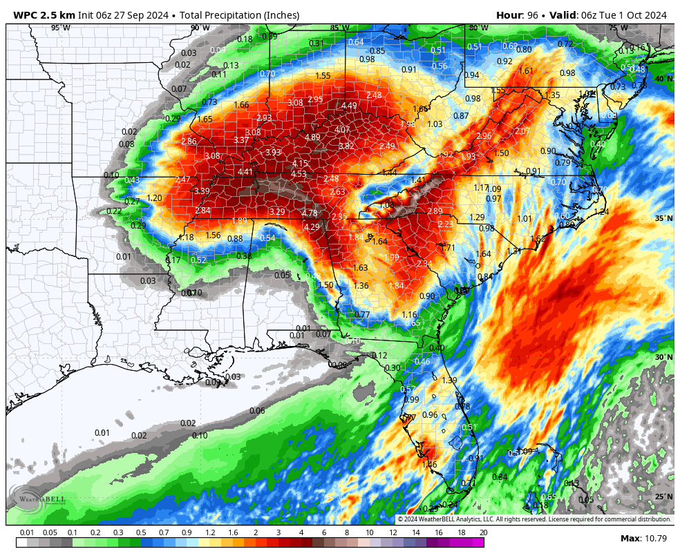
HELENE UPDATE: Helene is still powerful but it is now classified as tropical storm as it tears northward through Georgia. Atlanta has been experiencing catastrophic flooding. The storm will cause widespread prolific rainfall over muti-state area and a tornado threat east of the storm’s track.
We’ll be on the western edge of the Helene rainfall shield mainly this morning. Rainfall along the path of Helene will be prolific, especially in Georgia. The storm will cause widespread prolific rainfall over muti-state area.
Wind gusts 30+ mph will mainly be first half of the day in east Alabama. Tropical storm conditions persists in Georgia tomorrow. I wonder about operations at the ATL airport. Not sure how long there will be a ground stop and cancelled flights.
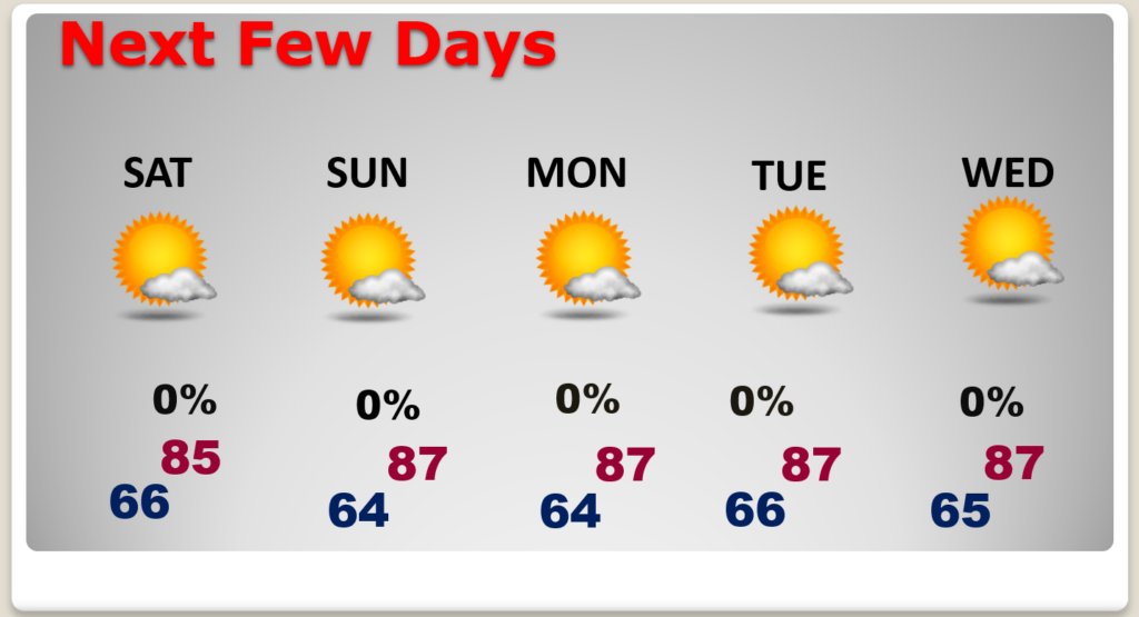
NEXT FEW DAYS: The weekend looks sunny and dry. Highs in the 80’s and 60’s at night. Low humidity. We should be dry through mid-week.
Elsewhere in the Tropics: Tropical Storm Isaac continues in the central Atlantic. It is what we call a “fish storm.” It won’t effect land. Invest 98-L could become the future Joyce. 98-L in the Tropical Atlantic MDR has an 80% chance of development. Next available name is Joyce. Meanwhile, there’s a new Area to Watch from the west Caribbean into the southern Gulf.
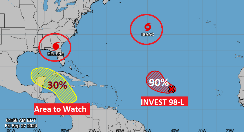
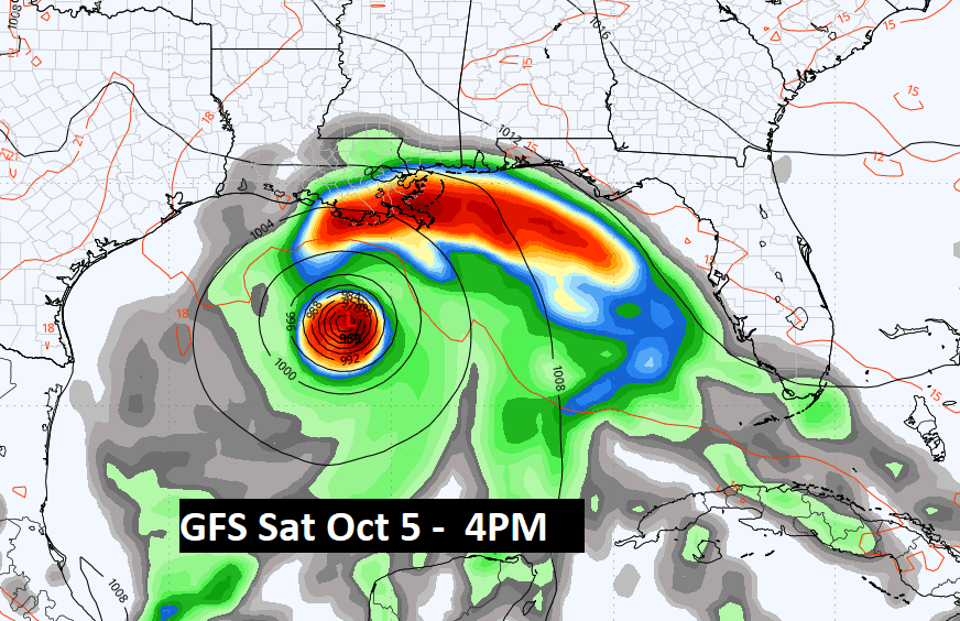
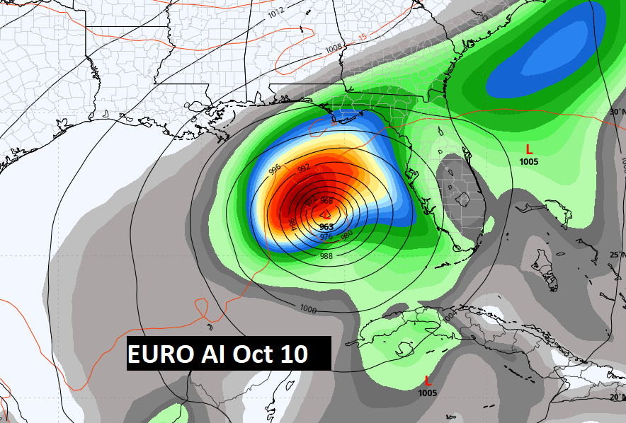
Don’t take this to the bank, but WAY out there some of the long range global models advertise future Gulf mischief, Stay tuned.
Thanks for reading the Blog . This morning, everything is normal including LIVE on the Radio from 6 to 9AM on NewsTalk 93.1 – WACV. Have a nice day!
–Rich