
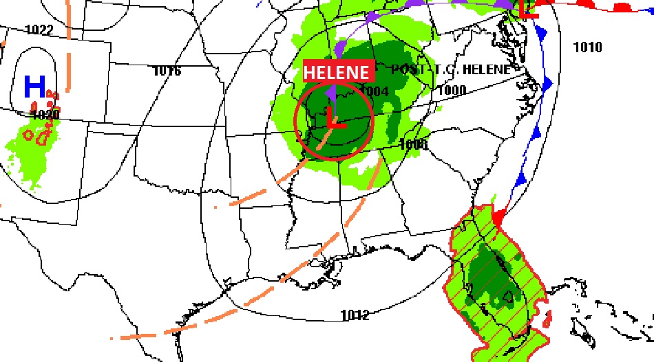
Good morning! The remnants of Helene, located near Louisville, is still influencing weather over much of the eastern half of the US, But, here in Alabama, things are slowly returning to normal. Clouds still dominate the northern half of the state, but we’ll call today partly sunny. It’ll still be quite breezy, I’ll put the rain chance at 15%, in our area. Expect a more routine forecast Sunday through Thursday with lots of sunshine and highs in the upper 80’s. Don’t look now. But, there’s a new Area to Watch from the west Caribbean into the Gulf, Could we have another named storm in the Gulf by next weekend?
TODAY: A sun/cloud mix. Breezy. High 85. SW wind 8 to 15 gusting 20+ mph. Rain chance 15% this afternoon through tonight. Partly cloudy tonight. Low 64.
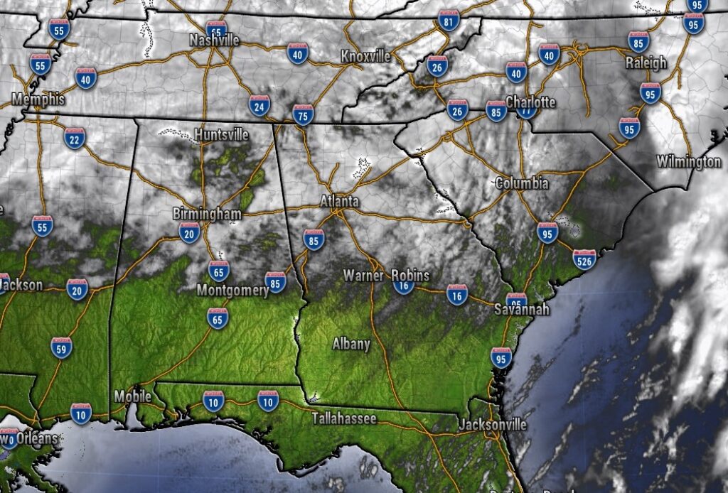
Clouds still dominate mostly the northern half of the state thanks to Helene.
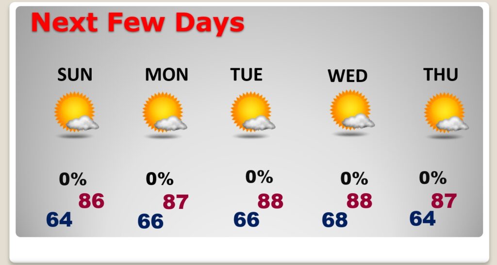
NEXT FEW DAYS: Expect a more routine forecast Sunday through Thursday with lots of sunshine and highs in the upper 80’s. Lows at night in the 60’s.
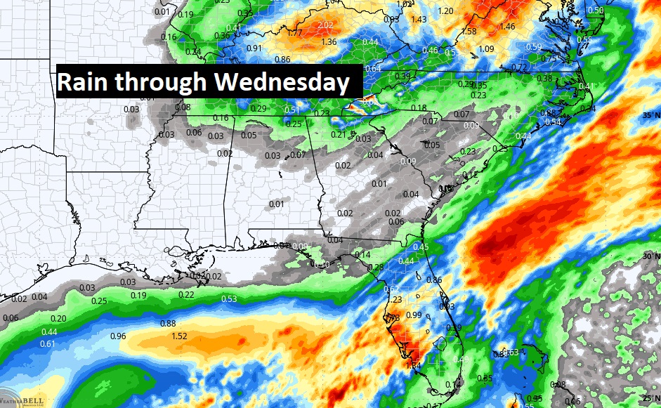
Here’s the expected rainfall through mid-week. Basically a dry forecast for us.
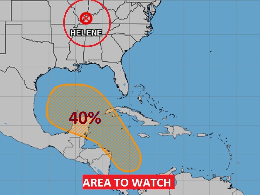
Elsewhere in the Tropics: UH OH. There’s a new area to watch in the west Caribbean into the Gulf. It currently has a medium 40% chance of development. NHC says a Depression could form by mid-week.
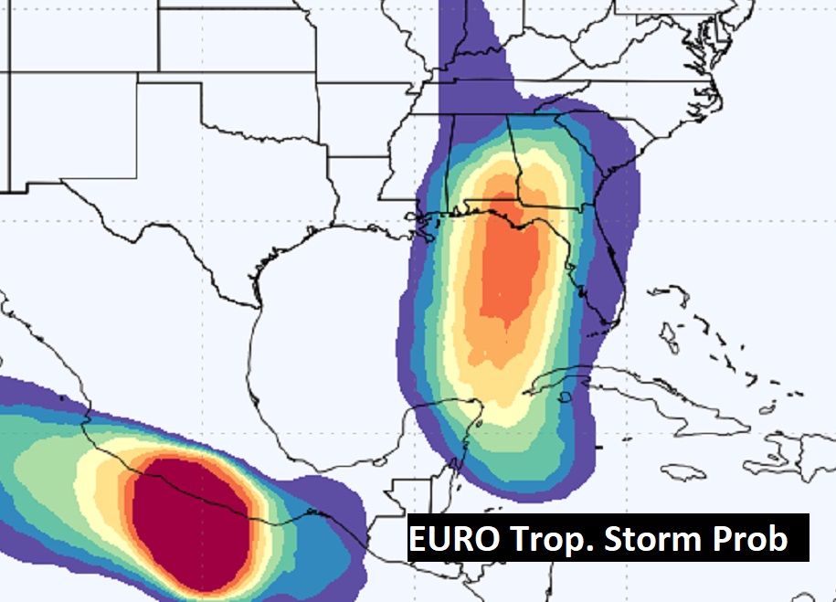
Check out the EURO Tropical Storm Probability next week. A decent chance of developing.
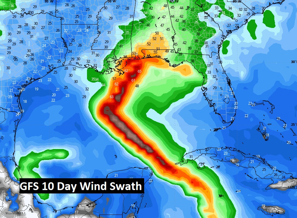
Even more disturbing, here’s the GFS wind Swath for the next 10 days.
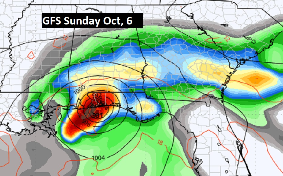
Don’t take this to the bank, but here’s the GFS on Sunday the 6th. The next two names on the list are Kirk and Leslie. I have a good buddy named Kirk in Pensacola. And, look where the GFS has the storm. Ironic.
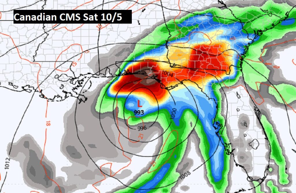
The Canadian CMC next Saturday.
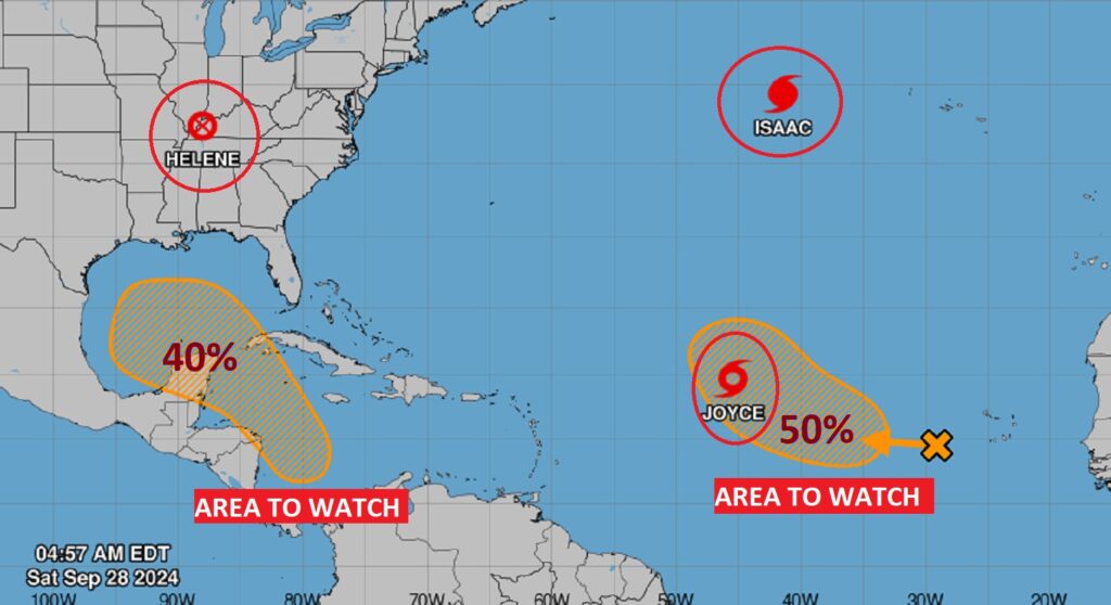
We don’t care about any of the other features in the Atlantic – including Isaac, Joyce and that Area to Watch.
Thanks for reading the blog. The next scheduled blog will be Monday morning, Have a nice weekend!
–Rich