BULLETIN: 4PM CDT – MILTON is now once again a cat 5 hurricane with 165 mph winds. Pressure: 918 mbs. Moving ENE at 9. More as we analyze the new 4PM CDT NHC Advisory. #milton
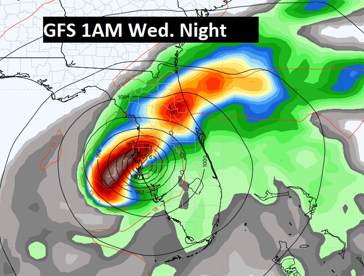
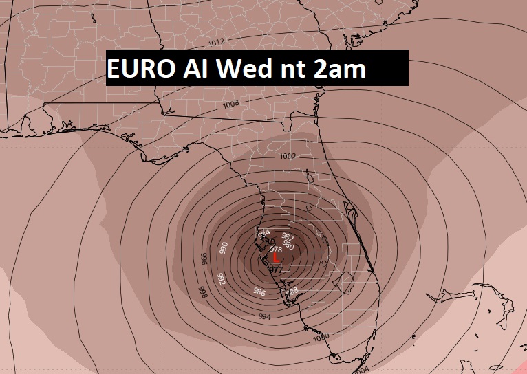
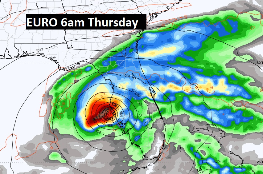
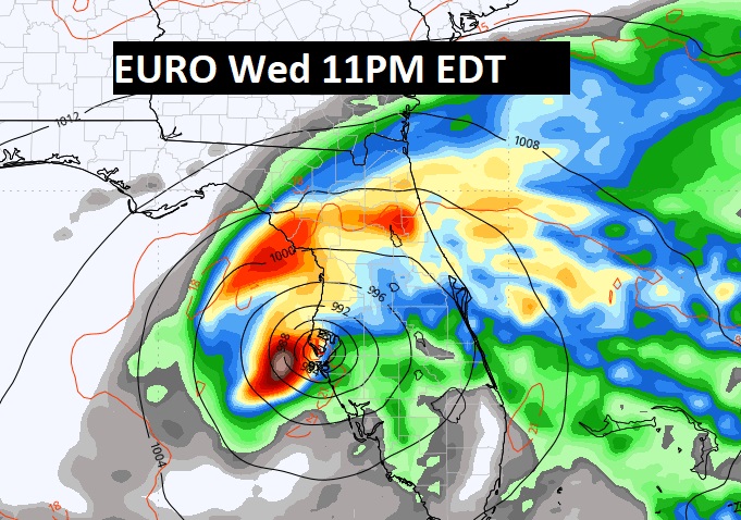
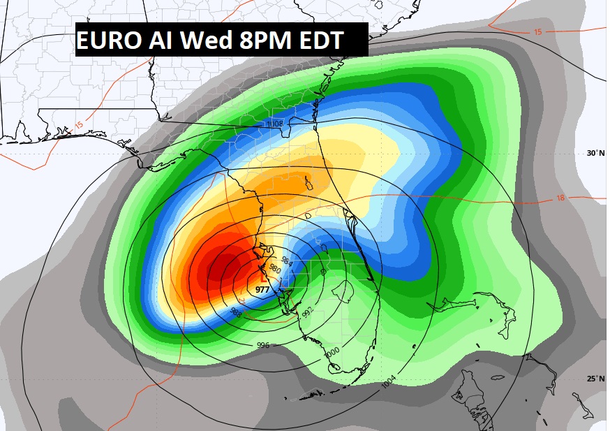
While the major models are on pretty much the same page on a potential landfall area on the western Florida Gulf coast, close to Tampa Bay, they do disagree a little bit on the arrival time of the eye crossing the coast
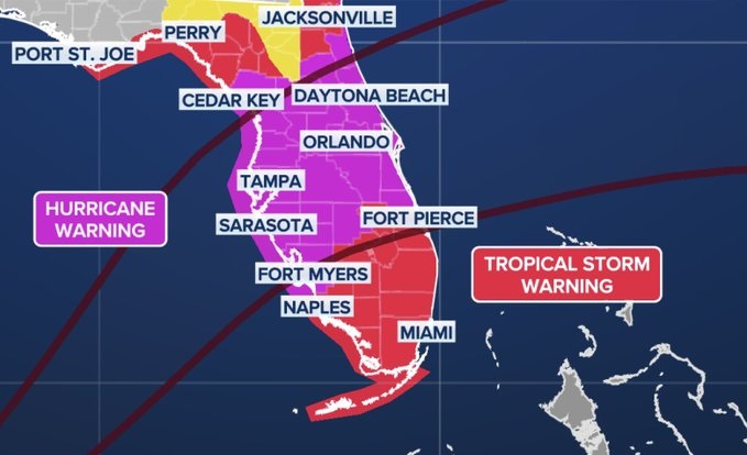
New developments as the tropical alerts expand in Florida, including the expanded Hurricane Warning now covers all of central Florida all the way to the east coast.
Good morning! All eyes on powerful Milton as it targets Florida with potentially catastrophic impacts by Wednesday evening/night. Much more on Milton, including timing and expected impacts below. Milton will have zero effect on our weather, except for the substance or sinking air it will promote, which will keep our air dry and comfortable with extremely low humidity. The cool front which moved through yesterday is gradually ushering in some very nice fresh fall air. Days will be warm. Nights will be progressively cooler. By Wednesday through Friday, highs will be in the lower 80’s. The coolest air of the season is on the way. We’ll be in the 50’s Wednesday through Saturday night a least. Perhaps low 50;s by Dawn Friday and Saturday mornings. Here’s my brief forecast discussion.
TODAY: Mostly Sunny. Warm for October High 87. Monday’s high was 91 . Mainly clear tonight. Cooler. Low near 63.
The cool front is now located closer to the coast, with dry air foiltering in behind it. The front will also be a player in steering Milton to the northeast across the Florida peninsula,
NEXT FEW DAYS: The coolest air of the season is on the way. By Wednesday through Friday, highs will be in the low 80’s. The coolest air of the season is on the way. We’ll be in the 50’s Wednesday through Saturday night a least. Perhaps lower 50;s by Dawn Friday and Saturday. It’s a dry forecast for several days.
.
Here’s the expected rainfall through the next 7 days. Bone dry for us. But, check out the corridor of flooding rain across Florida from Milton. Epic totals.
TROPICAL UPDATE: Milton is the only player in the tropics we care about in the tropics. Although, there is that little Area to watch off the SE Florida coast, which is a precursor low in front of Milton.
Milton just exploded in intensity Monday with EXTREME Rapid Intensification, reaching a peak of 180 mph late yesterday, Winds have come down quite a bit, but it’s still a powerful Cat 4 storm with 155 mph winds. (CAT 5 is 157 mph) The pressure which bottomed out at 904 mbs, has risen to 924 at 4AM. It is likely to arrive on the west coast of Florida Wednesday evening/Wednesday night still as a major Cat 3 hurricane. Devastating impacts are likely, including what could be catastrophic, life threatening storm surge and flooding rainfall.
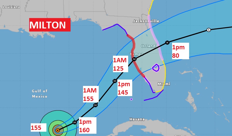
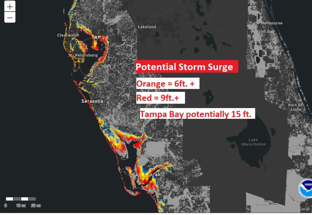
The Spaghetti Models are in much better agreement on the future track of powerful Milton. The news for Florida is potentially frightening. Here’s the GFS Ensembles spaghetti models.
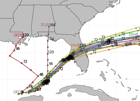
Will it go south of Tampa Bay or north of Tampa Bay? NORTH would be the absolute worse case scenario for millions in the Tampa Bay area, with historic devastating storm surge. Anyway you look at it, Milton will have horrific impacts for most of the Florida peninsula. Here’s a few snapshots of the Global model solutions starting with the GFS.
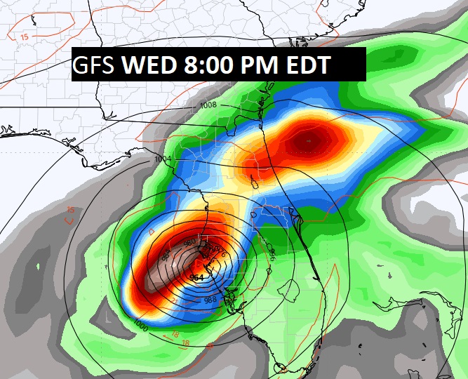
And now the Euro operational model, which is about 4 hours slower.
The EURO AI model shows a better scenario for Tampa Bay, as far as potential storm surge. A little farther south
Thanks for reading the blog. There will be another complete Blog update and video forecast discussion tomorrow morning. This morning, everything is normal including LIVE on the Radio from 6 to 9AM on NewsTalk 93.1 – WACV. Have a nice day!
–Rich
