
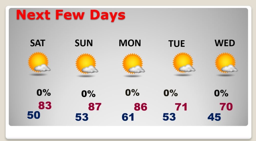
Good morning! We have a nearly perfect October weekend forecast. Expect comfortably warm days and jacket weather nights. Highs will be in the 80’s through Columbus Day Monday. An approaching cold front on Columbus Day Monday will usher in a shot of cool Canadian Air. Coolest of the season so far. Highs will only be near 70 by Tuesday and Wednesday. Expect mid 40’s at night by the middle of the week. Looks like our dry pattern will continue well into the future.
TODAY: Sunshine. Warm for October. High near 86. NW wind 5-10 mph. Clear chilly tonight. Jacket weather. Low near 53. (Normal hi/Lo 82/57)
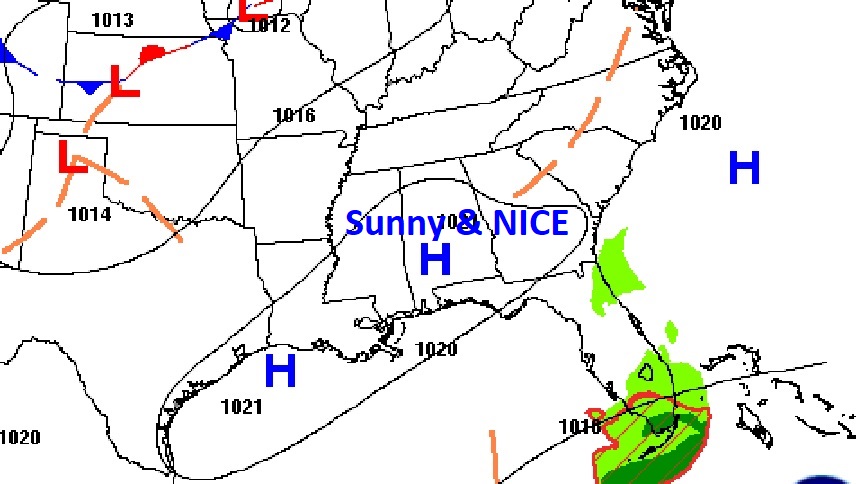
It’s a great day for the Fair and for tailgating around the Southest US with High pressure in control.
NEXT FEW DAYS: We are locked into a very nice October pattern. Dry, comfortable days with clear jacket weather nights. Highs will be in the 80’s through Monday. An approaching cold on Monday will deliver some much cooler Canadian air Highs will only be near 70 by Tuesday and Wednesday. Expect mid 40’s at night by the middle of the week. The coolest mornings will be Wednesday, Thursday and Friday.
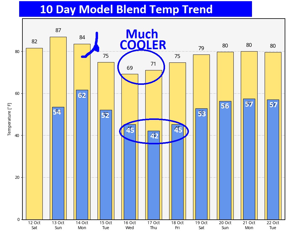
The 10 Day Model Blend Temperature Trend. That mid-week Canadian cool down will not last too many days. We’ll be back to near 80 next weekend.
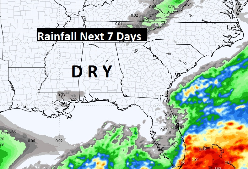
Not a drop of rain is expected across the Gulf South for several more days.
.
TROPICAL UPDATE: NHC is still monitoring two features in the far eastern Tropical Atlantic – Tropical storm Leslie and Invest 94-L.
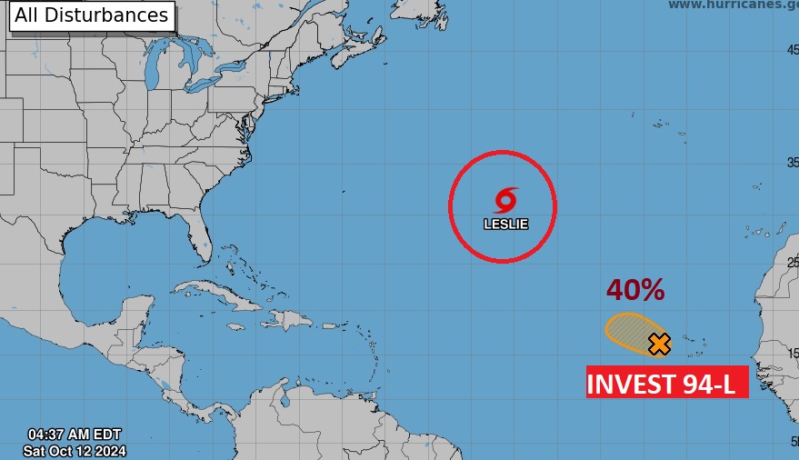
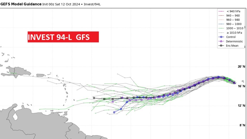
If 94-L can hang on, it could become Nadine and perhaps threaten the Islands late next week.
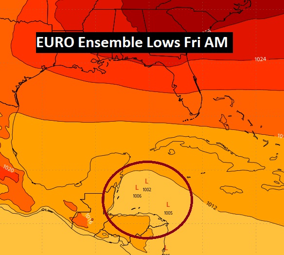
And check this out. The EURO tries to develop something in the West Caribbean at the end of next week. This an area we watch during October. Just saying….
Thanks for reading the blog. The next scheduled blog will be Monday morning, Have a nice weekend!
–Rich