
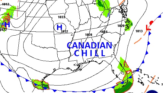
Good morning! Cool Canadian air covers Alabama and most of the eastern US. Today will be the coolest day. Tonight will be the coldest night. Parts of north Alabama are under a frost advisory. Expect mid 60’s today and near 40 by Dawn Thursday. The Canadian chill will fade by the weekend. We’ll be back to the upper 70’s by Saturday & near 80 by Sunday. Next week will be warmer. This storm-free dry pattern will continue for several days. Here’s my brief forecast discussion.
TODAY: Sunshine. Breezy & cool. High in the mid 60’s NW wind 7-13 gusting to 20 mph. Clear chilly tonight. Colder. Low near 40. (Normal hi/Lo 83/55)
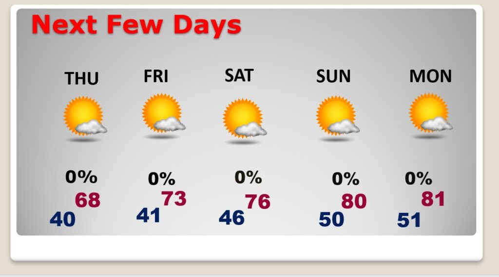
NEXT FEW DAYS: It’s a dry forecast for several days. Highs will only be in the 60’s again Thursday. The below normal, chilly nights will continue. By Thursday morning we’ll be close to 40 degrees. The Canadian chill will fade by the weekend. We’ll be back to the upper 70’s by Saturday & near 80 by Sunday.
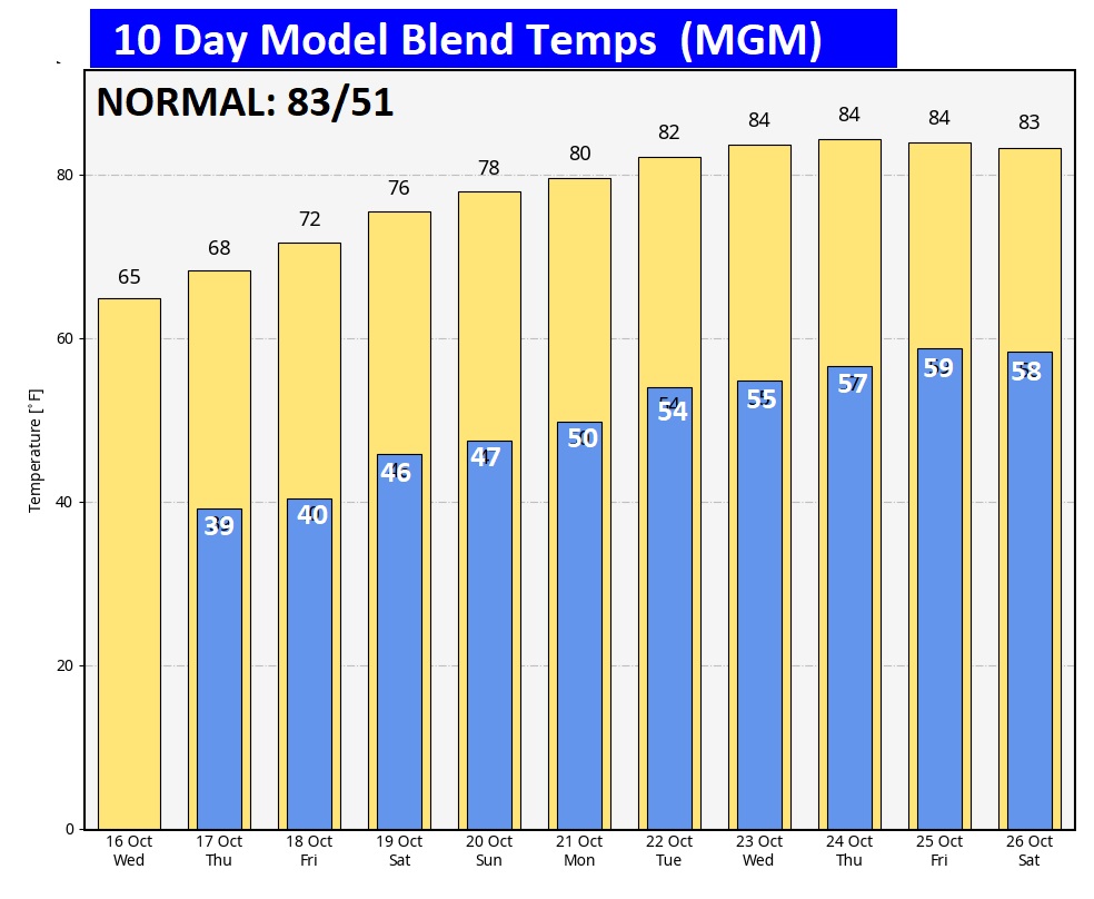
The 10 Day Model Blend Temperature Trend. Check out the major warming trend in our future, especially from the weekend through next week.
.
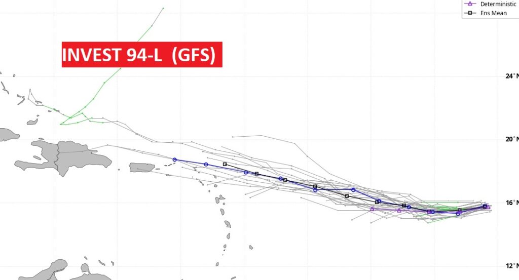
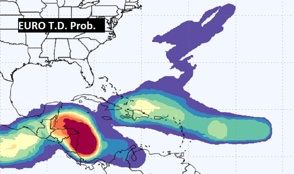
TROPICAL UPDATE: Invest 94-L has a medium 50% chance of future development as it heads toward the islands. The next available name Nadine. Also, there’s a new Area to Watch in the west Caribbean.
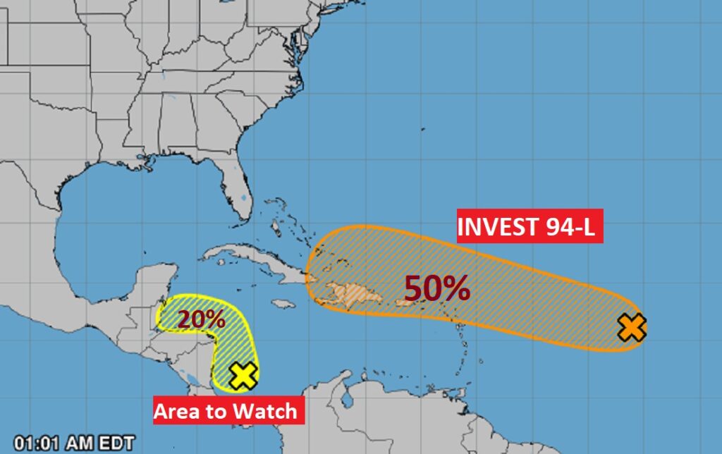
The models indicate a potential threat to the islands, including the greater Antilles.
Here’s the EURO probability of tropical development. It’s bullish on Future Tropical Development in the western Caribbean.
FULL HUNTER’S MOON: The October Full Hunter’s moon is this morning.

Thanks for reading the blog. There will be another complete Blog update and video forecast discussion tomorrow morning. This morning, everything is normal including LIVE on the Radio from 6 to 9AM on NewsTalk 93.1 – WACV. Have a nice day!
–Rich