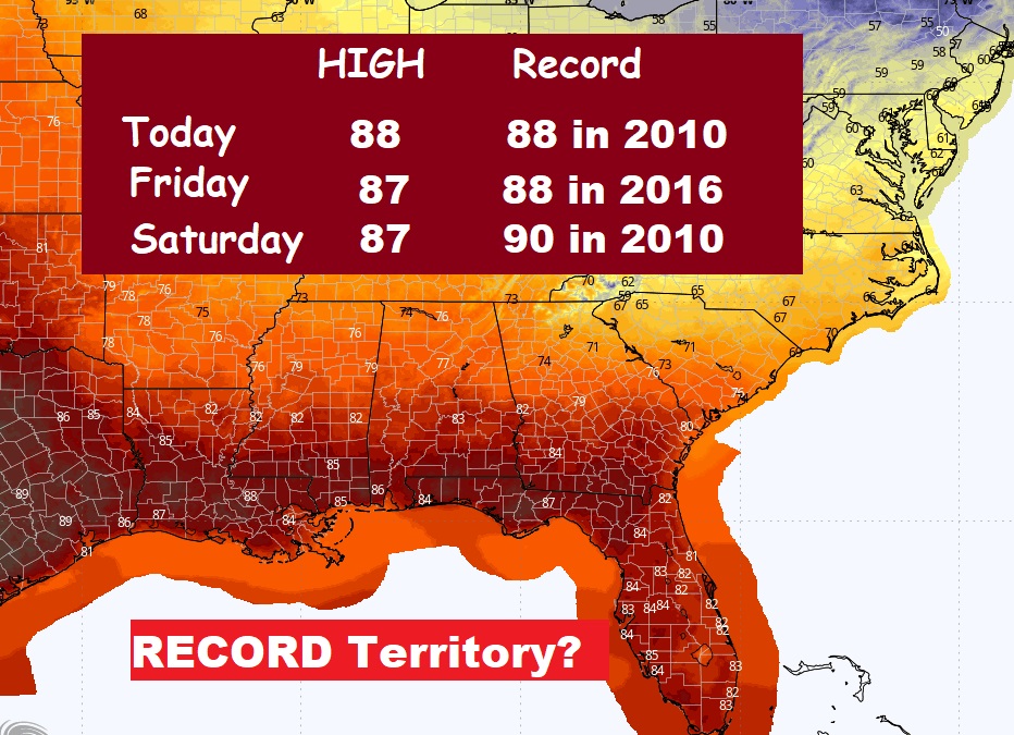
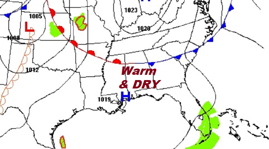
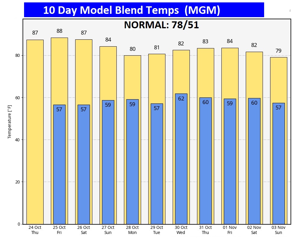
Good morning! The amazing late October warmth continues. It feels more like August than October. Yesterday’s high was 86 degrees at MGM. Today, tomorrow and Saturday we’ll be in the upper 80’s. Even the nights are very mild for late October. Meanwhile, our storm-free, dry pattern will continue for several more days. A weak cool front will move through the state on Sunday, but it will be a dry front. Monday will be slightly cooler, actually close to normal, And, the warmth will rebound next week. Rainfall prospects remain dim for several days. Here’s my brief forecast discussion.
TODAY: Sunny & warm. Comfortable humidity. High 88. Light wind Clear tonight. Mild for October. Low 57
Could we threaten Record Highs at MGM today and tease records Friday & Saturday? We’ll be close!
Yesterday’s low was 56 and the high was 86. (Normal hi/Lo 78/51) Rainfall for the month of October: .02”. Deficit for the month: -2.32.
. Much of America is still well above normal.
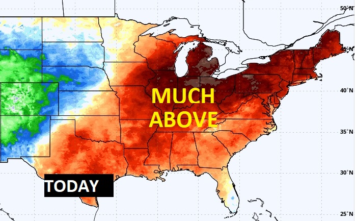
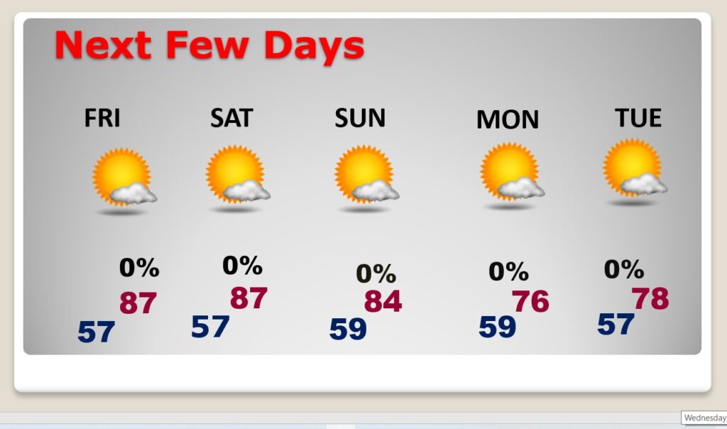
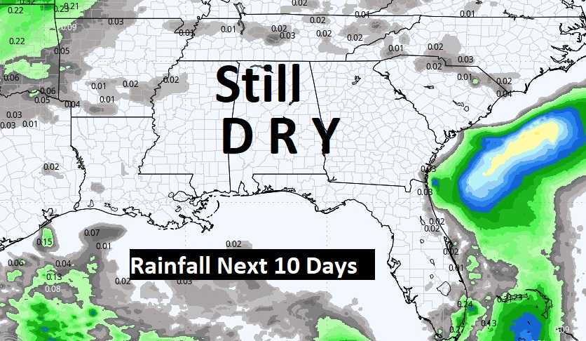
NEXT FEW DAYS: It’s a dry forecast for several more days. The Feels more like August than late October . We’ll be in the upper 80’s through Saturday. Meanwhile, our storm-free, dry pattern will continue for several more days. A weak cool front will move through the state on Sunday, but it will be a dry front. Monday will be slightly cooler,, but actually near normal. And, the warmth will rebound next week. Rainfall prospects remain dim for several days.
The 10 Day Model Blend Temperature Trend. The arctic flood gates wil be closed for several days.
.
Expected rainfall in the next 7 to 10 days. Disappointing.
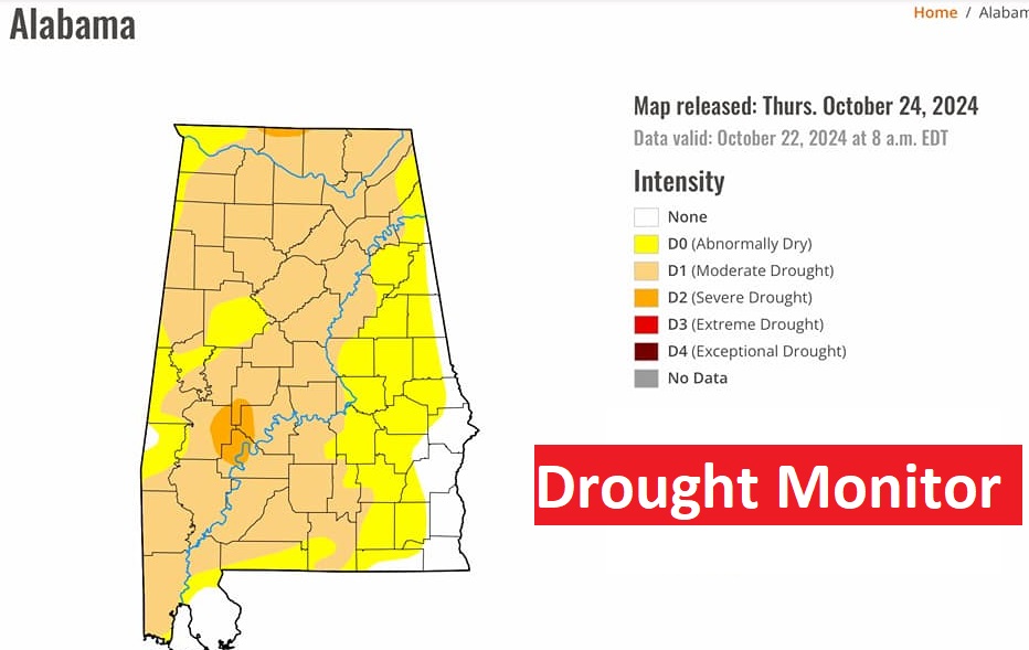
he New Drought Monitor map is not pretty. With 91% of the state now in some level of drought, the moderate or higher level has now risen to 63%. And, the prospects for rain over the next 7 to 10 days is dismal.
.
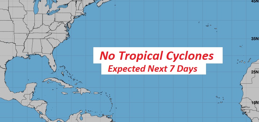
TROPICAL UPDATE: The tropics are quiet for now, NHC is not tracking any potential tropical systems in the next 7 days.
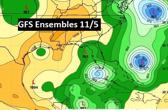
Major global models continue to hint at tropical mischief early in the first week of November, not far from the SE US coastline. Most bullish on this idea is the American GFS. The Tropical Trouble may not be done. The hurricane season continues until November 30th.
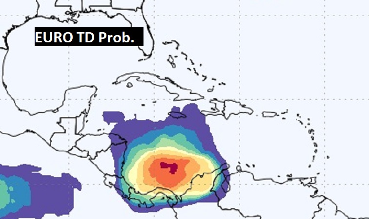
The EURO model warns that we need to monitor the Caribbean over the next 7 days.
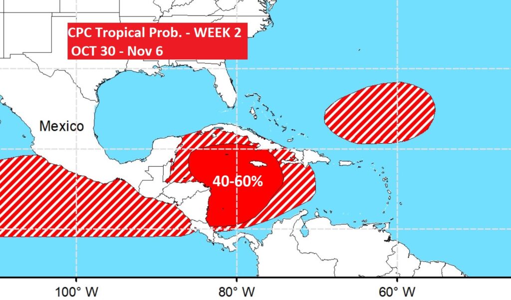
Now the Climate Prediction Center says there’s a 40-60% chance of development Week 2 – Oct 30 – Nov 5. We’ll see.
Thanks for reading the blog. There will be another complete Blog update and video forecast discussion tomorrow morning. This morning, everything is normal including LIVE on the Radio from 6 to 9AM on NewsTalk 93.1 – WACV. Have a nice day!
–Rich
Thanks for reading the blog. There will be another complete Blog update and video forecast discussion tomorrow morning. This morning, everything is normal including LIVE on the Radio from 6 to 9AM on NewsTalk 93.1 – WACV. Have a nice day!
–Rich
