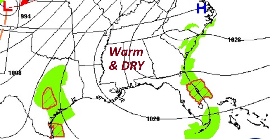
Good morning! Our long string of warm, dry days continues. The days and nights will remain well above normal. Highs will be in the 80’s. Lows at night in the lower 60’s through Sunday. The high on Halloween will be near 86. And, there’s still no rain drops in our future for the next several days, through the weekend. In the tropics, there’s new interest in that Area to Watch in the Caribbean Here’s my brief forecast discussion video.
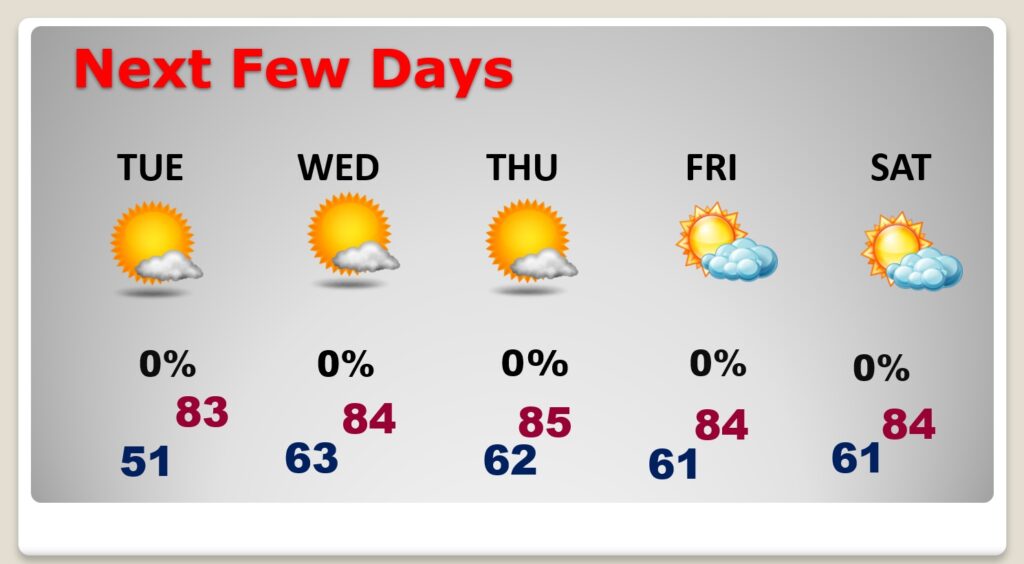
TODAY: Partial sunshine and quite warm for October. High 83. East wind 10 to 15 mph. Increasing clouds tonight . Low 61.
.
NEXT FEW DAYS: The warm and dry pattern continues for several more days. Highs in the low to mid 80’s days, and lower 60’s at night. Still dry through Saturday.
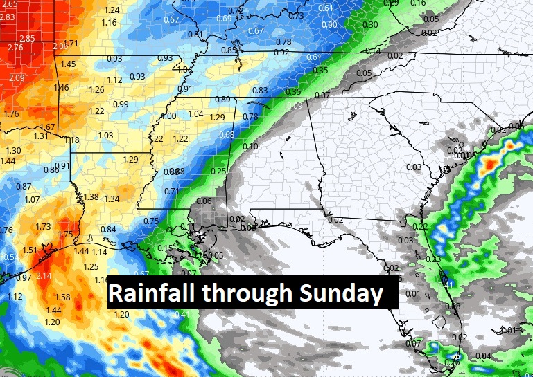
One of the driest Octobers on record:
Rain prospects through the weekend look dismal.
Driest months in Montgomery (1872-present):
October 1904 — 0.00″
October 1891 — 0.01″
October 1978 — 0.01″
October 1963 — 0.02″
October 2024* — 0.02″
October 1886 — 0.03″
September 2019 — 0.05″
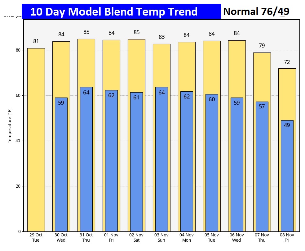
The 10 Day Model Blend Temperature Trend. There’s no chilly air expected. It’s an above normal forecast.
.
.
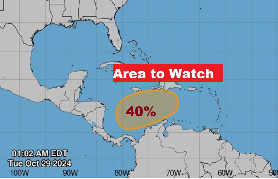
TROPICAL UPDATE: NHC is tracking and Area to Watch in the SW Caribbean. It’s broad area of low pressure, part of the Central American gyre (CAG). Although the potential for development this week, because of a hostile environment, the global models are in better agreement that an organized low pressure may start to develop late this week or this weekend and move northward in the west Caribbean.
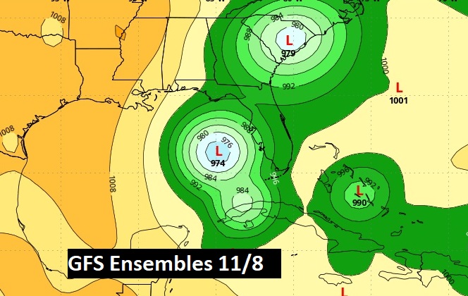
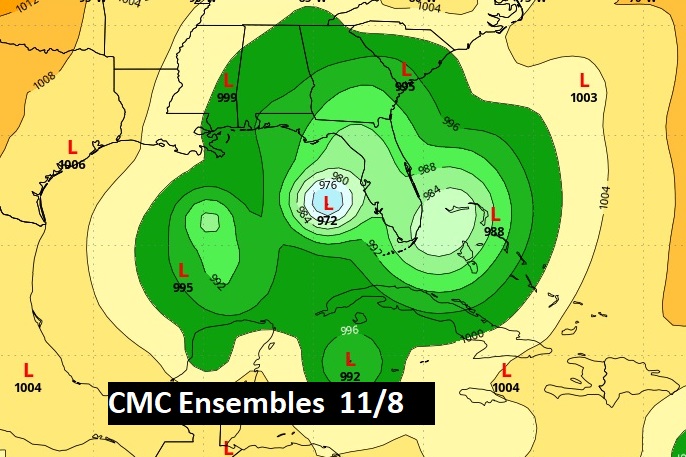
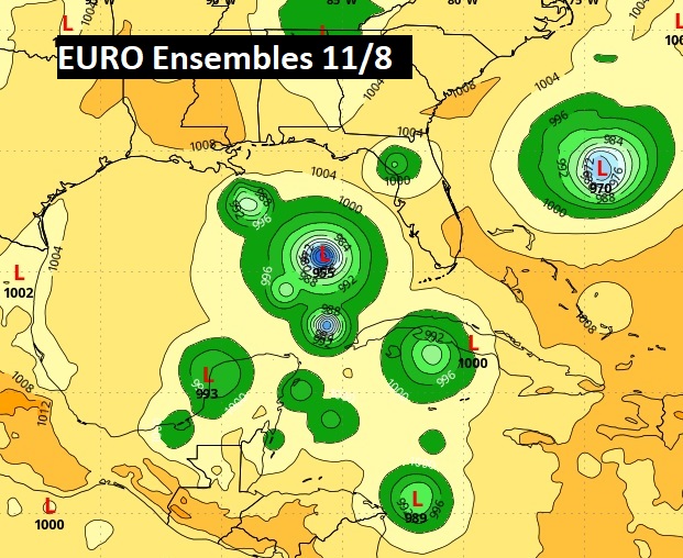
Three major global models continue to hint at future tropical development. Here’s a sample of Ensemble member Lows for the GFS, the Euro and the CMC late in Election Week. Hinting at eastern Gulf of Mexico Tropical Mischief.
Thanks for reading the blog. There will be another complete Blog update and video forecast discussion tomorrow morning. This morning, everything is normal including LIVE on the Radio from 6 to 9AM on NewsTalk 93.1 – WACV. Have a nice day!
–Rich
