Good morning! October ended Hot and dry. The Halloween high was 86. It was the third driest months in Montgomery weather history with .02”. November is starting very warm. We’ll be close to 86 today and tomorrow. Expect more dry and very warm weather through the weekend and into early next week. And, there’s still no rain drops in our future until perhaps Tuesday Night into Wednesday. Here’s my brief forecast discussion video.
CLIMATE: Yesterday was well above normal. Low 61. High 85. (Normal 75/48) Record Low: 29 in 1993, record high 90 in 2016. We ended October with only .02” rainfall, (2.85” below normal) Third driest month ever in Montgomery weather history which started in 1872.
TODAY: Sun and cloud mix. Hot start to November. High 86. South wind 6 to 12 mph. Mostly cloudy tonight . Low 63.
FIRE DANGER expands to all Alabama counties. counties
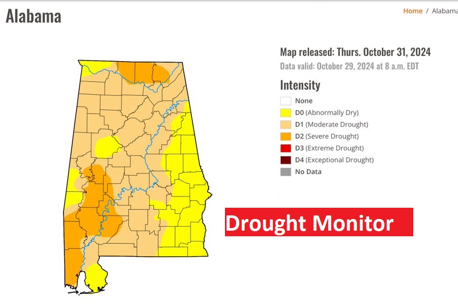
DROUGHT MONITOR: The new Drought Monitor is scary as the Drought expands and becomes worse. Now, 73% of the state is in at least a Moderate drought and 17% in a Severe Drought. The bIrmingham airport hit the jackpot yesterday evening with .25”.
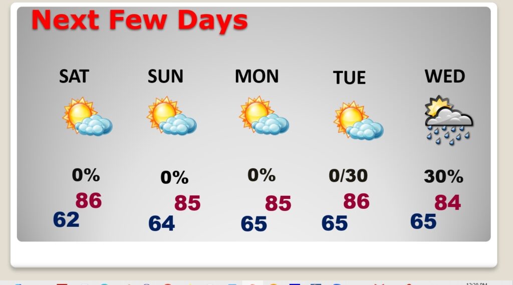
NEXT FEW DAYS: Expect more dry and very warm weather through the weekend and into early next week. Highs will be in the mid 80’s through Monday. Nights in the 60’s. And, there’s still no rain drops in our future until perhaps Tuesday Night into Wednesday.
.CLIMATE...


October 2024 Preliminary Rainfall Data:

Site                  10/31 Rain(in)  October Total(in)(Other Day(s)
---------------       --------------  ------------------------------
Anniston                   0.00                  0.00
Montgomery                 0.00                  0.02 (10/4)
Troy                       0.00                  0.17 (10/4 & 10/6)
Shelby County Airport      0.02                  0.02
Birmingham                 0.25                  0.25
Tuscaloosa                 0.44                  0.66 (10/4)
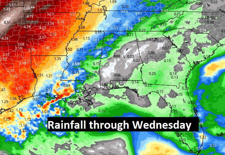
An approaching frontal system will bring a risk of showers and storms for most of us by Tuesday night into Wednesday. Here’s the expected rainfall through Wednesday. For most of us, not much.
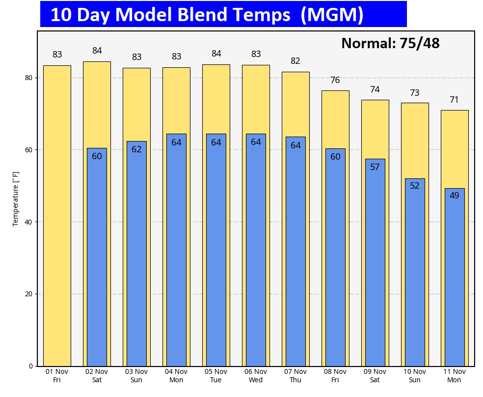
The 10 Day Model Blend Temperature Trend. If you’re looking for cooler weather, you’ll have to wait until next weekend. We’ll cool down a bit. Closer to normal.
.
.
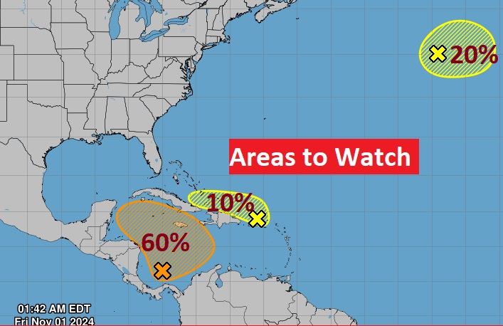
TROPICAL UPDATE: NHC is still tracking that Area to Watch in the West and SW Caribbean. There still could be some organized low pressure development by the weekend. There are also two other Areas to Watch in the Atlantic basin.
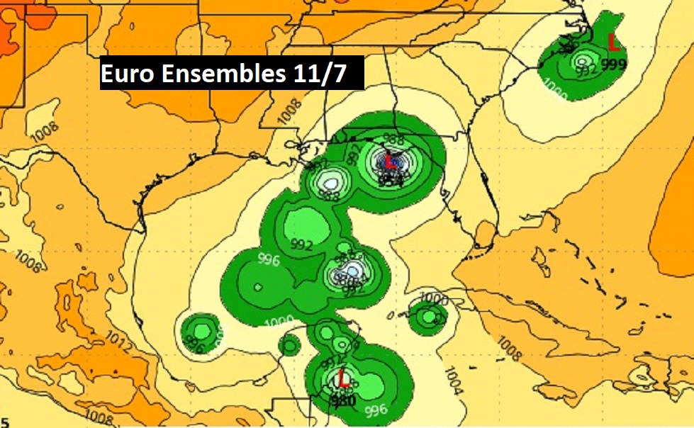
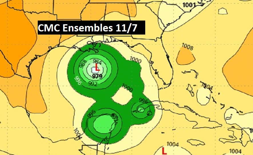
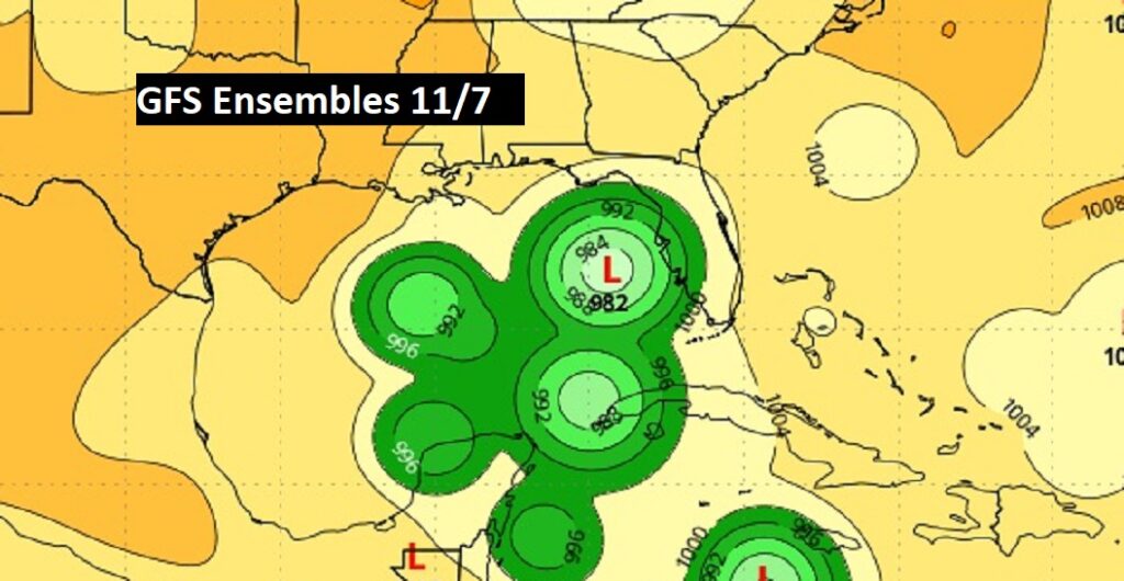
Next week, three of the major global models – the GFS, The Euro and the Canadian CMC shows varying degrees of low pressure development in the Gulf. The Euro is most bullish. Of course, we’d love some tropical rainfall from a Gulf low. Stay tuned.
FALL BACK THIS WEEKEND: This is the weekend we switch from CDT to CST.

Thanks for reading the blog. There will be another complete Blog update and video forecast discussion tomorrow morning. This morning, everything is normal including LIVE on the Radio from 6 to 9AM on NewsTalk 93.1 – WACV. Have a nice day!
–Rich
