Good morning! Shorts and tee-shirts weather continues. Yesterday, unfortunately, there just weren’t many showers on radar. Today, once again, showers will be rather isolated in nature. They will be few and far between. There will be at least a risk for widely scattered showers in the forecast Thursday through Veterans Day, Monday. But, the daily rain chance will be very low. Temperatures will remain above normal. Expect lower 80’s through Saturday. Upper 70’s are likely Sunday through the middle of next week expect 60’s at night. An important cold front will move through the state by about Wednesday night or Thursday, Hopefully, there will be better rain chances with the front. Much cooler air will follow for late next week. Here’s my brief forecast discussion.
TODAY: Mostly cloudy. Still Warm. High near 82. Normal 73/45. Widely scattered showers and today and tonight. But, they will be quite isolated in nature. East wind 6 to 12 mph. Low tonight near 69.
As you cab see from Future Radar, there simply will not be many showers around. Here’s a snapshot at Noon.
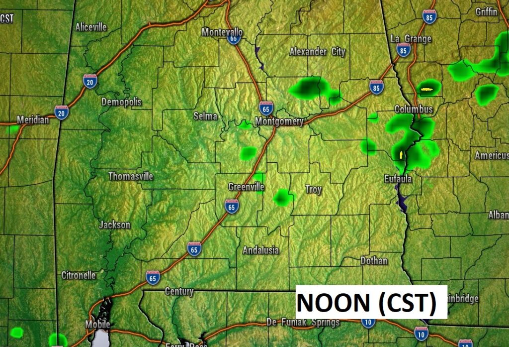
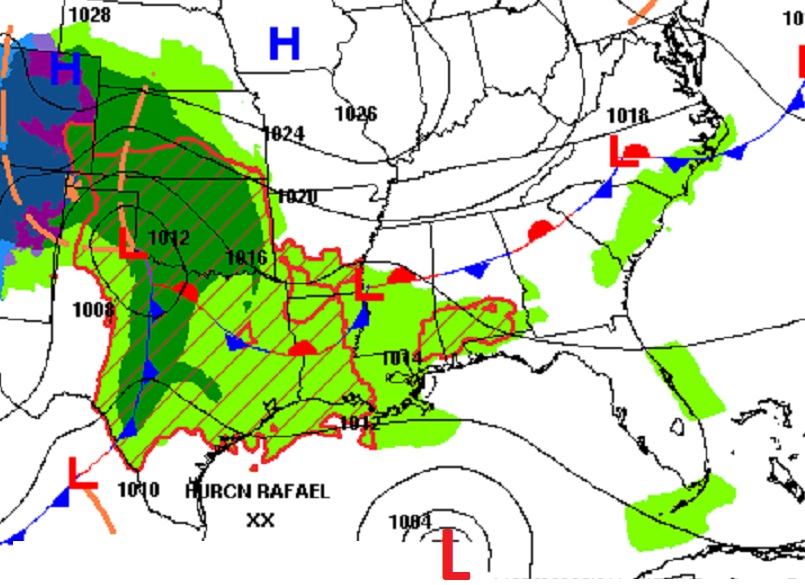
Here’s the map set-up for Noon today.
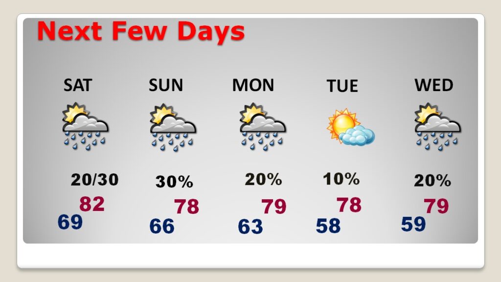
NEXT FEW DAYS: Not much change. There will be at least a risk for widely scattered showers in the forecast Thursday through Veterans Day, Monday. But, the daily rain chance will be very low. Temperatures will remain above normal. Expect lower 80’s through Saturday. Upper 70’s are likely Sunday through the middle of next week expect 60’s at night.
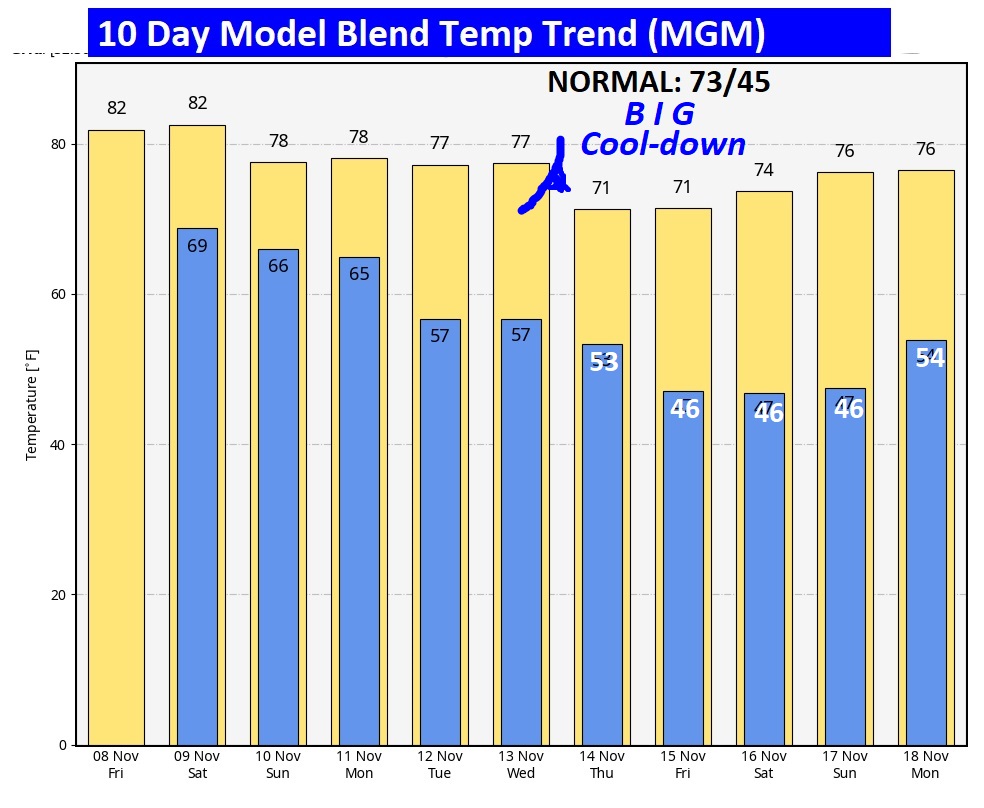
The 10 Day Model Blend Temperature Trend. An important cold front will move through the state by about Wednesday night or Thursday, Hopefully, there will be better rain chances with the front. Much cooler air will follow for late next week. Much cooler air will follow. Lows late next week will fall to the middle 40’s. That’s actually closer to the normal of 73/45.
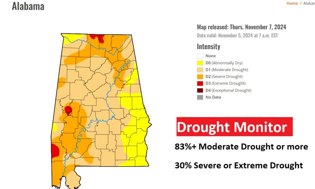
DROUGHT MONITOR: The desperate search for raindrops continues. The weekly Drought Monitor Map confirms an expanding and worsening drought across Alabama. Now, 83% of the state is in at least a moderate drought and, more disturbing, a third of the state (30%) is in a Severe or Extreme drought.
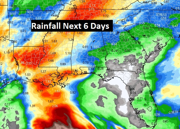
This map of potential rainfall next 6 days. Not much for us, unfortunately. Not enough,
.
.
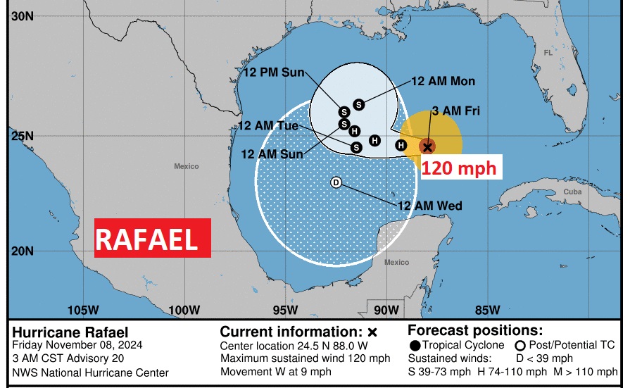
TROPICAL UPDATE: Rafael is a powerful Cat 3 hurricane in the Gulf with 120 mph winds! However, it is not destined for the United States, thankfully. It’s being blocked to the north. Is that the oddest Cone you have ever seen from NHC, The forecast shows it ki d of making a loop, loosing strength and then headed south toward the Bay of Campeche where it will begin to fall apart. Rafael is the 5th Major Hurricane of the Season.
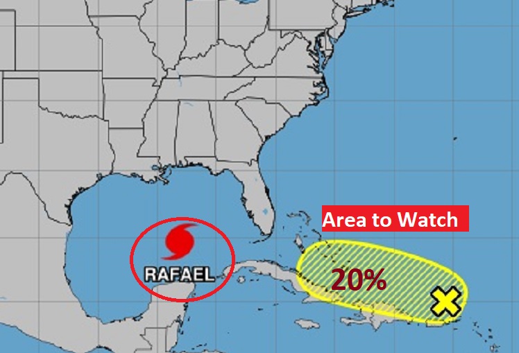
Elsewhere, there is an Area to Watch being monitored by NHC, located north of the Greater Antilles with a 20% chance of development.
Thanks for reading the blog. There will be another complete Blog update and video forecast discussion tomorrow morning. This morning, everything is normal including LIVE on the Radio from 6 to 9AM on NewsTalk 93.1 – WACV. Have a nice weekend!
–Rich
