Good morning! Sunshine returns in abundance today. It should be a very comfortable November day. Get ready for some changes as a cold front approaches the state Wednesday night and moves through Thursday AM. A band of, much needed, showers and thunderstorms will proceed the front. Much cooler air will follow late this week. Rainfall amounts may not be substantial, but we’ll take any raindrops we can get. Expect lower 40’s by Saturday Dawn. That’s actually normal. Meanwhile, there’s increasing interest in a future Tropical system in the Caribbean that could have implications for the United States by the middle of next week. Here’s my brief forecast discussion video.
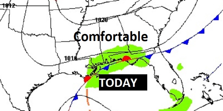
TODAY: A good bit of sunshine mixed with some clouds. Comfortable. High near 79. Normal 72/44. North wind 5 to 10 mph. Cooler tonight . Low 59
A weak cool front stalled near the coast will keep the rain chance south today,
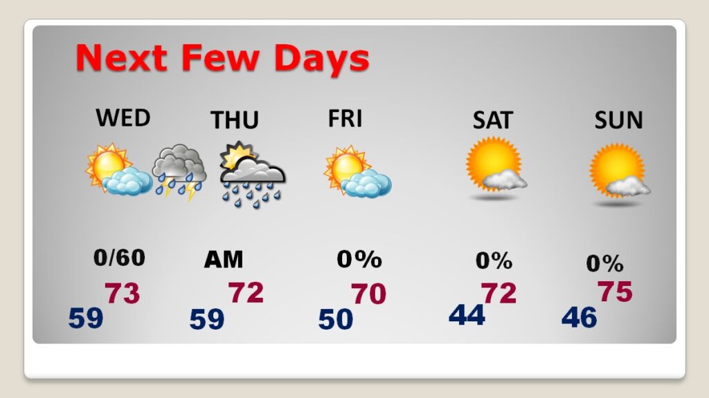
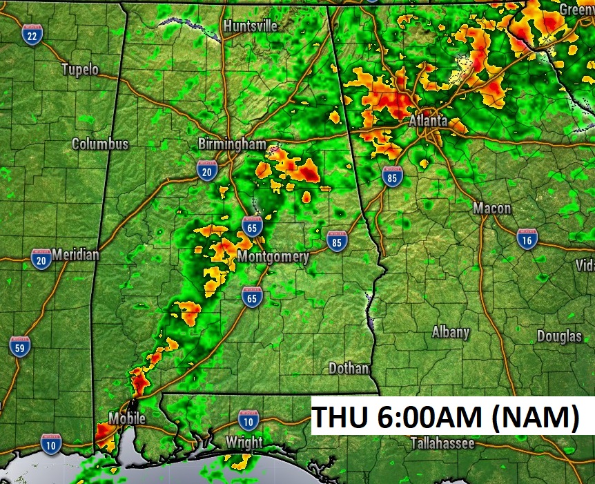
NEXT FEW DAYS: A cold front approaches the state Wednesday night and moves through Thursday AM. A band of, much needed, showers and thunderstorms will proceed the front. Much cooler air will follow late this week. Friday’s high will barely reach 70. Expect lower 40’s by Saturday Dawn. Looks like a nice weekend ahead. Comfortably cool, but mostly sunny and dry.
That approaching Cold Front will bring the best chance of rain in several days. Showers and thunderstorms Wednesday night. The front moves through early Thursday, ending the rain threat early.
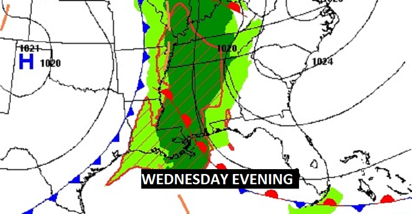
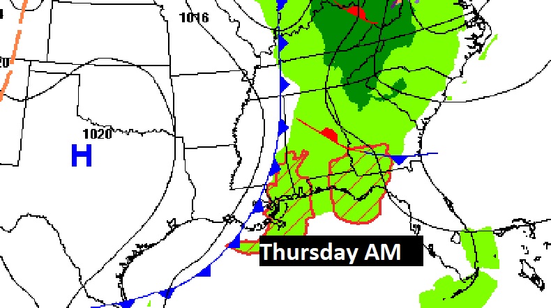
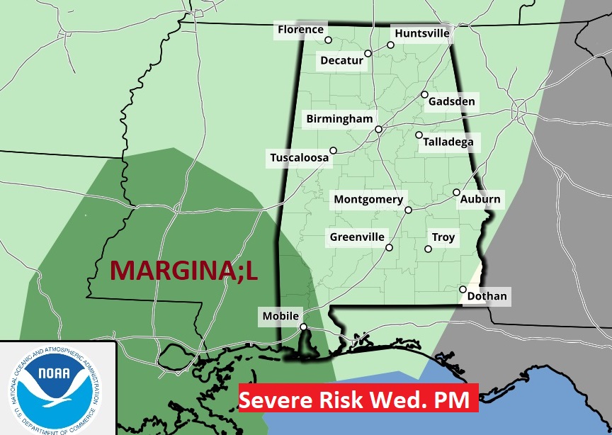
Southwest Alabama has a Marginal Severe Threat. As you know, we are into the tornado season.
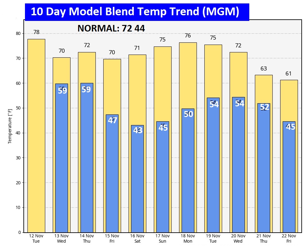
The 10 Day Model Blend Temperature Trend. The excessive warmth is gone, Temperatures are averaging closer to seasonal normal. By the way, the Average Date of the first freeze at mGM is November 18th. =
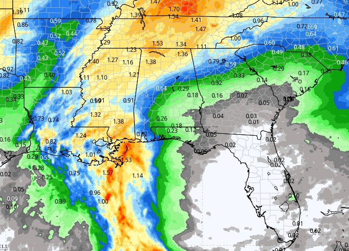
Here’s the expected rainfall next 7 days. The Cold Front brings our BEST chance for measurable rainfall. Probably not a a lotta rain, but we’ll take any rain drops we can get.
.
.
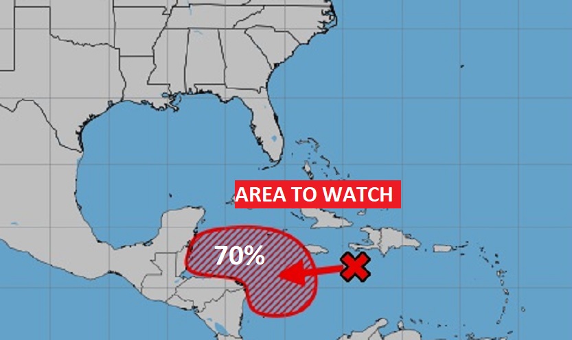
TROPICAL UPDATE: NHC is monitoring that area to watch in the west Caribbean. There’s increasing interest in that future Tropical system in the Caribbean, now with a high 70% chance of Tropical Cyclone development by late this week. Models indicate it could have implications for the United States by the middle of next week.
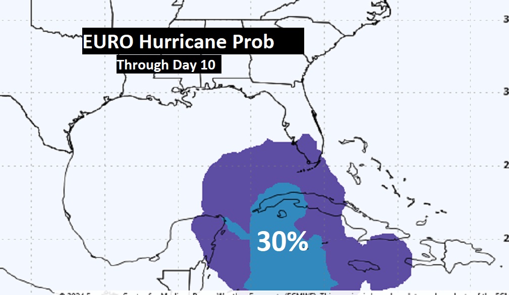
This really gets ones attention. This is the EURO probability of a Hurricane later next week. Very interesting. Next available name is Sara.
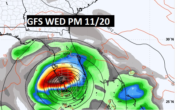
Here’s the GFS Operational model on next week on Wednesday 11.20. Don’t take this literally. We’re just looking.
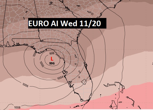
Here’s the EURO Artificial Intelligence model on Wed 11/20 at Noon. This model has had a good track record this season. Stay tined.
Thanks for reading the blog. There will be another complete Blog update and video forecast discussion tomorrow morning. This morning, everything is normal including LIVE on the Radio from 6 to 9AM on NewsTalk 93.1 – WACV. Have a nice day!
–Rich
