Good morning! Much of this day will be dry. Rain chances are small, through daytime. ( 20% or less.) It will become quite breezy with winds gusting to 30 mph later. An approaching Cold Front will bring in a band of, much needed showers and thunderstorms will proceed the front by tonight and tomorrow morning. Cooler air will follow, especially late this week. Expect lower 40’s by Saturday Dawn. That’s actually normal. Meanwhile, there’s increasing interest in that future Tropical system in the Caribbean. Not only is development likely, it could eventually move into the Gulf next week and impact the Southeastern US, especially Florida. Some global models take this system to Hurricane intensity next week. Here’s my brief forecast discussion video.
TODAY: Cloudy today. Much of this day will be dry. Rain chances are small, daytime. (20% or less). It will become quite breezy with easterly winds gusting to 30 mph later. High today 71. Showers and perhaps a few thunderstorms will become widespread tonight and Thursday morning. Continued windy tonight. Low 62.
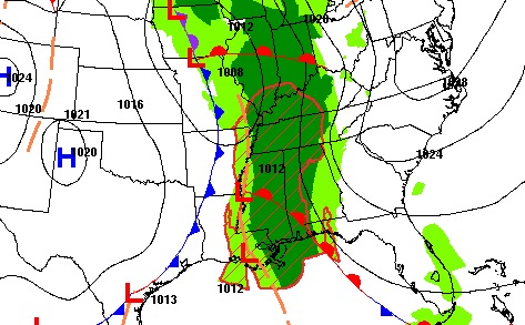
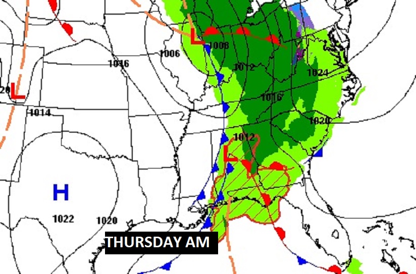
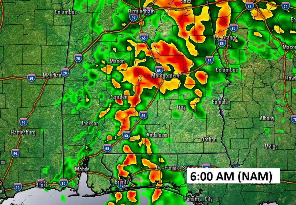
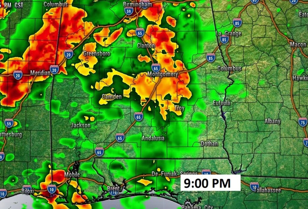
Future Radar suggests widespread showers and maybe a few storms across the area tonight and Thursday morning. No severe weather is expected, except perhaps in coastal Alabama.
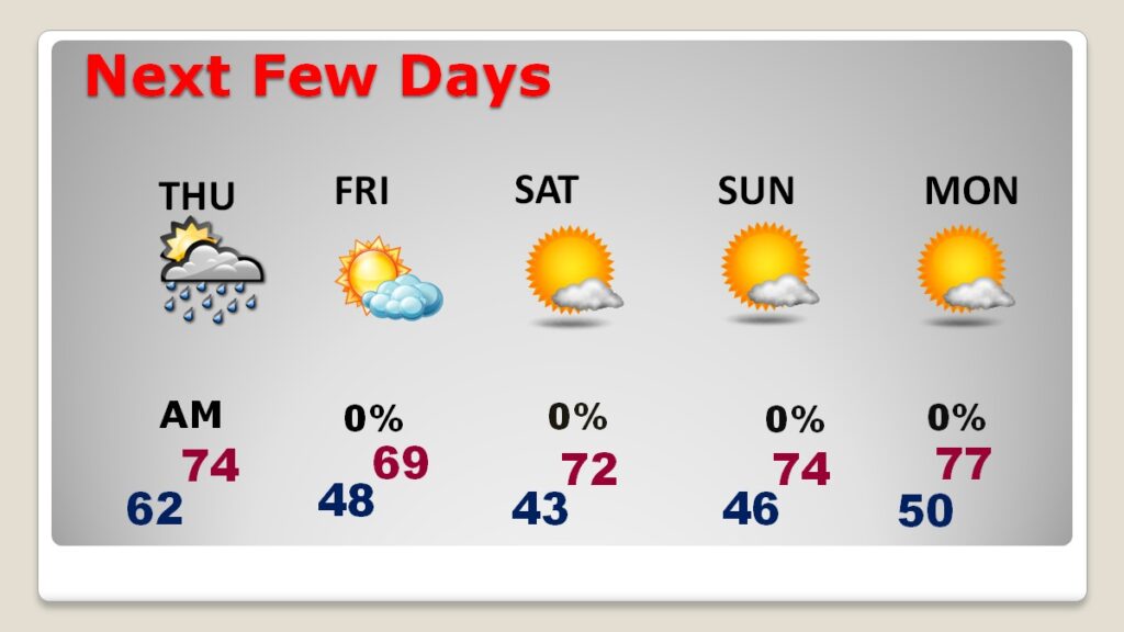
NEXT FEW DAYS: The risk of rain will stick around through the morning hours Thursday as the front moves through. Expect gradual improvement Thursday afternoon. Friday’s high may not reach 70. Expect lower 40’s by Saturday Dawn. Looks like a nice weekend ahead. Comfortably cool, but mostly sunny and dry. The nights will be chilly, but daytime highs will be well up in the 70’s
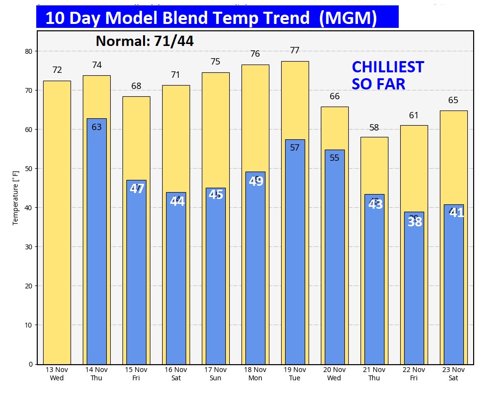
The 10 Day Model Blend Temperature Trend. Take a look at Days 7 through 10. The Chilliest Air of the season is on the way.
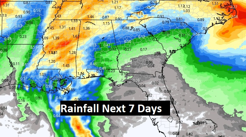
Here’s the expected rainfall next 7 days. The Cold Front brings our BEST chance for measurable rainfall. Probably not a a lotta rain, but we’ll take any rain drops we can get.
.
.
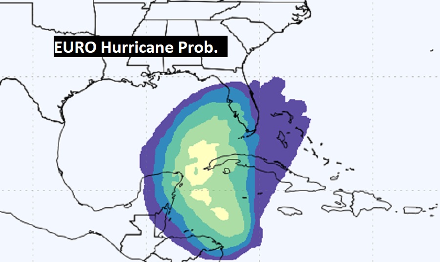
TROPICAL UPDATE: There’s increasing interest in that future Tropical system in the Caribbean. NHC gives the system a 90% chance of development in the next day or two. Not only is development likely, it could eventually move into the Gulf next week and impact the Southeastern US, especially Florida.
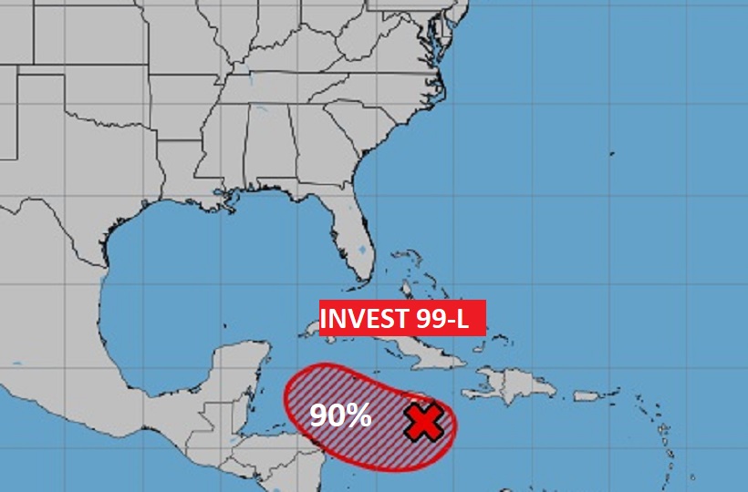
Some global models take this system to Hurricane intensity next week. Here’s the EURO Probability of Hurricane development. Next available name is Sara.
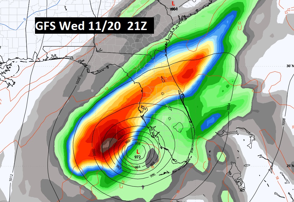
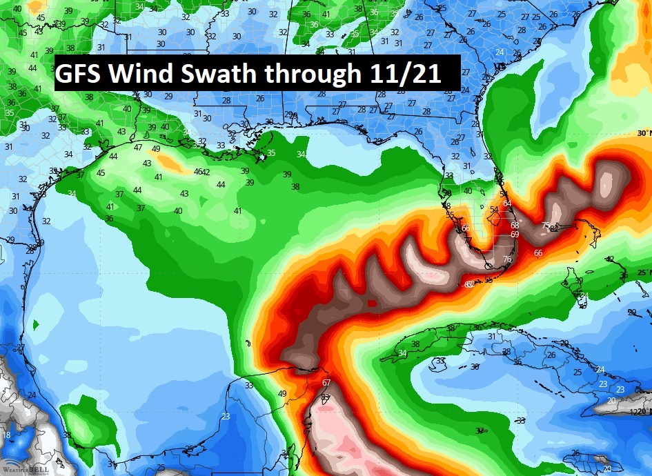
The GFS Model really gets your attention. It shows a very strong system, perhaps a hurricane, impacting Florida by the middle of next week. Not good. Stay tuned.
Thanks for reading the blog. There will be another complete Blog update and video forecast discussion tomorrow morning. This morning, everything is normal including LIVE on the Radio from 6 to 9AM on NewsTalk 93.1 – WACV. Have a nice day!
–Rich
