
Good morning! Today will be the coolest day of this current Cold Snap. A Frost Advisory covers the area this morning. Winds today will gust as high as 20-25 mph. The high will only reach the mid 50’s. But, the breeze will make it seem colder. A Freeze Warning is in effect tonight. . Many towns could see the first freeze of the season by Saturday and Sunday morning. Highs over the weekend will be in the 60’s. We’ll be back to the 70’s by Monday and Tuesday. Here’s my brief video forecast discussion.
TODAY: Frost Advisory This morning. Freeze Warning Tonight. Sunshine, breezy and cool. Hi 56. Northwest wind 12 to 16 gusting to 22 mph. Clear and cold tonight. Low 35,
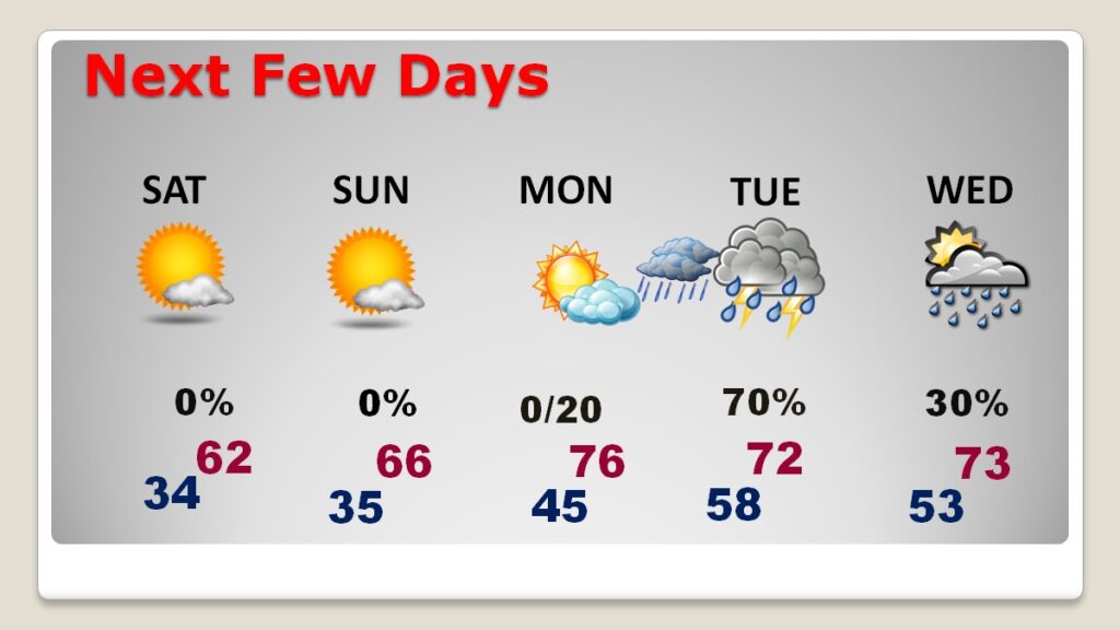
NEXT FEW DAYS: Freeze Warning covers much of central Alabama for Saturday morning. We’ll be somewhere in the lower 30’s by Dawn Saturday. Even Sunday morning we’ll be in the low to mid 30;s. Highs over the weekend will be in the 60’s. Looks like the 70’s will be back to the 70’s Monday & Tuesday. We should be dry through Monday. The risk of showers will returns Monday night and Tuesday.
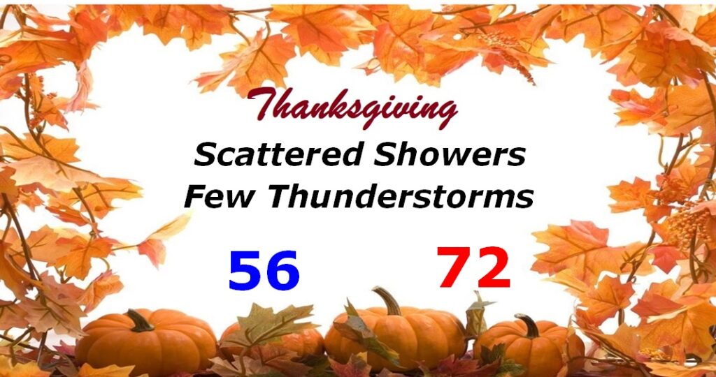
THANKSGIVING: Risk of scattered showers and maybe a few thunderstorms. (40% chance) Mild. Morning low 56. High 72.
\
The 10 Day Model Blend Temperature Trend. After our Canadian Cool-down, we’ll be back in the 70’s Monday and Tuesday. Get ready for a HUGE Temperature drop NEXT weekend Nov. 28th – Dec. 3.
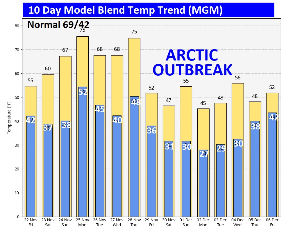
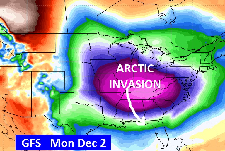
FUTURE ARCTIC BLAST: Looks like a cold front will sweep through the state around Black Friday. It will get progressively colder over that weekend, By Monday AM December 2nd, we could fall into the 20’s.
Thanks for reading the blog. There will be another complete Blog update and video forecast discussion tomorrow morning. This morning, everything is normal including LIVE on the Radio from 6 to 9AM on NewsTalk 93.1 – WACV. Have a nice day!
–Rich