
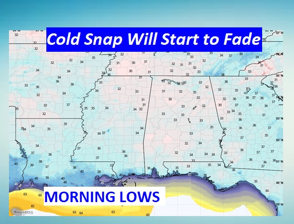
Good morning! Many towns here in Central Alabama are experiencing their first freeze of the season this morning. That’s not unusual. This is the average week of the first freeze based on the 30 year average. We’ll likely see one more frosty morning around Sunday Dawn. But, this current Cold Snap will start to turn around soon. Northwest winds today will shift to southerly on Sunday. Expect lower 60’s today, upper 60’s Sunday and 70’s Monday. The next risk of showers begins late Monday night into Tuesday as the next front approaches. Right now Thanksgiving looks rather wet & stormy. Severe weather can’t be ruled out. NEXT weekend – (Black Friday Weekend) we will sample some Arctic Air, but nothing too crazy. Here’s my brief video forecast discussion.
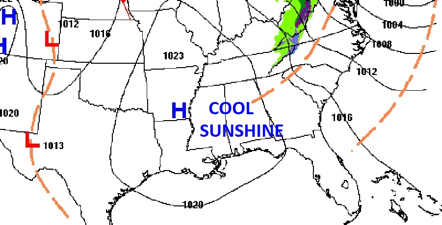
TODAY: COLD START at Dawn. Cool Sunshine, Hi 63. (Normal 68/42). Not as breezy. NW wind 6 to 12 mph. Clear and cold tonight. Frost likely again. Low 35.
NEXT FEW DAYS: The Cold Snap will be fading soon. After a Cold Frosty Sunday morning, southerly winds will help us rebound to the upper 60’s.Looks like the 70’s will be back to the 70’s Monday & Tuesday. We should be dry through Monday. The risk of showers will returns Monday night and Tuesday.
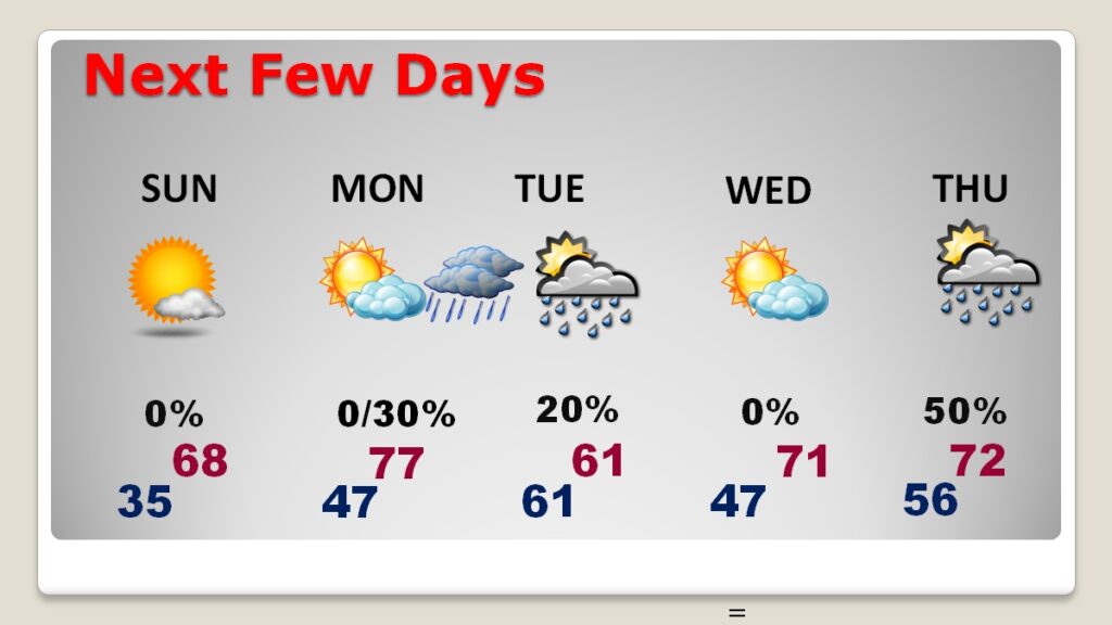
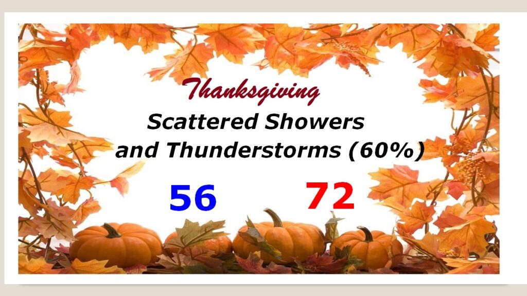
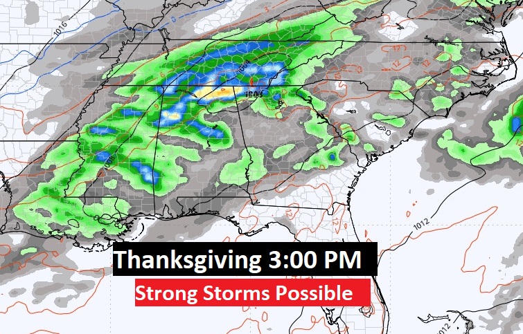
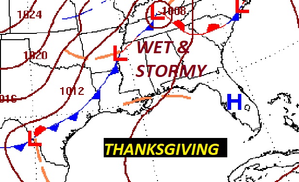
THANKSGIVING: Showers and thunderstorms are looking more likely as a strong Cold Front approaches. It’s too early to be specific, but a Severe Weather Threat is possible. ‘Tis the season Morning low 56. High 72.
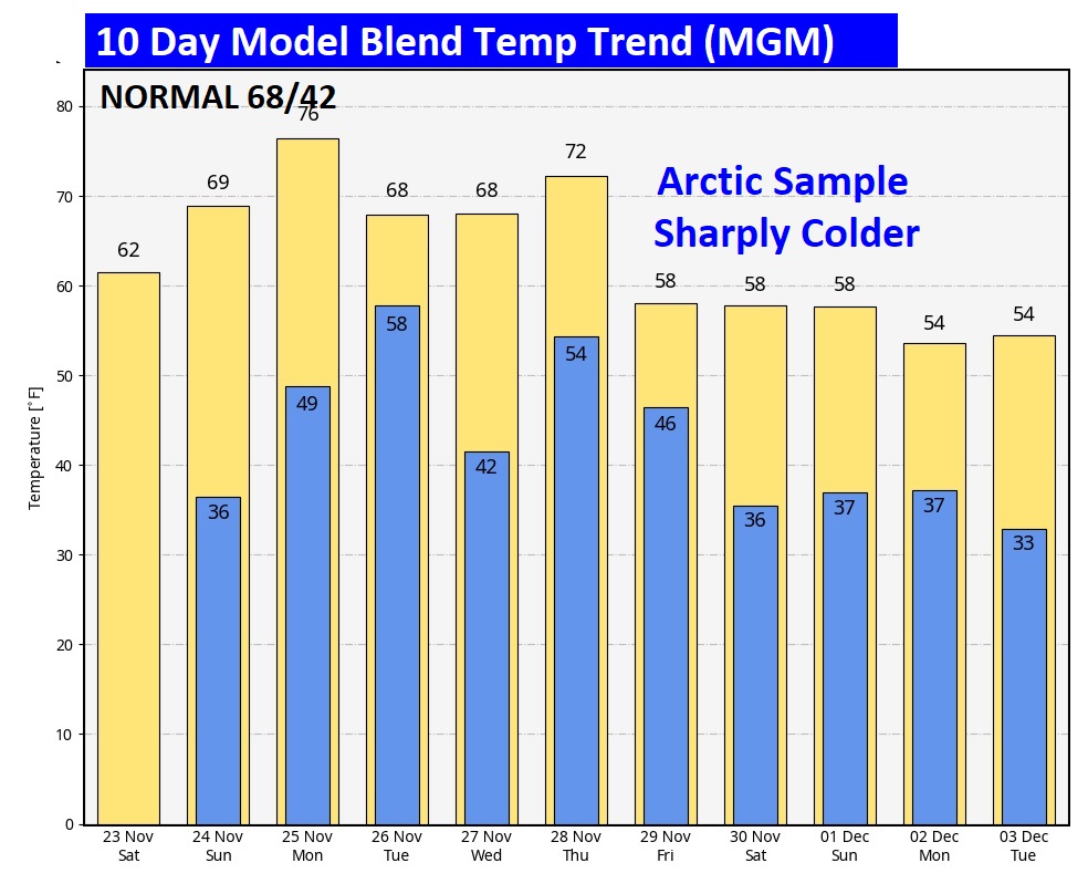
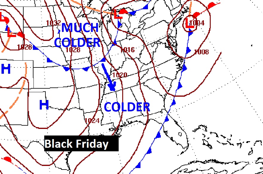
The 10 Day Model Blend Temperature Trend. Sharply colder air starts to arrive Black Friday after the first of 2 Cold Fronts. It will get progressively colder as the weekend unfolds. But, nothing, too crazy.
Thanks for reading the blog. The next scheduled blog will be Monday morning, Have a nice weekend!
–Rich