Good morning! Here’s a Brief Special Sunday morning blog update. We have some big ticket weather on the way. Here are the Main points.
- Strong Storms possible by late tonight ahead of a Strong Arctic Cold Front.
- Wind advisory begins this afternoon at 3 until Monday evening at 6PM. Winds could gust as high as 40 mph.
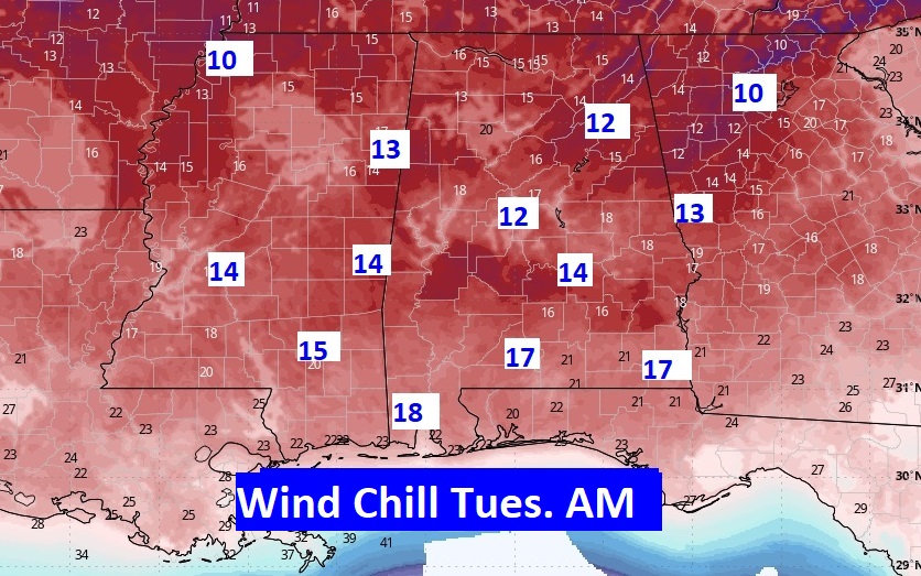
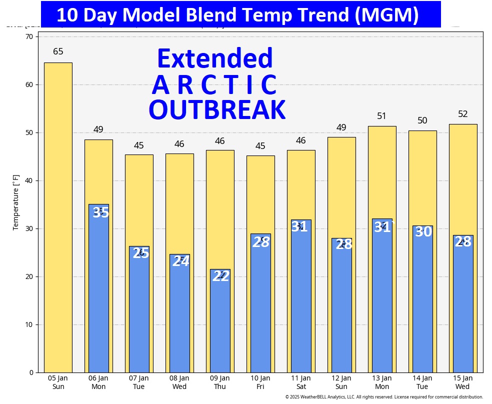
- Extreme Arctic Temperature plunge is in our future. Highs only in the 40’s especially Tuesday through Saturday. Lows in the 20’s, Wind chill in the teens especially Tuesday and Wednesday morning.
- Wintry precipitation possible for parts of the state Thursday night/Friday AM and/or Friday night, especially in North Alabama. But there are still much uncertainty.
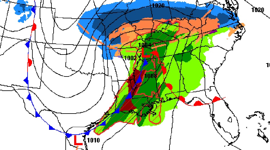
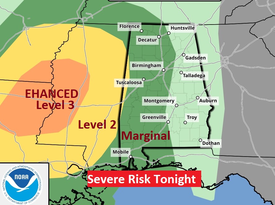
STRONG STORM RISK TONIGHT: Showers are possible anytime afternoon today/ But, the line of strong storms along the Cold Front arrives late tonight. Most of west Alabama west of I-65 is in a Marginal Severe Risk.
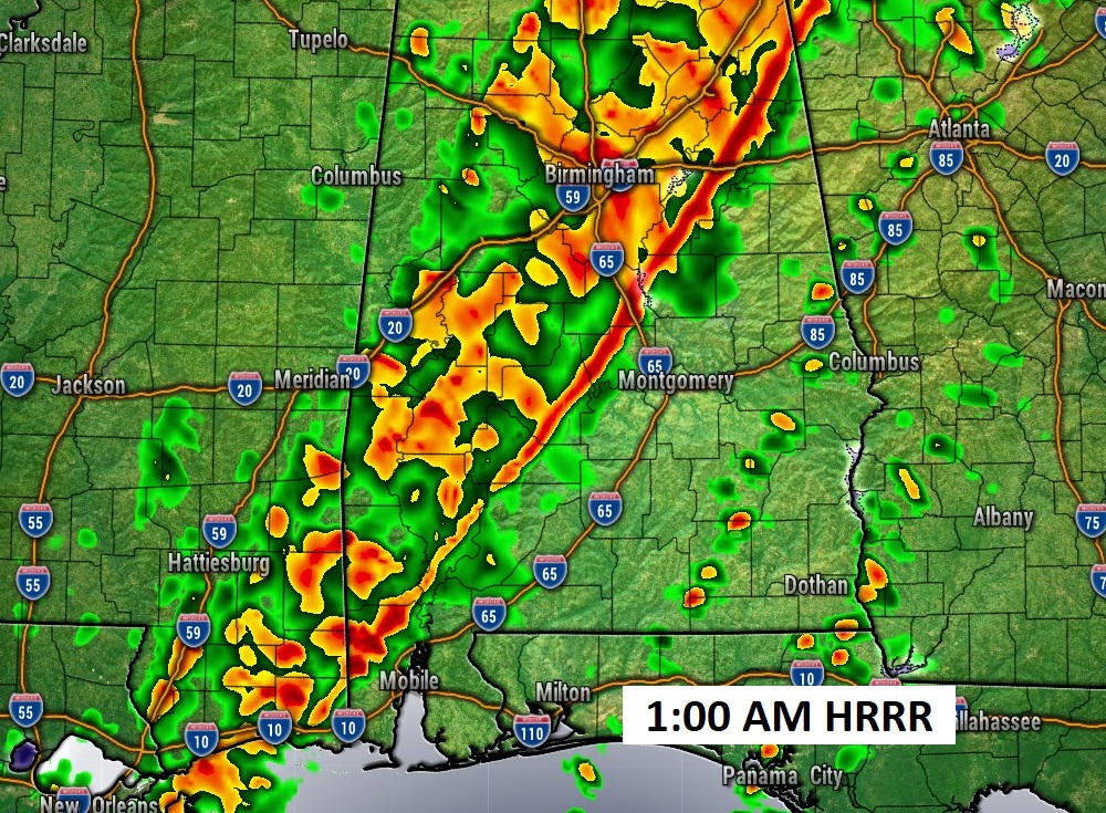
WIND ADVISORY: Gusty winds both ahead of the front tonight and after the frontal passage through much of Monday could reach 40 mph at times.
Major ARCTIC PLUNGE: Alabama and a Huge chunk of America will have to endure an extended week long Arctic Outbreak. Highs only in the 40’s especially Tuesday through Saturday. Lows in the 20’s, Wind chill in the teens especially Tuesday and Wednesday morning.
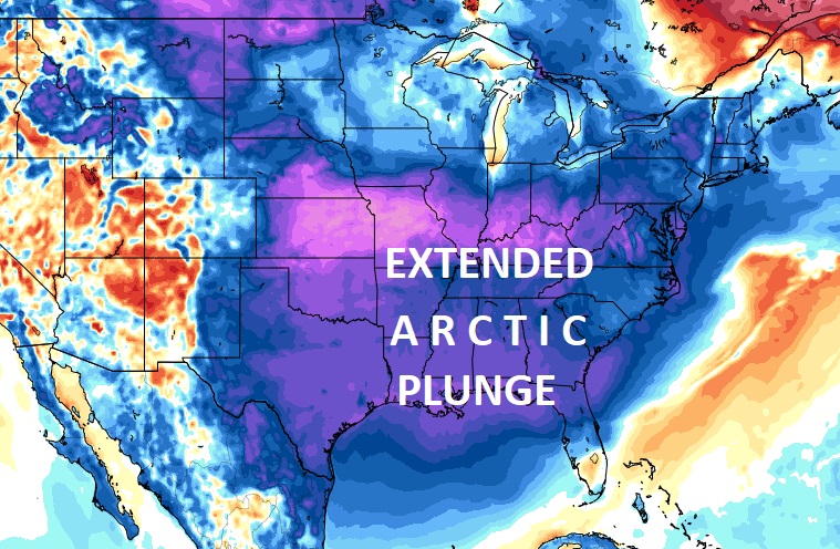
Get ready to dress in layers this week. Here’s a sample of Tuesday morning projected Wind Chill.
Take a look at the numbers on the 10 Day Model Blend Temperature Trend. WINTER IS COMING.
.
Thanks for reading this special blog update. The next scheduled FULL blog will be tomorrow morning. Stay weather aware.
–Rich
