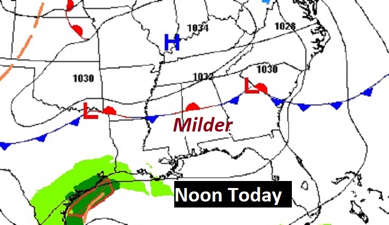
Good Morning! Lots of interesting potential weather in the next 8 days and beyond, and none of the news is good. Today and Thursday will be nice. Sunshine Slightly milder. On Friday we may make it into the lower 60’s. Periods of rain will move in late Friday night into at least the first half of the day Saturday. Sunday will be much colder. By early and mid-week it will get progressively colder. This particular chunk of Arctic Air will be the COLDEST so far this season, so far. And, that’s not all. A low pressure system will track along the northern Gulf coast. This would be the perfect set-up for a potential Ice Storm. The potential time line varies from model to model. The EURO is fastest, arriving Tuesday night 1/22. The GFS is more robust with possible Ice Accumulation, and is a little slower with the main threat on Wednesday 1/23. We’re several days from this event, and the details are still very fuzzy. This is just a heads up. Here’s my brief forecast discussion,
TODAY: A good bit of sunshine, a little milder. High 56. Mostly cloudy tonight. Low 32.
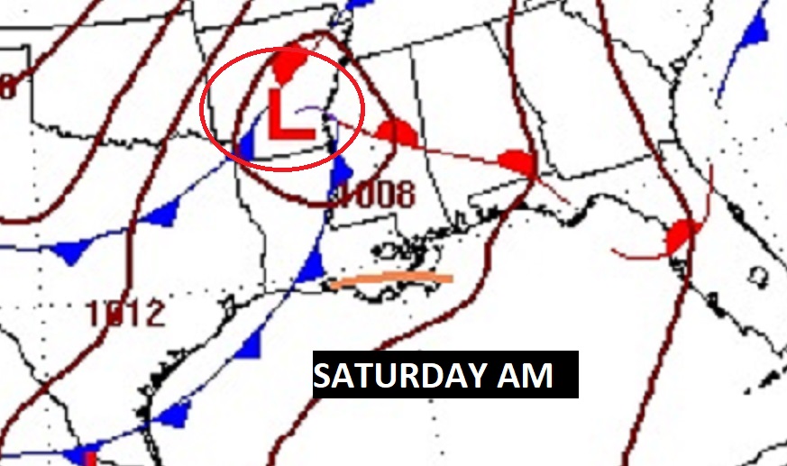
NEXT FEW DAYS: Expect a brief warm-up Friday and Saturday as the next storm system approaches. It’s a dry forecast through Friday evening Rain returns Friday Night after midnight and first half of the day Saturday. Another round of showers is possible Saturday night. Rain will exit by mid-day Sunday. Friday and Saturday will warm to the 60’s. Sunday will be much colder. Next week will be brutally colder,
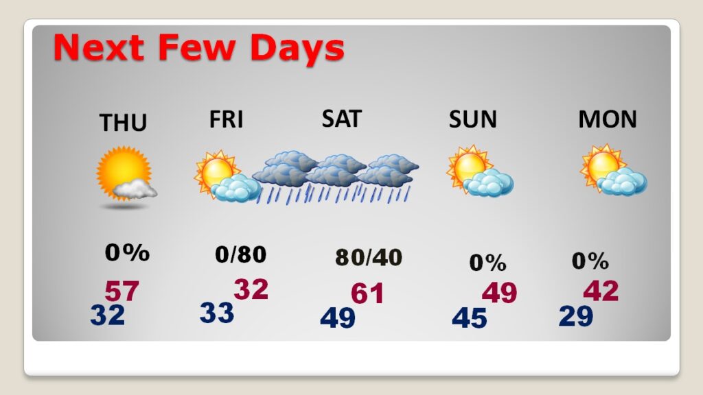
Friday night and Saturday look wet indeed.
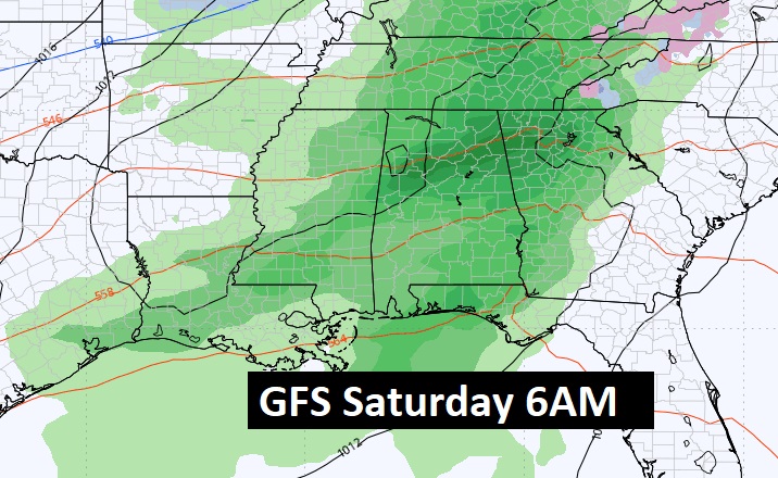
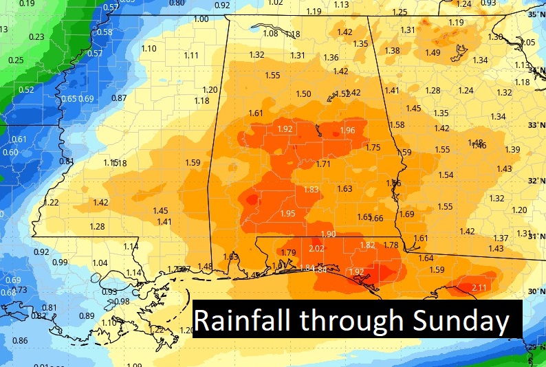
Here’s the expected rainfall through Sunday.
WINTER ASSUALT NEXT WEEK: By early and mid-week it will get progressively colder. This particular chunk of Arctic Air will be the COLDEST so far this season, so far. And, that’s not all. A low pressure system will track along the northern Gulf coast. This would be the perfect set-up for a potential Ice Storm. The potential time line varies from model to model. The EURO is fastest, arriving Tuesday night 1/22. The GFS is more robust with possible Ice Accumulation, and is a little slower with the main threat on Wednesday 1/23.
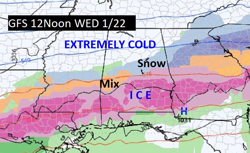
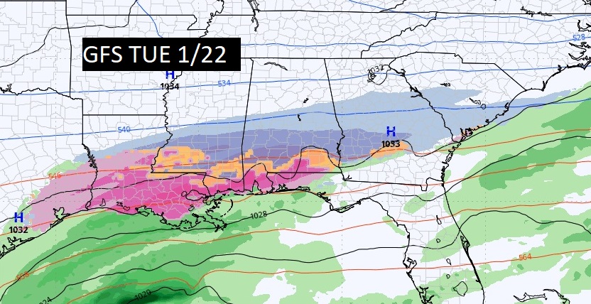
The EURO is the fastest on this storm arrival, with the GFS lagging behind maybe 12+ hours.
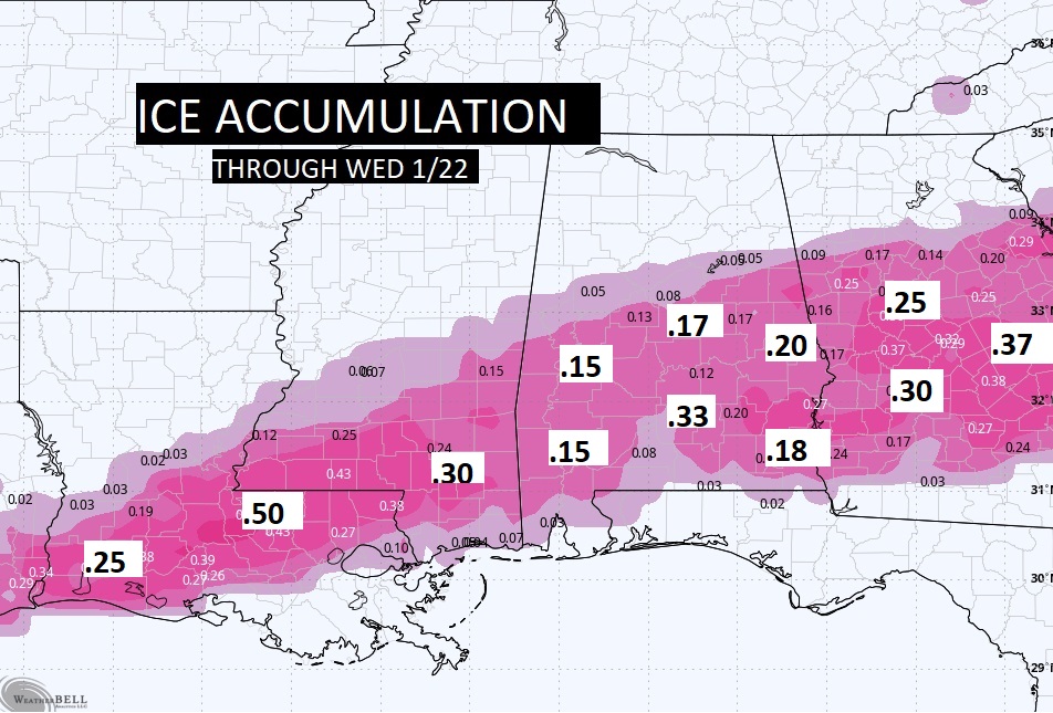
This is the most disturbing map so far. Hopefully this does not verify. In a winter storm, any ice accumulation over .10 is a big deal, especially for travel. .25 is considered a Severe Ice Storm. We’re still several days away. Hopefully this will change. Fingers crossed.
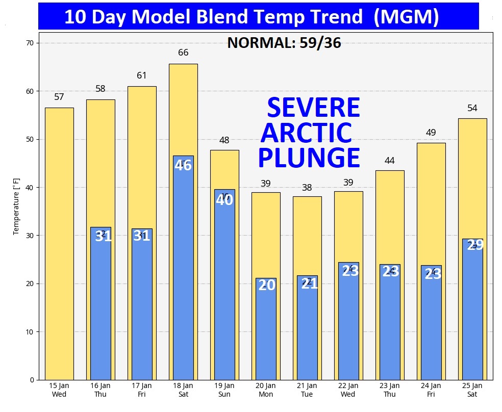
Here’s the 10 day model blend temperature trend. Depressing. Look at that next Arctic Plunge next week. It is the COLDEST Arctic plunge we’ve seen so far this season. This January has been simply awful on every possible level.
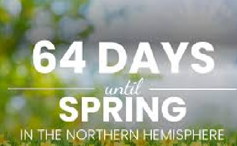
It can’t get here soon enough. January has been depressing here in the Deep South on many levels,
=
Thanks for reading this special blog update. This morning everything is normal. We’ll be LIVE on NewsTalk 93.1. There will be another Blog Update and Forecast Video discussion in the 4’o’clck hour tomorrow morning. Have a good day,
–Rich
