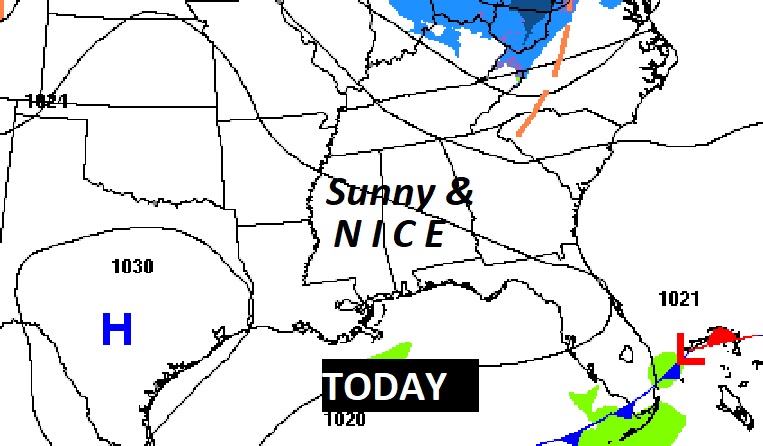
Good Morning! Enjoy some nice mid-January weather today and Friday. It’s an “oasis of niceness” in an otherwise disturbing forecast for the next 7-8 days. Periods of rain will move in late Friday night and through much of Saturday. Sunday will be much colder. By early and mid-week it will become significantly colder. This Arctic Air will be the COLDEST so far this season, so far. Low pressure will develop in the Gulf, and move along the southern edge of the Arctic Air. There is a growing likelihood of a High Impact Winter Storm, which will track across the south in the Tuesday through Thursday. It could produce a band of accumulating snow and/or ice. We’re still several days from this event. Details are still very fuzzy. The exact track of the low will determine which areas are most likely to see accumulation. Here’s my brief forecast discussion,
TODAY: Nice day. A good bit of sunshine. milder. High near 60. Partly cloudy tonight. Low 32.
NEXT FEW DAYS: Periods of rain will move in late Friday night and through much of Saturday. Sunday will be much colder. By early and mid-week it will become significantly colder. This Arctic Air will be the COLDEST so far this season, so far. There is a growing threat of a potential High Impact Winter Storm next week, perhaps as early as Tuesday. Right now, confidence as far as timing, placement, potential track, precipitation type remains low. We’re too far out to nail down details.
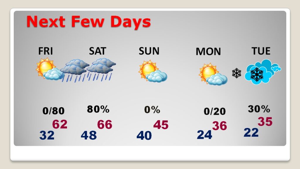
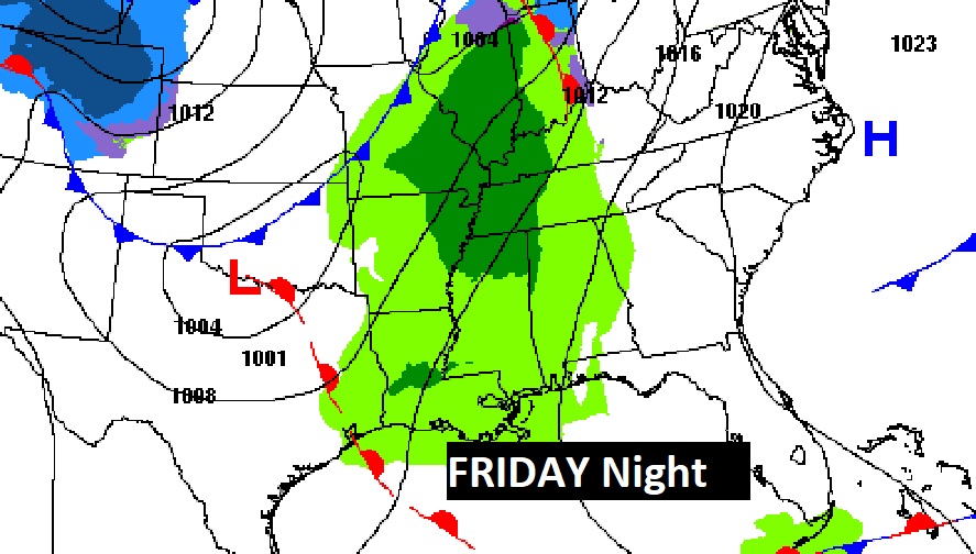
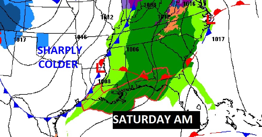
Friday night and Saturday look wet indeed.
.
WINTER ASSUALT NEXT WEEK: There is a growing threat of a potential High Impact Winter Storm next week, perhaps as early as Tuesday. Right now, confidence as far as timing, placement, potential track, precipitation type remains low. We’re too far out to nail down details. The GFS and the EURO. Completely different on track and timing and potential impact. We do know that brutally cold Arctic Air will be in place. That part is certain.
First the COLD Artic Air. We will easily be 20-25 degrees below normal Tuesday, if not colder. COLDEST of the season so far. There is HIGH confidence in this part.
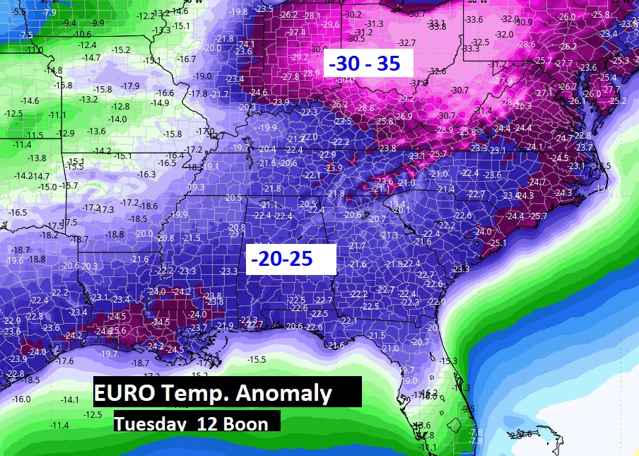
NOTICE low pressure developing in the SW Gulf Tuesday morning. The exact track of this low will determine the severity and potential impacts.
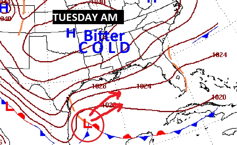
The EURO is the fastest on this storm arrival, with the GFS is much slower. Here’s a EURO snapshot Tuesday morning.
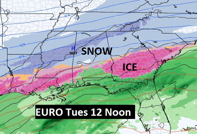
DON’T TAKE THIS TO THE BANK. This WILL certainly change many times between now and Tuesday. Here’s the EURO and GFS Ensemble members showing the potential of accumulating snow. BUT, will it be snow? Could it be ICE? Ice would be worse.
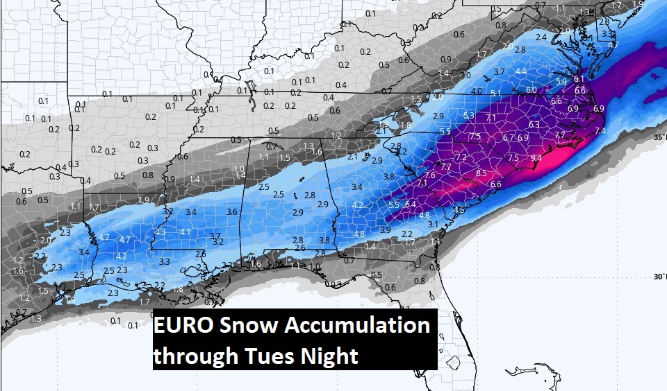
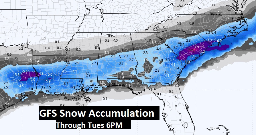
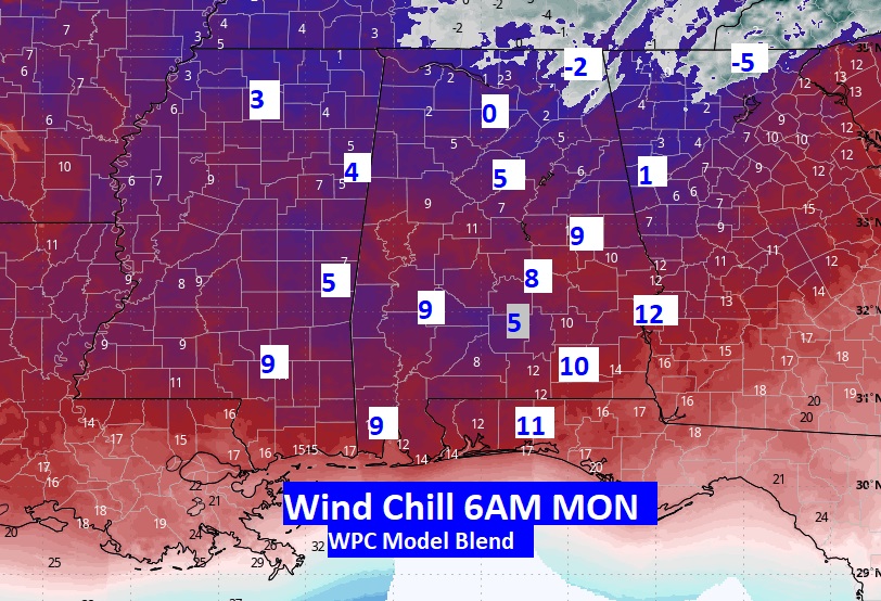
While the confidence in a High Impact Winter Storm next week remains low at the moment (20-40%), here’s what we do know. Get ready for the coldest Arctic Airmass of the winter so far. Saturday’s high may reach the mid 60’s. But, by Monday morning, with lows in the lower 20’s, Wind Chill values will be dangerously low. Here’s a map that may get your attention. This is Monday morning Wind Chill near Dawn. Tuesday morning will be similar.
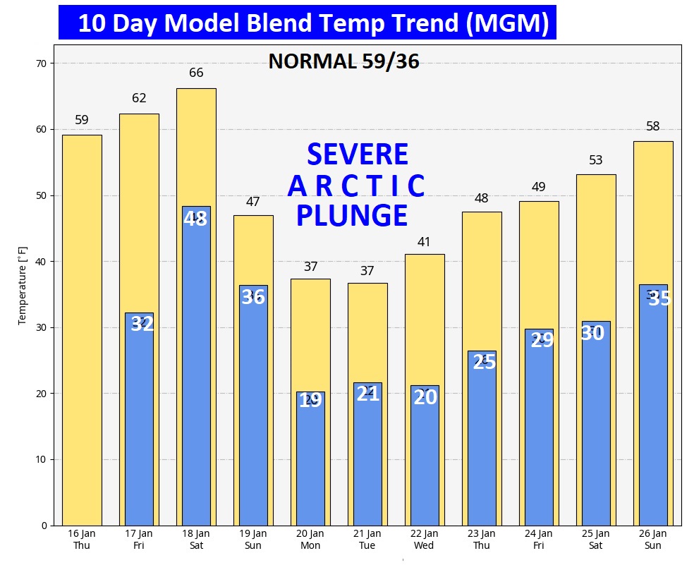
Here’s the 10 day model blend temperature trend. Depressing. Look at that next Arctic Plunge next week. It is the COLDEST Arctic plunge we’ve seen so far this season

Thanks for reading this special blog update. This morning everything is normal. We’ll be LIVE on NewsTalk 93.1. There will be another Blog Update and Forecast Video discussion in the 4’o’clck hour tomorrow morning. Have a good day,
–Rich
