Good morning!
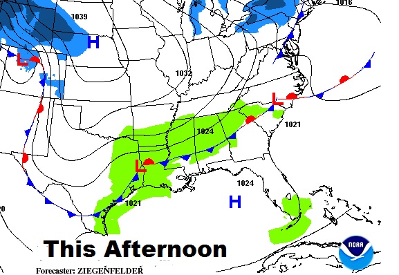
A southward moving cool front will be the weather maker today. I’ve added a few showers to the forecast, and we are easing into a cooler Super Bowl weekend. I’ll update the Sunday shower threat, and perhaps a more substantial storm system next week which will bring a big change to our weather. Sit back, sip your coffee…this is your Thursday morning personal weather briefing.
Showers will be very spotty and widely scattered in nature today, tonight and Friday, as the leading edge of cooler air heads southward.

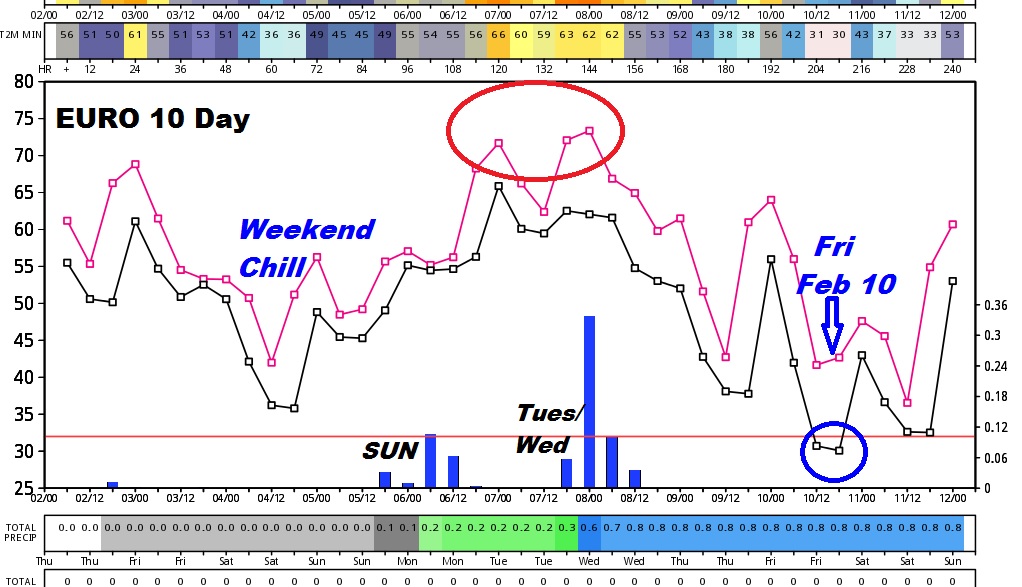
I love how this graph captures the spirit of the forecast over the next 10 day. This is the Euro model. It shows our weekend cooling trend, following a rebound next week, before sharply colder at the end of the week. The blue bars at the bottom depict the Super Bowl Sunday shower threat, and a more substantial front/storm system by the middle of next week.

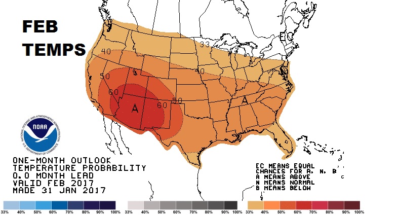
The Climate Prediction Center’s updated February outlook shows, on average, much of the nation will tend to be above normal in temps for the month ahead.

