
Our unusual May chill will be fading as a strong warming trend takes hold in the week ahead. Yesterday morning many of us were in the middle 40’s. Prattville was the cool spot on Saturday morning at 40. A weak front has drifted into central Alabama this morning. It will have little affect on our weather, except to bring us another cool night tonight. We will be storm-free for a few more days. The next storm system affects the state by Friday.

TODAY: Mostly sunny. High near 80. Mainly clear, chilly tonight. Low 52.
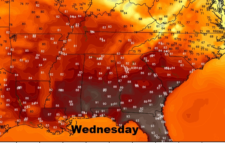
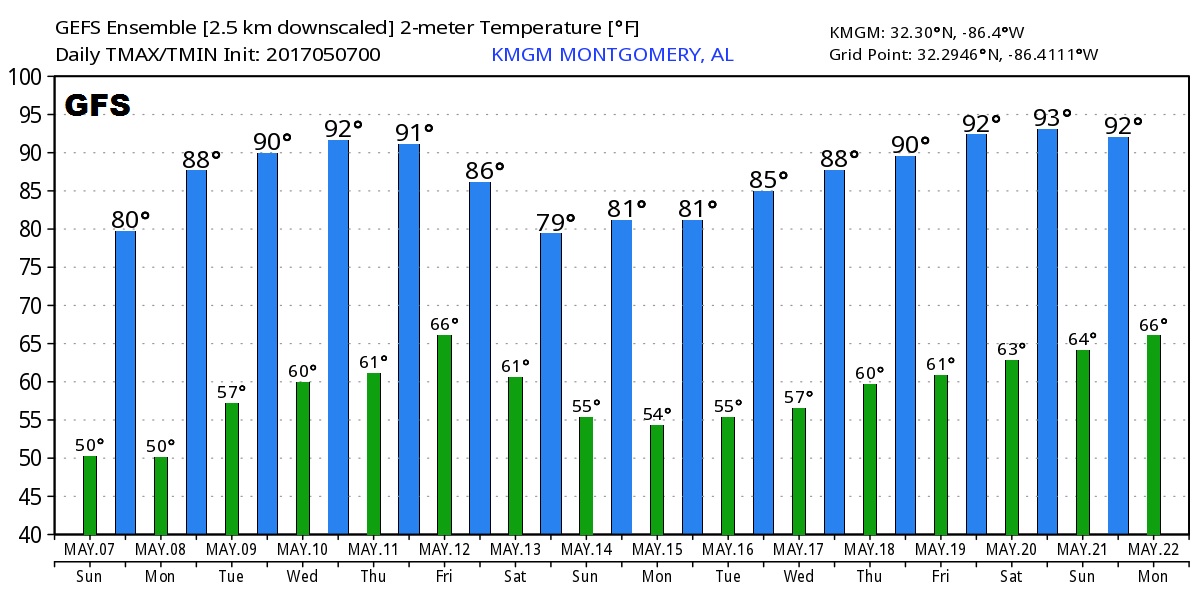
THE WEEK AHEAD: Temperatures will soar, again. Highs will be well into the 80’s Monday & Tuesday, and reach a peak at or above 90 Wednesday and maybe Thursday. Rain & thunderstorms return to the forecast on Friday.
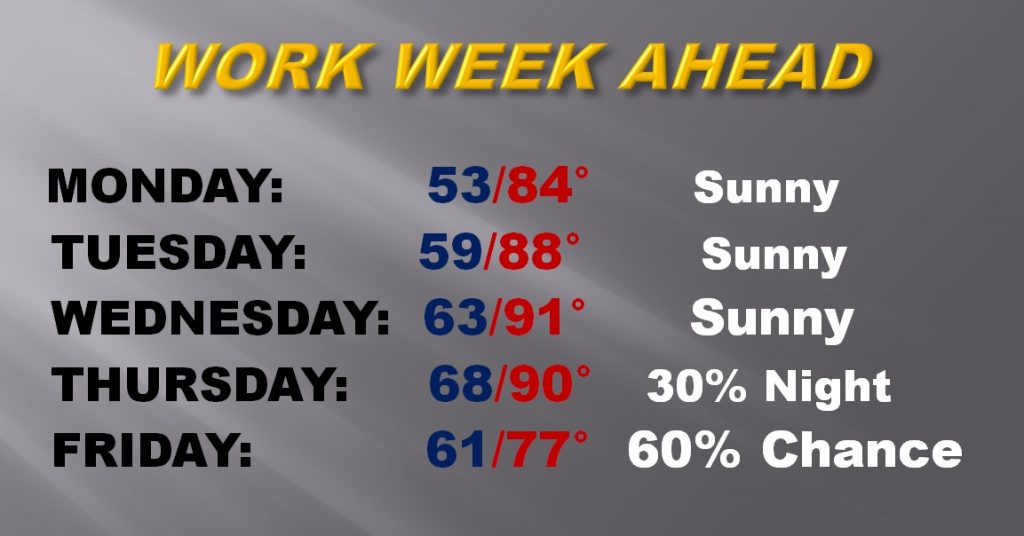
Temperatures peak mid-week.
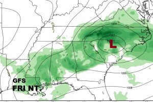
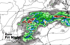
FRIDAY STORM SYSTEM: A storm system & front will bring showers and storms into the state perhaps as early as late Thursday night, but more likely Friday and Friday night. This system will cause a severe weather threat in the plains and parts of the lower Mississippi, but it is unclear if it will still pose a severe weather threat when it arrives here. It appears showers will clear the state early Saturday leading to a nice weekend, although a bit cooler, but nothing like this weekend. The global models are in “general” agreement on timing.
I do not see any more unusually cool episodes during the remainder of May. Here’s the GFS guidance out 16 days.
Have a nice Sunday! I’ll be back with your complete Monday morning video briefing, which will be online a little before 5AM.
Rich