It’s not going to rain all the time, but a lot of outdoor plans will be affected by the higher than normal rain chance. Clouds will dominate most of the time. We are stuck in this pattern for about 4 more days, before we get back to a real nice pattern. So, whether your plans involve a backyard cookout, a trip to the Lake or the Beach, you know the drill – be flexible and have a Plan B.
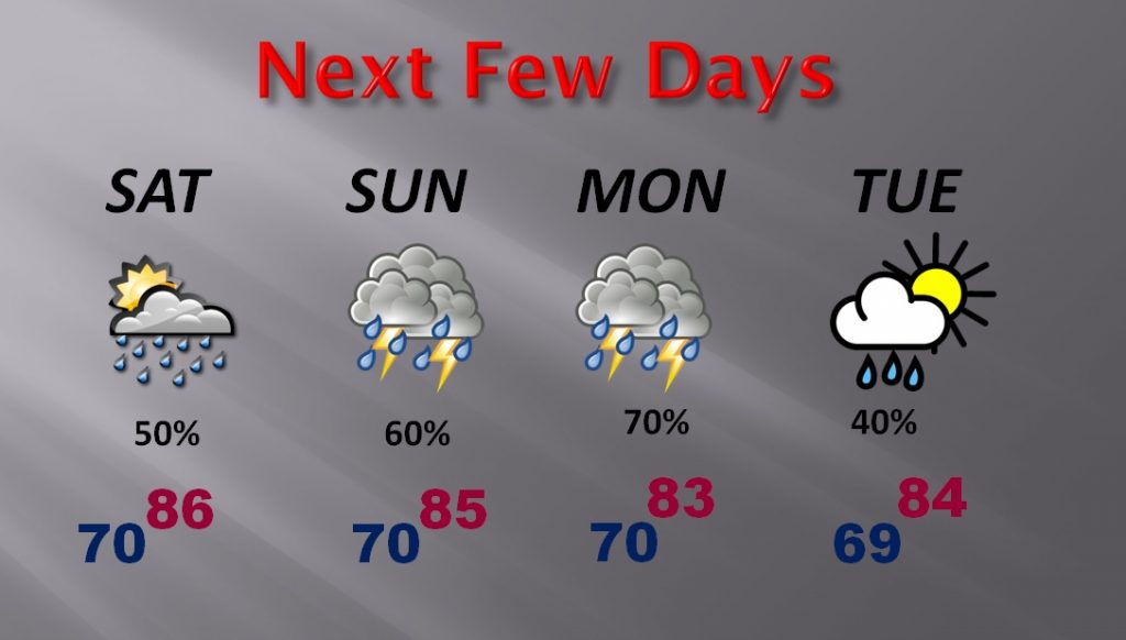
WEEKEND RAIN CHANCES: Showers and storms will be numerous. Rain coverage 50-60% today, 60% to 70% Sunday, and at least 70% Monday. Highs in the mid 80’s. Lows around 70. A few sun breaks perhaps, otherwise Mostly cloudy.
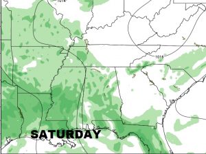
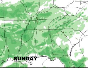
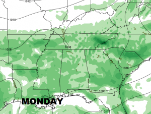
FUTURE RADAR: Keep in mind this is only one model, and sometimes these “miss” in a big way in a complicated mesoscale convective pattern, but this model shows the most concentrated rain especially across central and SW Alabama through early evening.
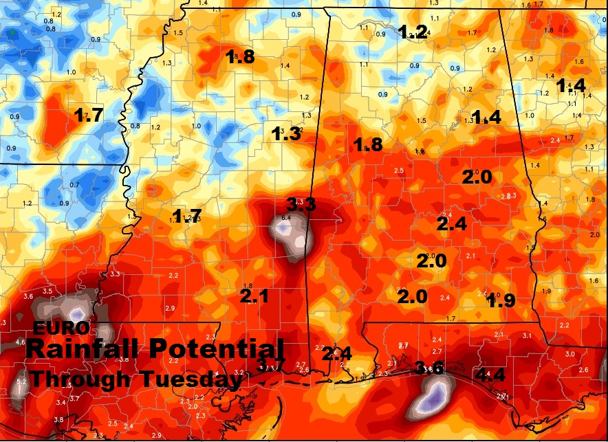
POTENTIAL RAINFALL AMOUNTS: Rainfall could be heavy in spots. 2” amounts will be common, but because of slow moving storms, localized rain amounts could be much heavier. Flash flooding in spots can’t be ruled out.
NEXT FEW DAYS: The wet pattern will be around through Tuesday.
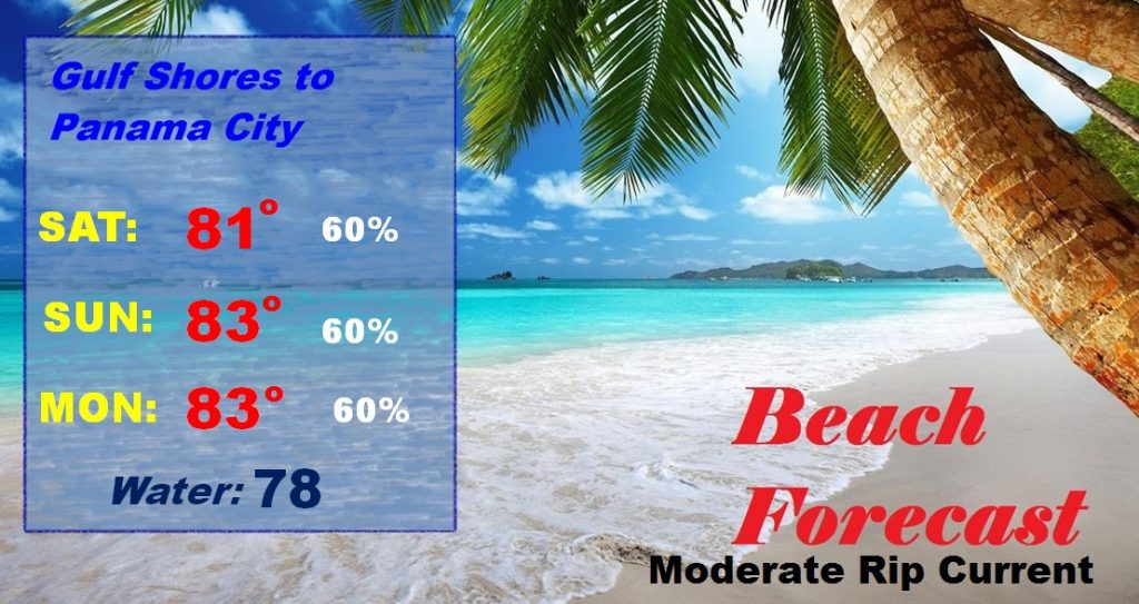
BEACH OUTLOOK; There is simply no way to sugar coat the forecast. It will be mainly cloudy and there will be rain and thunderstorms from time to time through Monday. Moderate rip current risk. Things get much better by mid week through the following weekend.
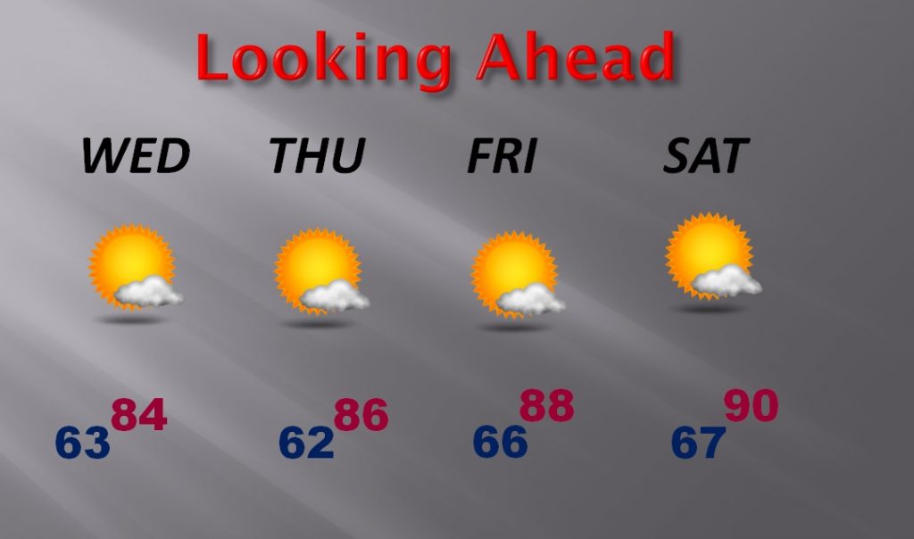
LOOKING AHEAD: Keep your chin up. The forecast gets much better by mid-week, and late week and through the weekend of June 10 and 11th. Hang on!