
Showers & storms are returning to the forecast. Decent rain probabilities will be around every day this week and through the following weekend. But, remember: we are into that summer pattern when showers & storms will be random, and actual rainfall totals will vary greatly. The point is, the rain chances will be good every day, but it will be a “feast or famine” as far as rainfall distribution. And, needless to say, showers reach a peak in the afternoon & evening, and fade away at night.
TODAY: Partly sunny. Scattered afternoon and evening storms. Roughly 40% coverage. High upper 80’s. Low tonight lower 70’s.
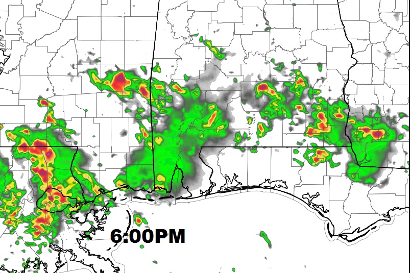
Here’s a Future Radar snapshot. (6PM) I hesitate to show these in the summer, because this is NOT the way radar will actually look. This gives you an idea on the level of coverage.
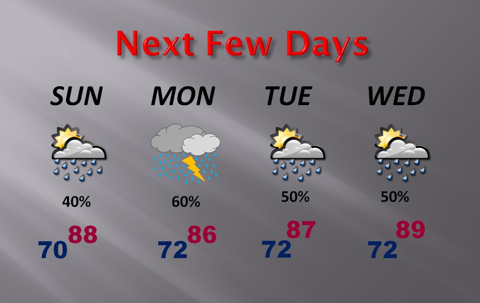
NEXT FEW DAYS: Although the BEST coverage days might be Monday & Thursday at 60%, each day will have decent probabilities through Friday and through the next weekend. Here’s a snapshot of the next few days.
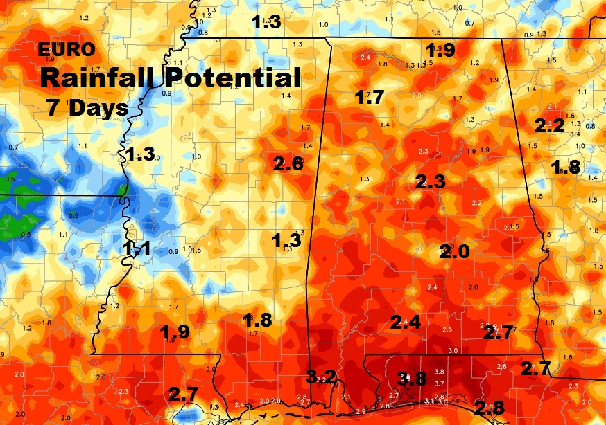
RAINFALL AMOUNTS: Rainfall is spotty and random in the summer, so, these QPF charts can be misleading, except to point out, that many places could easily ‘average’ more than 2”. But, localized flooding rainfall is possible in heavier storms.
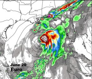
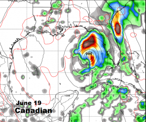
WATCHING THE GULF NEXT SEVERAL DAYS: This is several days out, in the vicinity of June 19-21. But, a couple of the global models, the Euro and the Canadian, are advertising some tropical trouble in the Gulf. Tropical depression? Tropical storm? Maybe… The American GFS suggests this could be a Texas problem. Anyway, we have a long time to watch this.
DAYS ARE GETTING LONGER: Sunrise this morning 5:38, sunset 7:52. Daylight: 14 hrs. 14 mins. Days will be 2 minutes longer on the longest day, June 20, the Summer solstice.
Have a great Sunday. I’ll have your next video for you tomorrow morning, online by about 4:45 AM.
-Rich