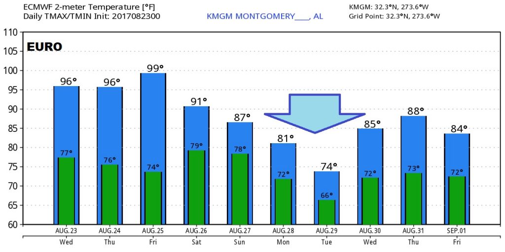
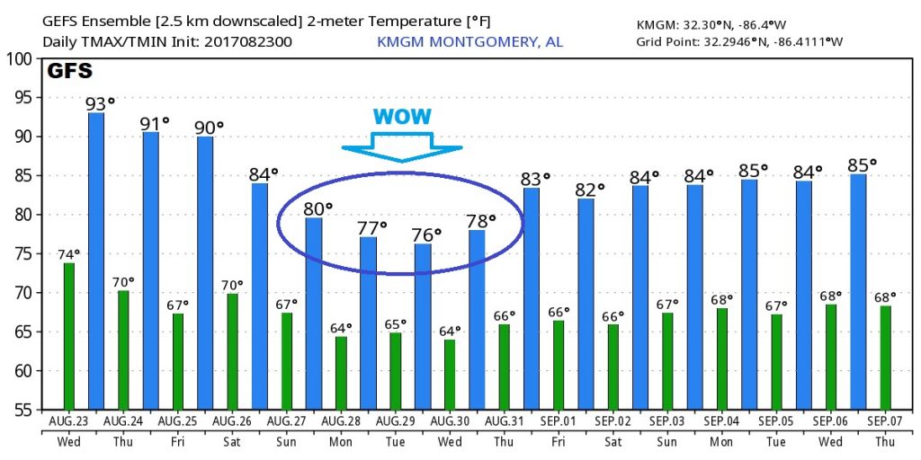
Good Morning! A more active pattern ahead. Today, as a front sinks southward, our storm threat will increase. Plus, the tropics will take center stage, I’ll tell you how regenerating “Harvey” could affect our future weather next week. Wait till you see what the models say about next week’s temperatures. I promise a lot of good information as we look at some very interesting possibilities for the week ahead.
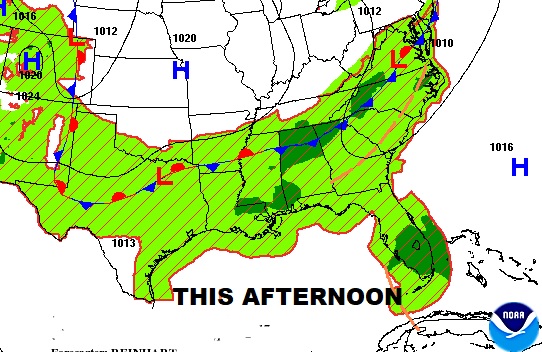
Today…a southward moving front will increase the coverage on showers and storms.
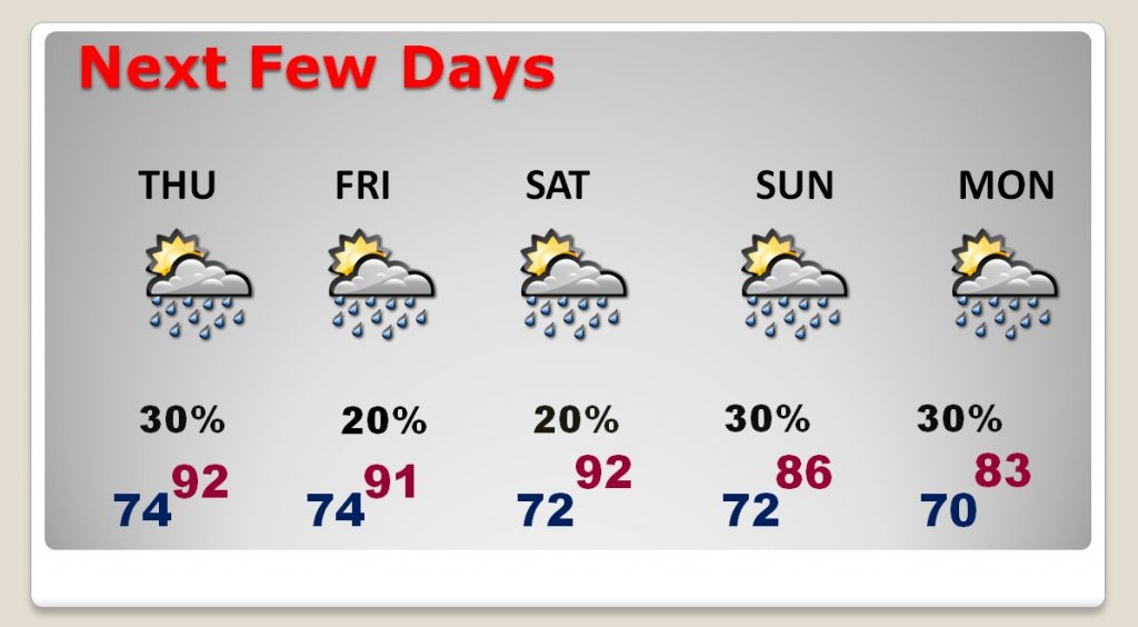
The next few days.
Tropics take center stage. Harvey will become a depression or storm today in the warm Gulf waters. Could become a hurricane before reaching Texas. 92-L bringing heavy rain to Florida.
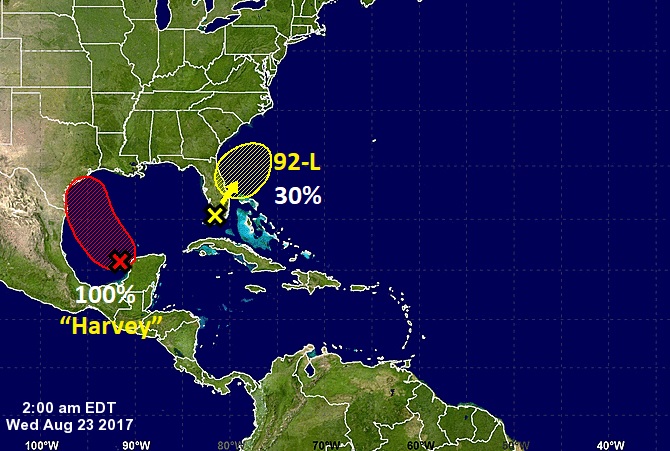
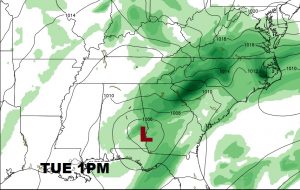
Models suggest Harvey could slow down and hang around Texas for a few days causing catastrophic flooding. Then the system moves northeast through the Gulf states.
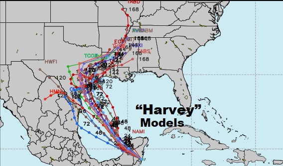
It’s possible Harvey could have a big influence on our weather early next week.
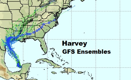
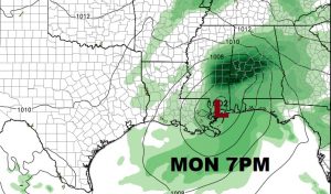
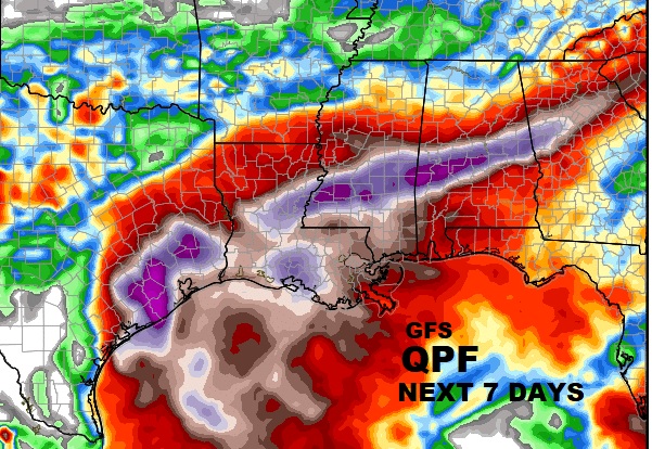
This is just one model…the GFS. But it prints out a crazy amount of rainfall over Texas and then spreading eastward across the Gulf south. Stay tuned.
Are you ready for another shock? How about potential future temperatures next week, from 2 Global models…the GFS and the Euro. LOOK!
