
Irma’s western migration on the models has increased the chance of a significant impact from Irma in Alabama on Monday & Monday night. I think most of us will see sustained winds nearing tropical storm force and we could see much higher gusts which will cause several power outages through eastern Alabama and southeast Alabama.
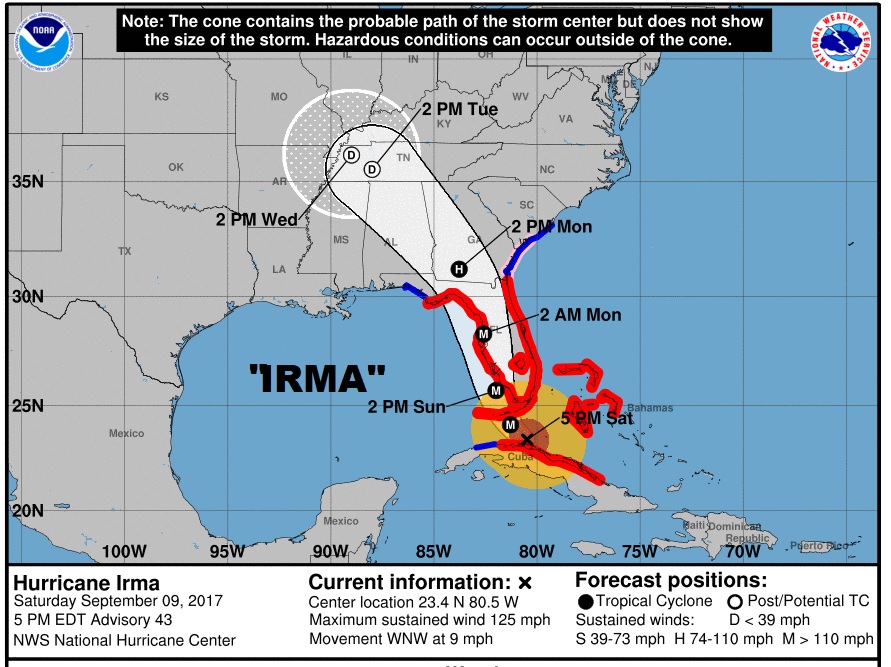
IRMA NOW: Latest 4PM CDT information from the National Hurricane Center: Still a powerful Cat 3 Hurricane, just off the north coast of Cuba, moving WNW at 9 MPH, pressure 933 millibars.
NHC:
Given
the excellent satellite presentation, the lower pressure just
reported by the NOAA plane, and the fact that the hurricane will
move over the warm waters of the Straits of Florida, some
intensification is anticipated during the next 24 hours. Irma is
expected to remain a very dangerous hurricane while it moves near or
over the Florida Keys and near or over the Florida Peninsula. After
48 hours, Irma will be moving farther inland and weakening.

Radar data indicate that Irma is moving toward the west-northwest
at about 8 kt. The turn toward the northwest and north-northwest is
about to begin since the hurricane is already at the western edge of
the subtropical ridge.
IRMA still could be a minimal hurricane in SW Georgia Monday afternoon at 1PM
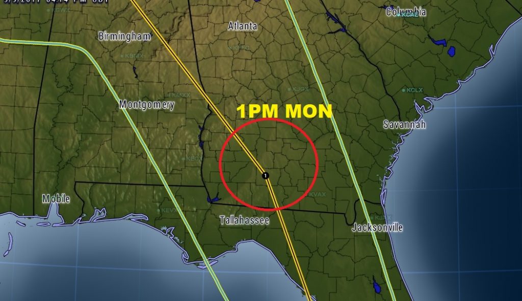
EFFECTS IN ALABAMA: Monday morning, what will then likely be minimal hurricane Irma will depart Florida and enter south Georgia. It will curve left and probably be close to the Alabama/Georgia line, as a tropical storm, by Monday evening. We will be on the west side of storm. The greatest threat of spin up tornadoes is on the other side of Irma’s track.
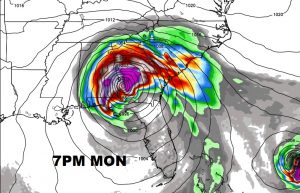
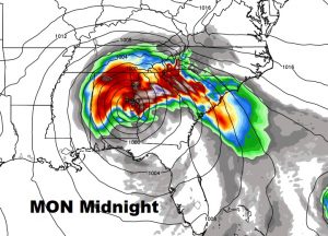
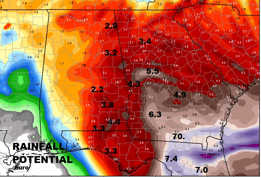
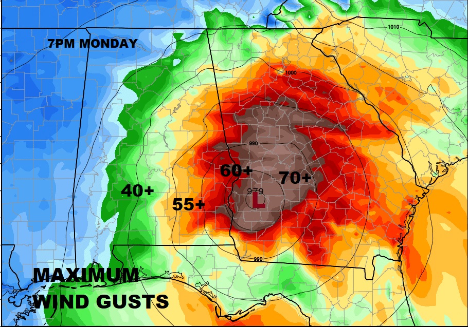
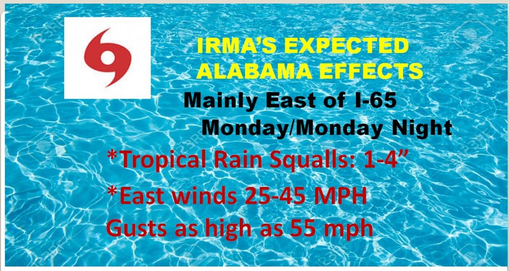
Alabama, especially eastern Alabama, from about I-65 eastward can expect rain squalls around the circulation of Irma. Winds will increase Monday and Monday night, to 25-40 mph sustained, with gusts to near 55 mph (Tropical storm force). Even higher wind gusts possible near the Georgia line. This could bring down some tree limbs and some trees. Can’t rule out power failures, especially anywhere in eastern and and SE Alabama, and even more likely closer to the Georgia border. Map below shows potential rainfall of 1-3” mainly east of I-65, increasing to 3-4”+ in SE Alabama and near the Georgia border. (Notice the swath of extremely heavy rain in Georgia near the path of Irma)
WIND POTENTIAL: Sustained winds of 25-40 mph are a good bet along and east of I-65, increasing as you get closer to the GA border. Wind gusts could easily be as high as 55 mph. This will down, trees, tree limbs and powerlines . Be prepared for power outages in spots Monday and Monday night. Winds will begin to subside by Tuesday morning. You may want to spend a good bit of time Sunday, securing loose objects around the yard and small pieces of patio furniture, which would blow around.
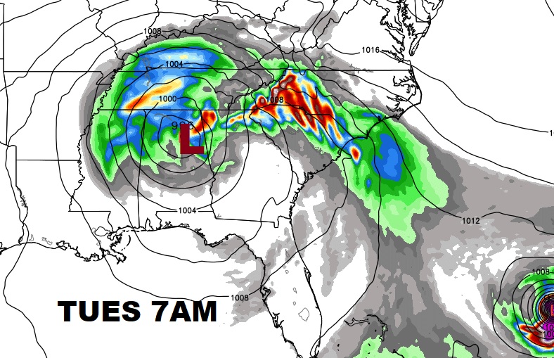
TUESDAY MORNING: By Tuesday morning, Irma will be a depression in NE Alabama and the affects on Central Alabama’s will be gradually relaxed. Gusty winds in the morning and a few left over showers will decrease by afternoon.
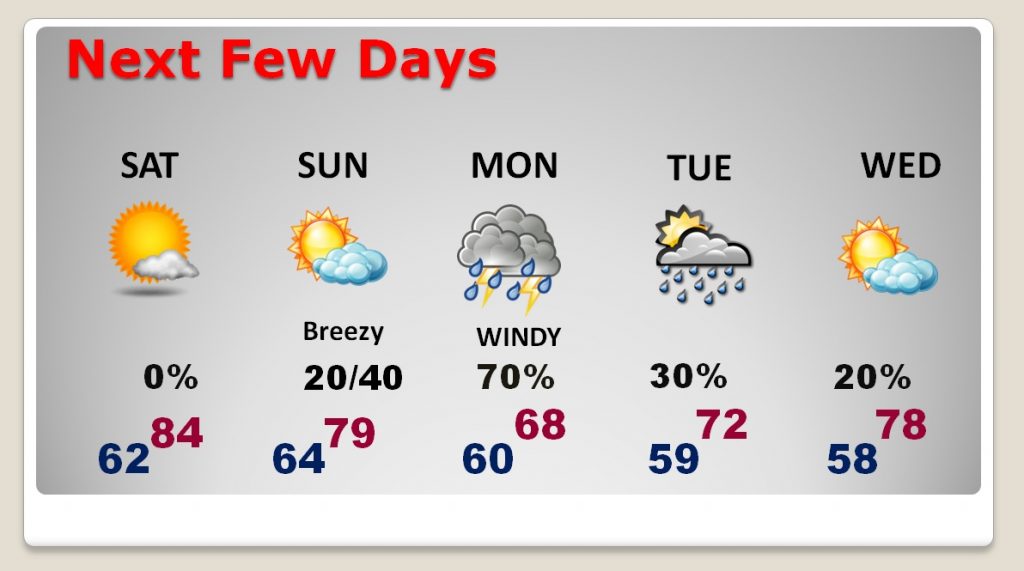
Next Few days:
Please feel free to share this post.
I will have a Special Sunday morning Video Update and Blog post, updating our threat from Irma and tweaking the latest forecast. I’ll see you in the morning. Have a good night!
–Rich