
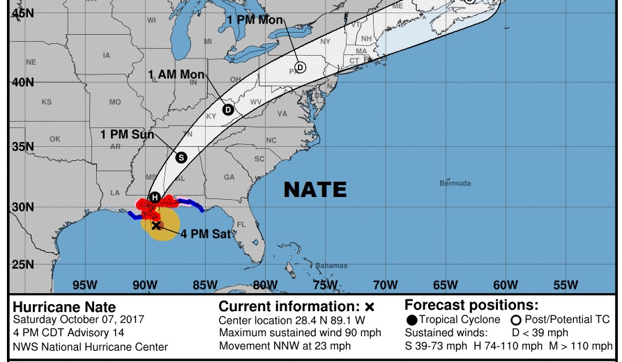
4PM NHC UPDATE: Hurricane Nate is still a 90 mph, Cat 1 hurricane, located about 50 miles south of the mouth of the Mississippi river, moving rapidly to the NNW at 23 mph. Pressure at 981 mbs. Nate is running out of time, but still could reach category 2 status before reaching landfall tonight. It will weaken rapidly as it races northeastward through west Alabama into north Alabama Sunday and Sunday night. Here’s the new NHC forecast cone graphic.
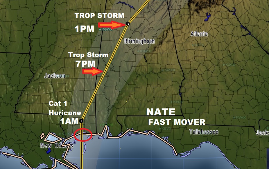
Here’s a closer look at the track which hugs the western Alabama border for much of the day.
Nate will have a very high impact on our weather here in Central Alabama beginning very, very early, perhaps before dawn , continuing through the morning into the afternoon, with diminishing effects late in the afternoon and into the evening.

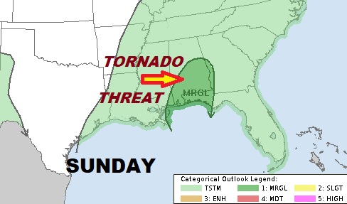
From the Storm Prediction Center.. Spin up tornado threat across central and south Alabama Sunday, east of Nate’s track as it races north.
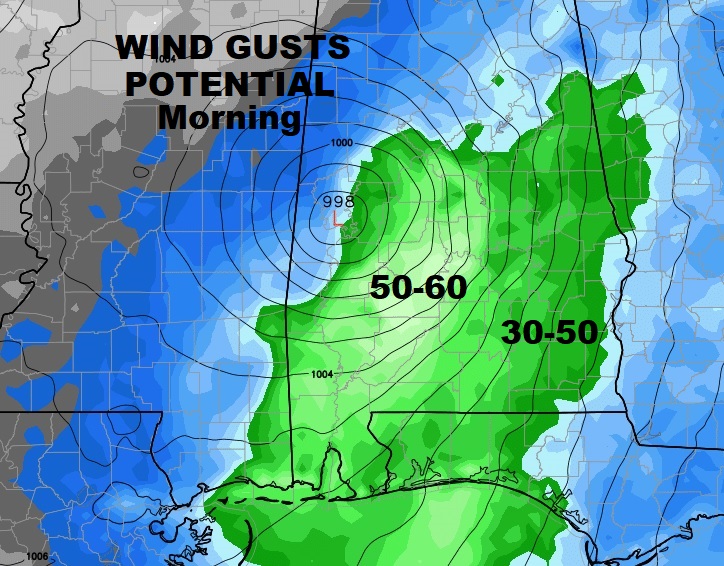
Potential wind gusts could easily be 50-60 mph in parts of central Alabama, more than enough to bring down several trees and cause multiple power failures. Be ready. Pick up loose objects around your yard today. While this
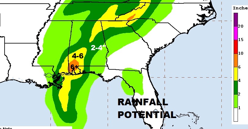
The expected rainfall map has not changed from this morning.
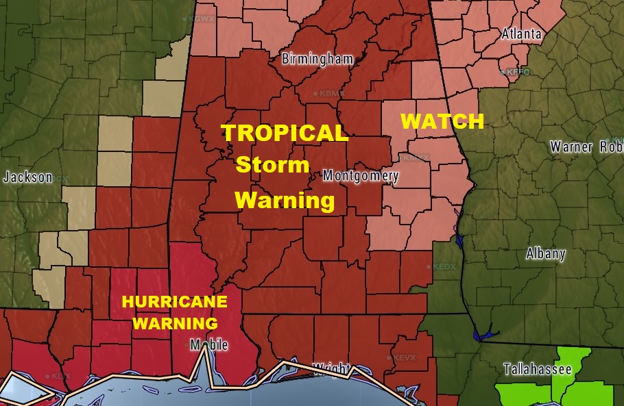
Tropical Storm WARNING now includes a huge area. All but east central Alabama at the moment.
My alarm is set to go off at 1AM. We’ll be LIVE in the Bluewater Weather Center later in the morning. There will be a LIVE stream available on our Weather App, and on our website: richthomasweathernetwork.com, and on You Tube. We will be interrupting across the dial of the 8 Bluewater radio family of stations as needed. Stay up with the latest on Nate. We will do our best to keep you up to date.