
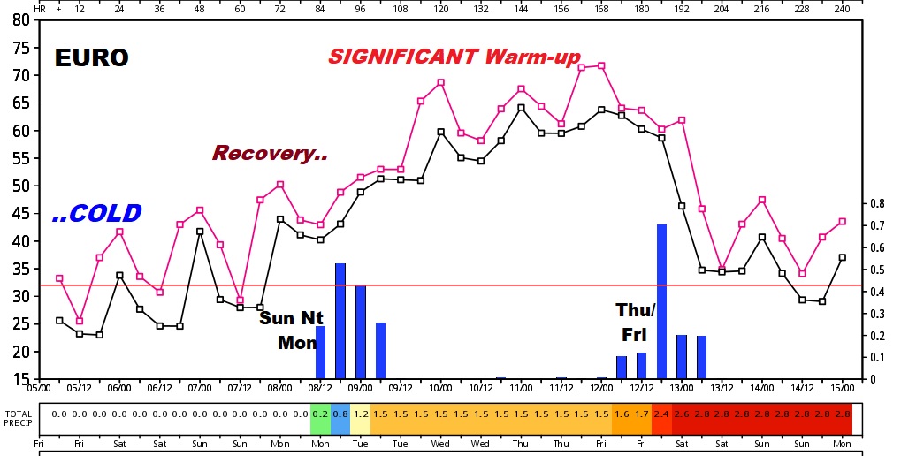
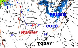
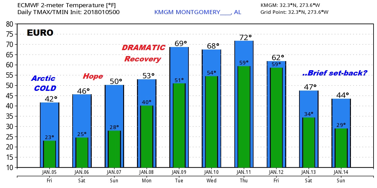
Finally, we have bottomed out, in the Arctic Cellar. Starting Saturday, and continuing through at least Thursday, we will add a few degrees every day to our highs & lows. Gradually, our temperatures will recover. Sixties are a good bet next week, by about mid-week! Hang on. In the meantime, many of us are starting in the teens this morning, including 16° at Alex City and 18° at Prattville and 19° at Selma. Today will be a cold day, but there is now hope, an a reason to be excited, as we look forward to a January Thaw. First off, take a peek at the Euro model trend this morning. You don’t have to be Einstein to see what’s happening here.
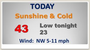
TODAY: After teens this morning, sunshine will at least get us past the 40° mark. High temperature will reach, perhaps 43. Another hard freeze tonight…with lower 20’s expected. Not much wind today, compared to yesterday.
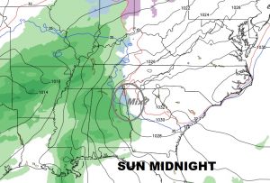
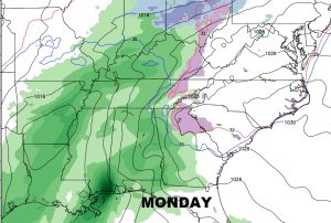
NEXT FEW DAYS: Each day will get a little warmer. It will be slow and gradual. The “normal” or “average” high is 57° The “average” high is 36°. This week we will finally go above normal. A storm system will bring in showers by Sunday night. In fact, showers are likely Sunday night and Monday. Some of us could get 1” of rain. Heavier amounts are a good bet in southeast Alabama and closer to the coast.
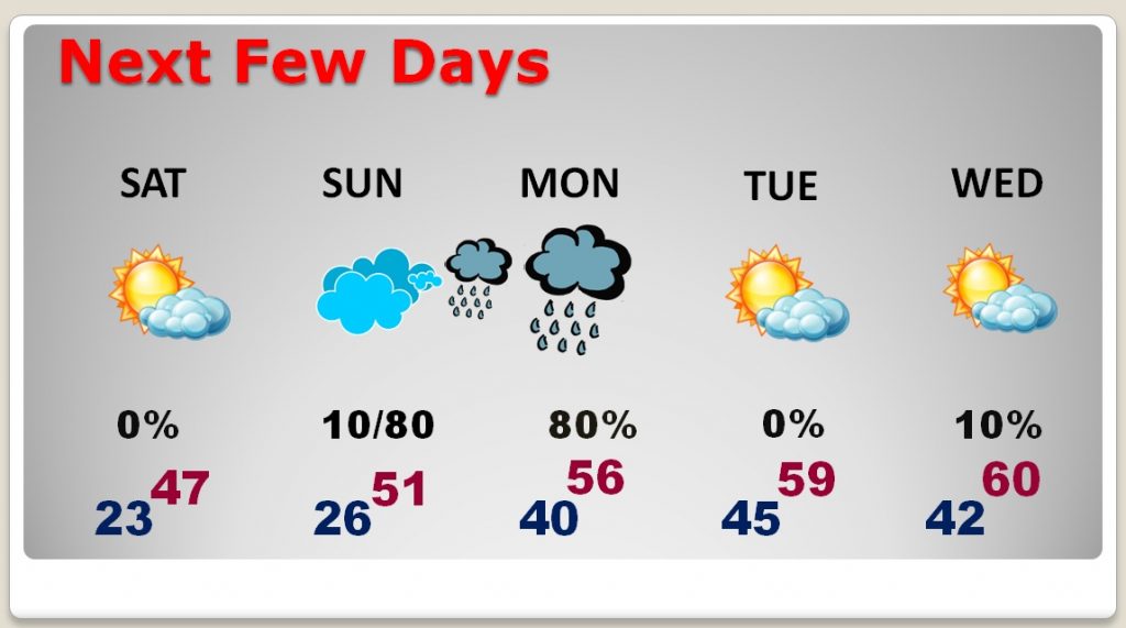
NEXT STORM SYSTEM: We need some rain. Much of the state is in a stage 1 or stage 2 drought. That next storm system will bring in showers by Sunday night. Rain probabilities are quite high from Sunday night through much of Monday. Some of us could get 1” of rain. Heavier amounts are a good bet in SE Alabama and closer to the coast.
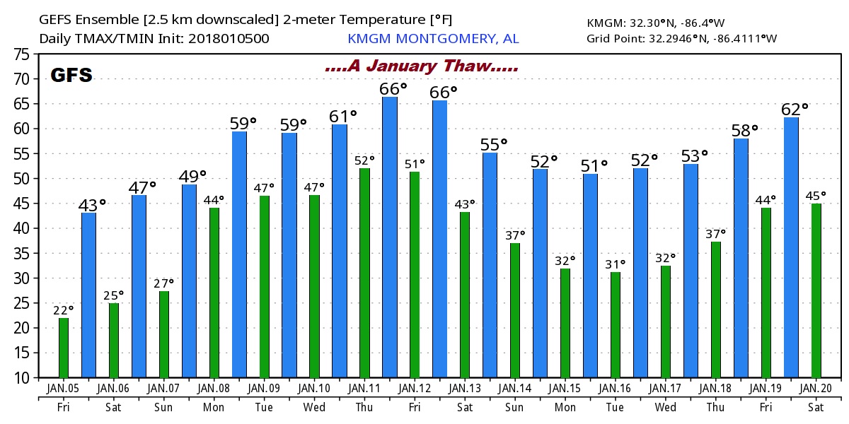
THE GLOBAL MODELS – LOOKING AHEAD: Two words: January Thaw. Or, at least a mini-thaw, perhaps before a more pronounced and lasting thaw. Below are the raw numbers from two key global models…the US GFS and the European (ECMWF) model. Again, I have to add the disclaimer. Do not take the actual numbers literally. We are merely looking at trends, here. The trend is very good. Warmer. The Euro suggests there could be a minor set-back at mid month, followed by a longer, even more definitive January Thaw indicated on the Long Range model. Don’t think though, that winter is over. There’s reason to believe it could return with a vengeance at some point in February, for at least a little while. Stay tuned!
–
NO VIDEO TODAY. I’m still dealing with the flu. But, I Seem to feel a little better this morning. A blog is easier to produce than a video. There will be another Blog post tomorrow morning, too. (and Sunday).
Videos return on Monday morning, I promise! Plus, of course, you will hear my forecast, across the dial, twice an hour on the entire 8 station Bluewater family. I hope you and your family are healthy! Smile. Warmer days are ahead SOON. Stay warm!
–Rich