Our 6 day string of 80+ temperatures ended yesterday, with a record breaking 84. Now today, as expected, a band of rain and thunderstorms is moving through the state, and a secondary surge of rain and storms will soak the state tonight. Fortunately, the severe weather threat has eased for most of us. So, hopefully we get the needed rain without much of a severe weather worry, and maybe some of this pollen will get washed out of the air, for now.
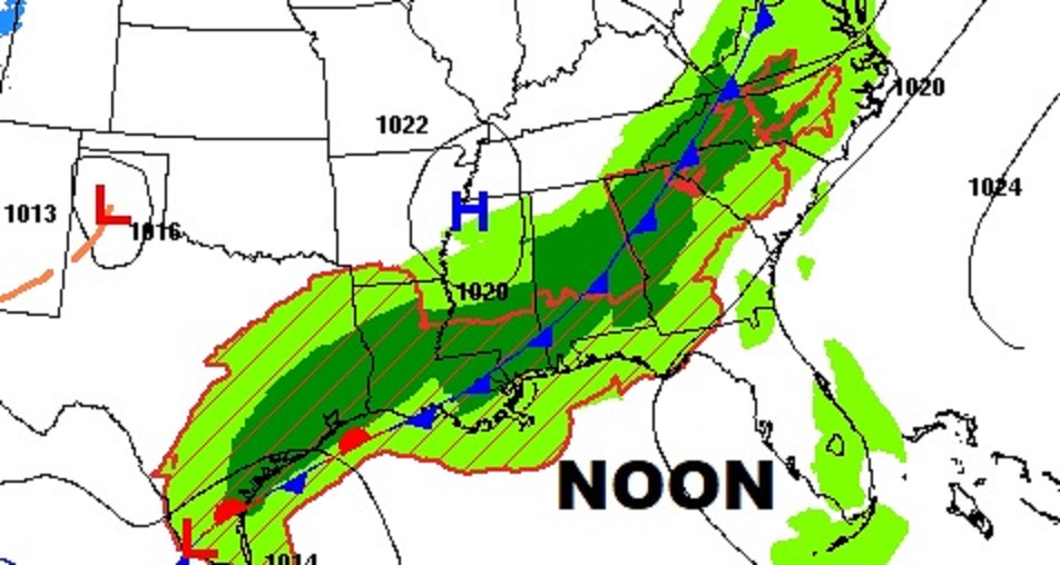
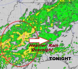
TODAY: A band of rain and storms will continue sliding southward through the day. There may even be a brief lull in the activity around mid-day. But, a secondary disturbance will bring a resurgence to the rain and storms this evening & tonight. Some of the heavier rainfall totals could occur in the overnight hours. Temperatures, which were near 70 at dawn will be steady, then fall to the low 60’s by late afternoon. Winds will gust to near 20 mph at times, shifting to the north behind the front this afternoon. Temperatures fall into the 50’s tonight. Here’s the frontal position at noon.
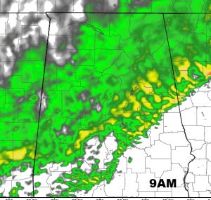
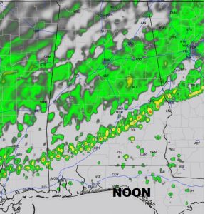
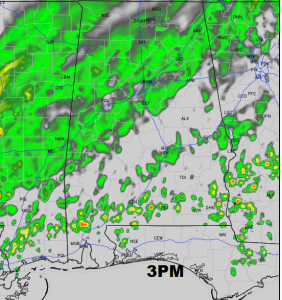
FUTURE RADAR: The shifting band of mainly rain, but a few thunderstorms moves into south central Alabama this morning and into the rest of the state this evening and especially tonight. Here’s just a a few future radar snapshots to give you a sense of the coverage. Our weather app on your phone will show you updated Future Radar throughout the day.
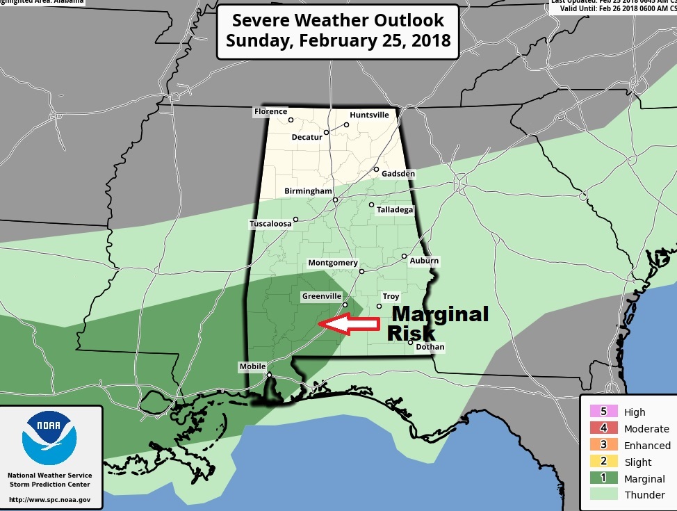
STORM PREDICTION CENTER: Fortunately, the Storm Prediction Center has pulled back on the areal coverage severe weather risk for today/tonight in their latest outlook. Currently they are indicating a Marginal Severe Risk confined to mostly to Southwest coastal Alabama, mainly along and southwest of a Greenville to Camden line. Damaging wind would be the main threat, but a spin up tornado or two is not out of the question. However, severe weather is possible by mid to late week.
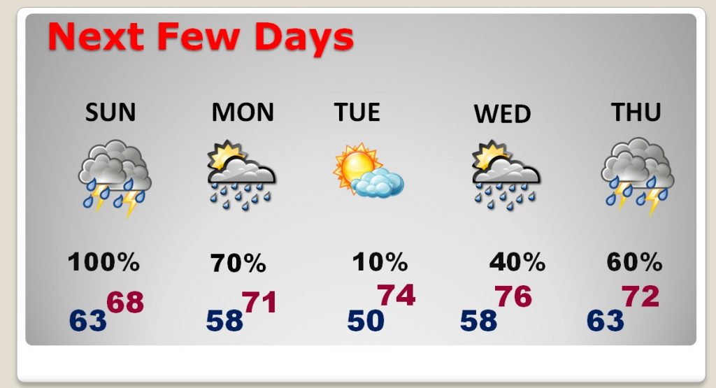
NEXT FEW DAYS: Rain and storms are a good bet through about lunchtime Monday. We get a brief break Tuesday, before another round of showers & storms Wednesday through Thursday. It’s certainly possible that some of the storms could be severe in the Wednesday night through Thursday timeframe. Stay tuned. Will continue to refine and examine that threat as we get closer and details become clearer. The 80’s are gone, but still some mild 70’s are in the cards.
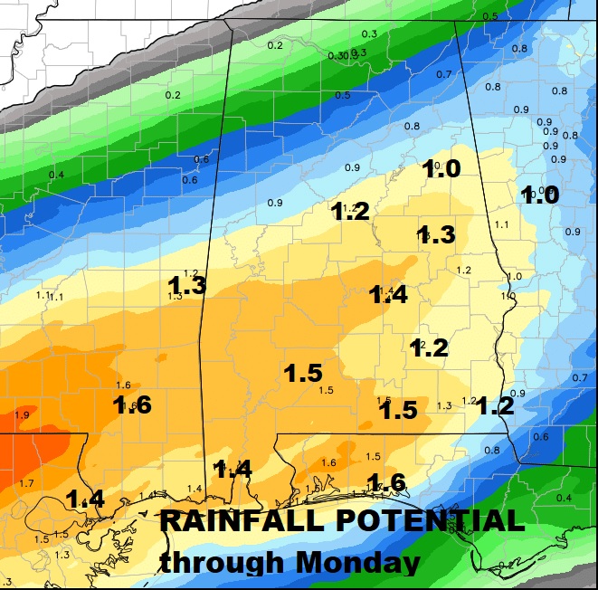
HOW MUCH RAIN?: Just focusing on the rain today, tonight and through Monday… looks like some places could see 1 to 1.5”, which would be nice. That’ll help the pollen problem at least for now.
“TEMPERATURES SLIDE”: So the 80’s are now gone. Look for mostly 70’s this week. Then, as we get into the early Month of March, which begins Thursday, highs fall back to the 60’s and then, perhaps, 50’s for highs and 30s at night, through the first third of the month. What happens after that? Not sure yet. We’ll take another look at this on your complete video in the morning. I don’t think winter is over, and I would be shocked if we did not have more freezes.
—
. Make sure you have our weather app downloaded, and allow push notifications for severe weather alerts. Your Next complete video will be online tomorrow morning at 4:45AM Have a great Sunday!
-Rich
