If you have plans outdoor plans today, like maybe a trip to Zoo Weekend, here in Montgomery, I think much of this day will be dry and comfortable. Shower chances get better this evening, and much better late tonight, in the wee hours of the morning, and through a good part of Sunday. We could see some decent rainfall amounts. Then, colder air funnels into Alabama, again. And, guess what? I think there will be a couple or mornings in the lower 30’s, and there’s a very good chance we will see one more freeze this week.
TODAY: Partly sunny. Clouds will be increasing. Warmer…high 73° Can’t rule out a stray afternoon shower, but chances are small. Slightly better odds of shower or thundershower in the evening hours, but the best chance begins late tonight, in the wee hours of the morning. Low 56°
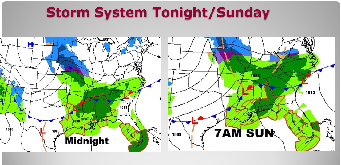
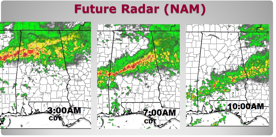
STORM SYSTEM APPROACHES: Showers and storms through the overnight hours will be drenching north Alabama but will be evolving southward as the night goes on. Sunday morning looks storm in central Alabama and eventually into south Alabama. Future radar gives you a sense of how that evolution occurs, keep in mind as you look at these snapshots, that Daylight Saving Time begins at 2AM. Remember: these are just model ideas. Don’t take the times are the aerial coverage literally. This is a forecast idea.
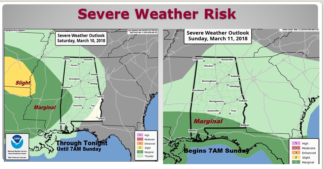
SEVERE THREAT?: Every storm system this time of year is suspect for severe weather. Right now, the Storm Prediction Center has part of west Alabama in a Marginal Risk through 7AM, and then after 7AM, on the Day 2 outlook, much of extreme south Alabama is included in the Marginal Risk. The main threat will be damaging wind gusts. A brief tornado or two can’t be ruled out. I should point out, that SPC will update theses maps 2-3 times today, and they could expand the threat area.
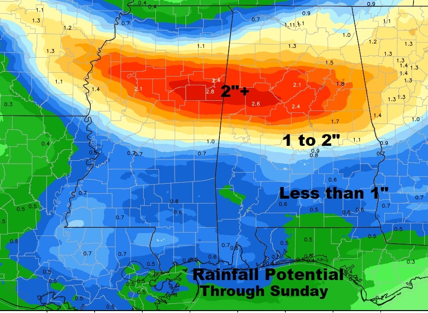
HOW MUCH RAIN?: North Alabama could see drenching 2”+ rainfall. Farther south, central Alabama is likely to see 1 to 2”. The southern counties should see less than 1” based on the current outlook.
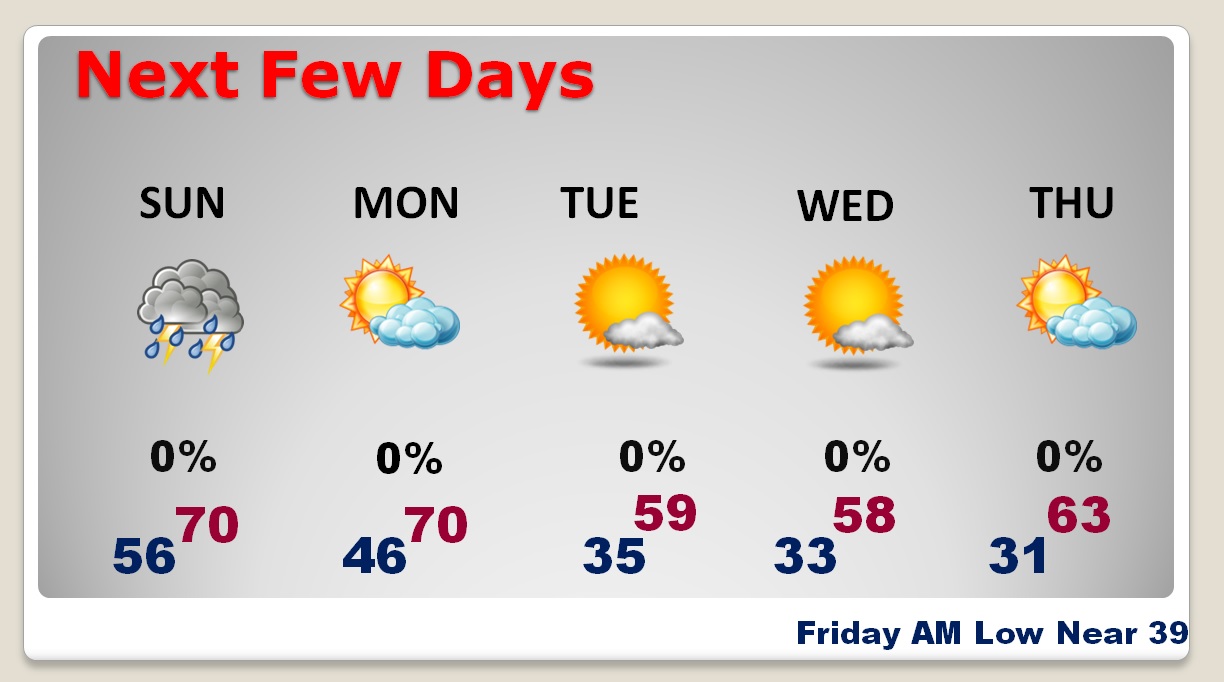
NEXT FEW DAYS: Deja Vu. Just like last week, after the storm system, much cooler air will funnel back into the state. Windy again, with highs in the 50’s and lows in the 30’s. Like last week it appears we will be close to a freeze by Wednesday and Thursday morning. I truly thing this may indeed be the last freeze. There is no way to know that for sure, though.
SPRING FORWARD TONIGHT: Do not forget. This is the night we Spring Forward. Turn the clocks one hour forward late tonight before you go to bed, as we go back to Daylight Saving Time at 2AM. Fortunately, these days, many clocks on many devices automatically make that change for you. Still, though, I always find a handful of clocks that have to be changed manually, like the stove and my car clock.
—
I hope you have a great weekend! There will be another blog update, bright & early tomorrow morning. I’ll have a complete video on Monday morning at 4:45AM.
-Rich
