
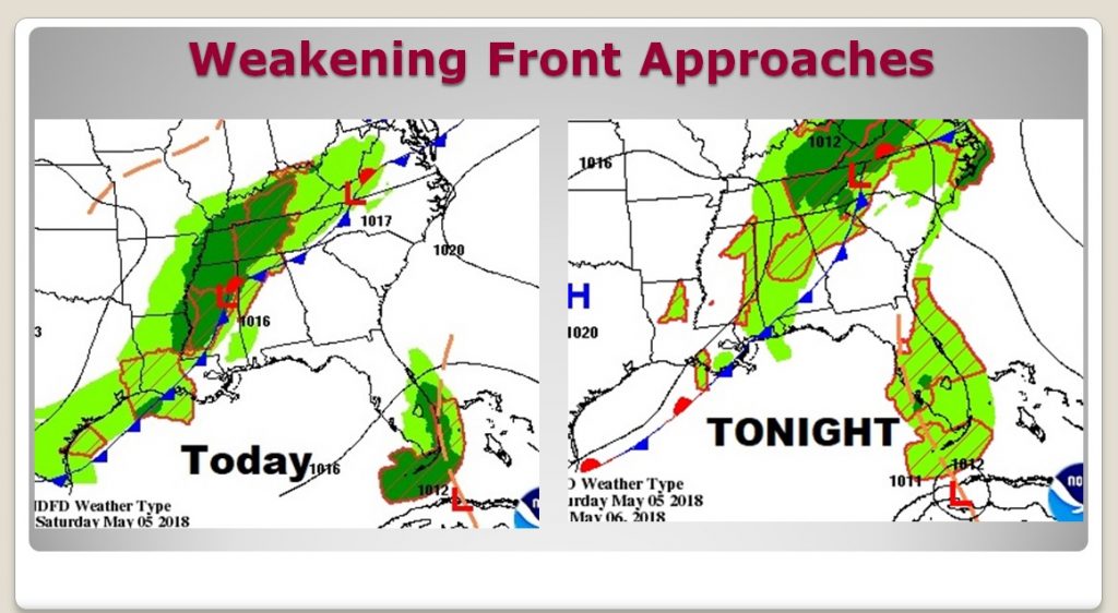
The first weekend in May is always loaded with so many outdoor events and activities. It’s a busy weekend across central & south Alabama, and the forecast is a pretty good one, all things considered. A weakening frontal system is approaching. Locally, rain chances are not zero, but very low during the day today. Spotty showers will be around this evening and tonight. (See future radar below) Tomorrow, behind the front, will be warm and dry with plenty of sun. The very warm, mostly dry pattern, will roll on through next week and beyond.
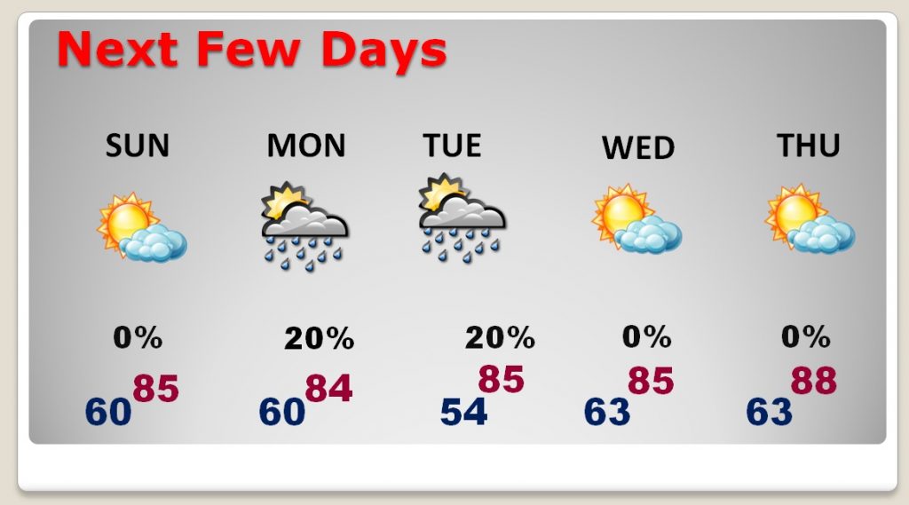
TODAY: There will be a sun/cloud mix. Warm day. High in the mid 80’s. (Yesterday’s high was 87) Rain chances are relatively small, 20% or less today and 20-30% during the evening tonight. Tonight’s low near 60. Mostly cloudy.
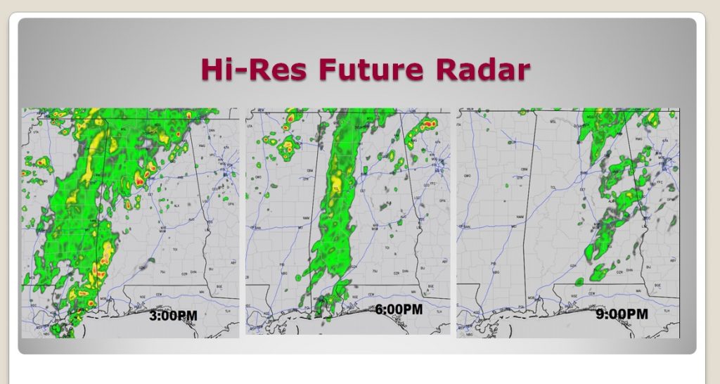
FUTURE RADAR: Notice, on these snapshots, at 3, 6 & 9PM, that the best rain chances are across the western and northwestern part of the state. As the front reaches central Alabama this evening, a weakening line of showers will affect some of us. Some towns will stay dry.
NEXT FEW DAYS: The very warm, mostly dry pattern, will roll on. Highs will generally be in the mid 80s through most of the week, with upper 80’s late week. Rain prospects are very tiny and scant. This is not good. We need some raindrops soon. Remember last May? We had more than a foot on rain! Very unusual for May. This May could be a complete opposite.
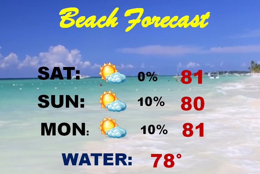
BEACH FORECAST: Looks like a very good Beach forecast. Rain chances are so small, I have removed them. Highs around 80. Water temp is now 78. Caution..The National Weather Service says:
“A moderate risk of dangerous rip currents is expected along area beaches today though tonight.”
—
I hope you have Great Cinco De Mayo weekend, whatever you have planned. I’ll have another blog update for you first thing Sunday morning
Rich