
This is a special day, in that Fall begins this evening, the moon is nearly full, and we have a great space station flyover tonight. But, on the other side of the coin, the heat & humidity is still in place, and the chance for “liquid” heat relief is small. Unfortunately, the hopes for some nice heat relief from a meaningful frontal system is apparently not in the cards for many days. Our wait will continue for much longer than we expected. More on the “frontal delay” below.
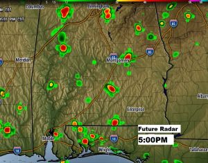
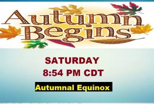
TODAY: It may be the first day of Fall, but today will be just like any summer day. Highs in the lower 90’s. High near 93, Low 72 tonight. There will be abundant sun, mixed with some PM clouds. Widely scattered storms will be roaming around. There are a lot of big games in our state today. If you are headed to Tuscaloosa, your looking at about a 30% chance of storms, for the game starting at 2:30. In Auburn, it looks like less than 20% chance for the 6:30 start. Fall officially arrives at 8:54 PM, the Autumnal Equinox.
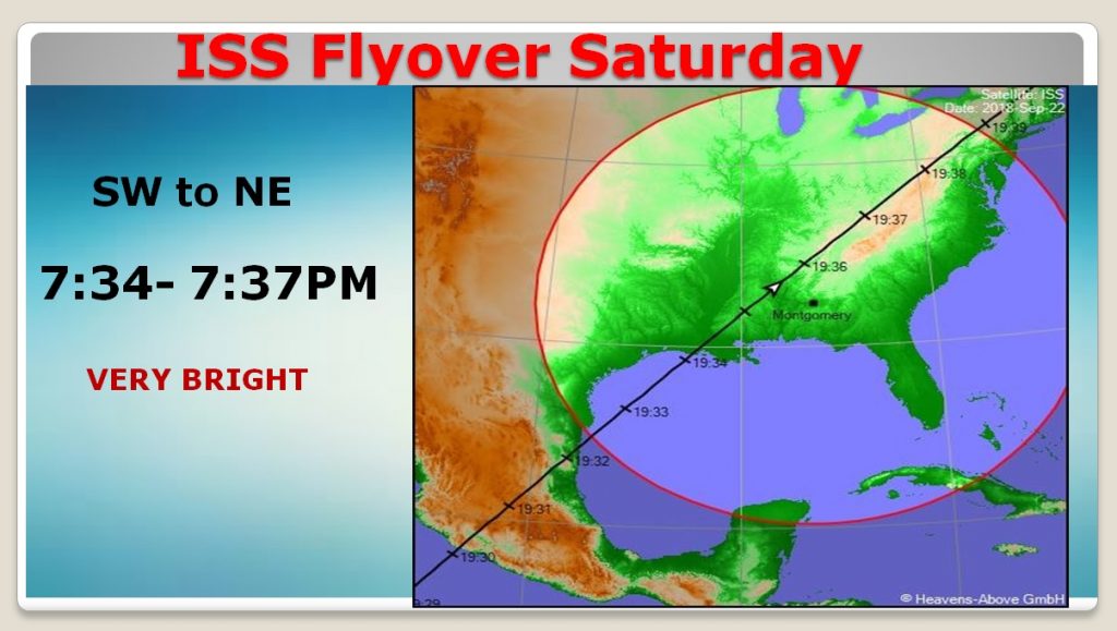
Should be good viewing weather for the ISS flyover. More below.
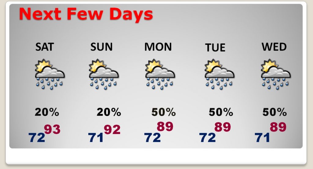
NEXT FEW DAYS: After relatively small weekend rain chances, the daily rain chances ramp up dramatically Monday through Wednesday. That’ll knock the temperatures down just a few degrees, too. The ridiculous humidity will continue all week with no end in sight.
NEARLY FULL MOON & ISS FLYOVER: Officially the Full Harvest Moon is tomorrow night, but it will be 93.2% full tonight, when the Space Station flies over tonight between 7:34 and 7:37PM from southwest to northeast, almost directly overhead, and very bright, at magnitude 3.2. How about that on the first evening of Fall? Set you smart phone alarm so that you remember.
FRONTAL DELAY: When will Relief Arrive?: If you watched some of my videos earlier in the week, there was a spark of excitement that a meaningful “nice front” would make it all the way through the state sometime between Sept. 29 and Oct. 2. That’s not going to happen. A blocking pattern in the atmosphere, will keep the nice air away. Our delay, unfortunately, will apparently be much later. I hate to even speculate on a date. Perhaps the first October weekend? Don’t know yet. The wait goes on. Not anytime soon. Our hopes for relief in the short-term have been dashed.
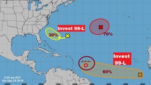
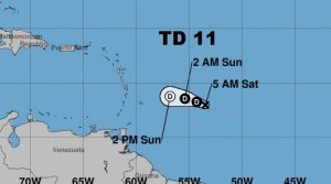
TROPICAL UPDATE: The tropical board looks busy, and yet I don’t see anything that sends up dire warning flags for the next few days. There’s one tropical depression, Eleven, east of the Islands, but it looks like it will encounter a difficult future as it approaches the Caribbean Islands. Invest 98-L is interesting, in that it contains some of the “DNA” of what used to be Florence. It could loop around and tease the Southeast coast, but it is not expected to be a significant system.
—
There will be another Blog update first thing Sunday morning. Have a nice weekend! Enjoy the Football today, and the great show in the sky tonight with the nearly full moon and the ISS Flyover.
Rich