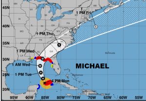
Hurricane Michael is beginning a intensification cycle. Currently located 45 miles from the western tip of Cuba, it has 80 mph wind, moving north at 9 mph. It is expected to undergo a rapid intensification cycle and Michael is forecast to become a major category 3 hurricane by Tuesday or Tuesday night. It should make landfall along the coast of the Florida panhandle on Wednesday afternoon and move northeastward rapidly across the southeast US on Wednesday night and Thursday. The official forecast track has been nudged just slightly westward based on the latest model guidance. The hurricane watch has been changed to a Hurricane WARNING from the Alabama/Mississippi border to the Florida Big Bend near the Swannee River. Tropical storm warning for the Florida west coast. Storm surge warning along the Florida panhandle. Here’s the new forecast cone fron NHC.

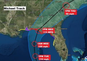
The cone close-up shows maximum intensity of 120 mph south of the coast Wednesday morning and 115 mph winds at landfall Wednesday afternoon, then rapidly moving northeastward, losing intensity quickly into Georgia and across the SE US. Some models suggest Michael could reach category 4 intensity. The storm could be ‘catastrophic’ for parts of the northeast Gulf coast according to NWS in Tallahassee.

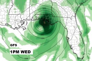
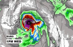
COMPUTER MODELS: it’s interesting to note that, finally, the GFS and EURO models have come together on timing and track on Michael. The Euro has nudged westward and is close to the GFS position. Here’s both models and 1PM Wednesday.


Affects from Michael in Alabama will vary from dramatic and significant in Dothan, to far less dramatic and impactful in the River Region. The exact extent is yet to be determined, pending the exact track of Michael. Main impacts would be from late Wednesday through Wednesday night. Join me in the morning for my video update which will be online by 4:45AM. I will have the latest on track, timing, intensity and Alabama’s expected impacts from Michael.
Rich
