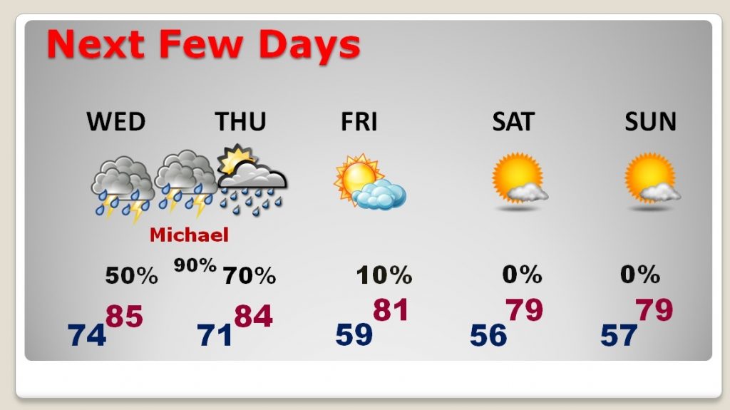
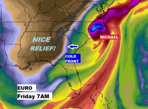
As we continue to follow Michael’s northward progress in the Gulf, the storm is growing stronger and is forecast to be a Major category 3 Hurricane when it makes landfall on the Florida panhandle Wednesday and then races northeast. I have the latest on the track, timing, intensity and I’ll give you a sense of the potential impact where you live. The impact will vary dramatically, for instance between Montgomery and Dothan. Then, after the hurricane, a strong cold front sweeps through the area, bringing a significant change, and nice relief. Wait until you see the temperatures after the front. Lots of good, important information on your Tuesday morning weather briefing.
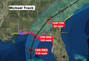
Hurricane warning remains in effect from the Alabama Florida border east to the Florida Big Bend. A hurricane watch and Tropical Storm Warning is in effect on the Alabama coast. Michael, after making landfall Wednesday, will rapidly accelerate NE in through the Carolinas and into the Atlantic.
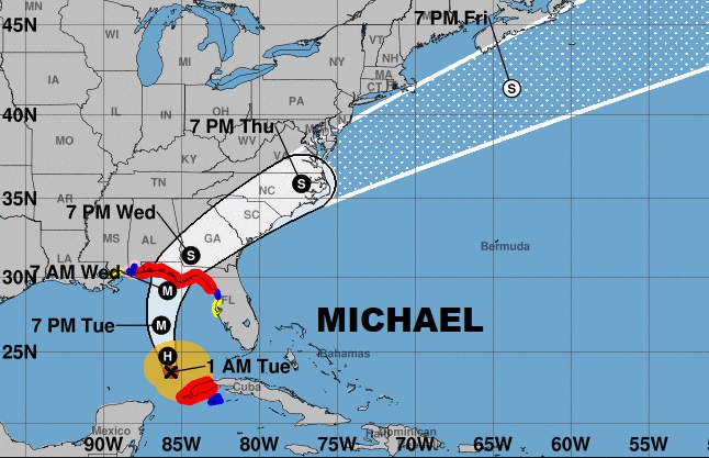
A close up of the cone shows Michael could be a 120 mph, category 3 hurricane at landfall Wednesday afternoon with a potential historic storm surge.
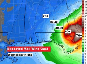
Maximum wind speeds vary from 20+ mph in Montgomery to well over 60+ mph in Dothan. Houston county and Geneva county are under a hurricane WARNING.
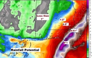
Rainfall totals will be extremely heavy in a narrow band along the hurricane’s path. Notice how the rain totals fall off dramatically into central and west Alabama.
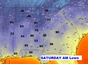
The the wake of Michael, a significant cool front will sweep across the state Thursday night and deliver some very nice air on Friday and through the upcoming weekend. Lowes at night will fall to the 50’s with afternoon highs in the upper 70’s.
