..Severe Weather Threat Late Tonight & Tuesday… The stage is set for severe weather across much of the Mid south today and tonight, and spreading into Alabama late tonight and in through the wee hours of Tuesday. Tornadoes are possible. On this video, we’ll outline what part of the state has the greatest threat and I’ll show you the updated timeline in through Election Day. Active weather week ahead. Another potent frontal system will affect us before this week is over.
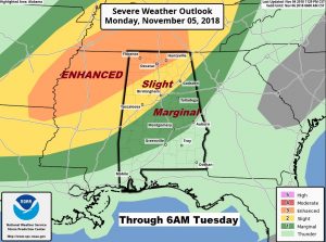
Significant tornado threat in the Enhanced risk area today covering parts of Arkansas, Mississippi, NW Alabama and Tennessee. Stage 2 threat down to the Demopolis area, with the Marginal risk south to Greenville through 6AM Tuesday. All modes of severe weather possible including tornadoes.
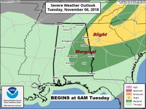
After 6am Tuesday, the Day two threat continues across east central and southeast Alabama on Election Day.
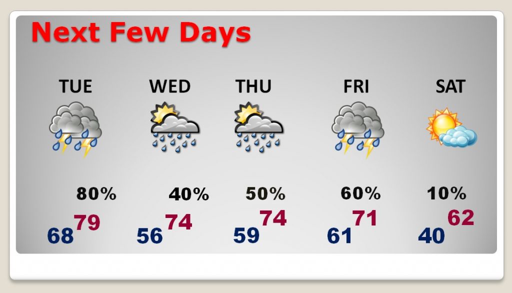
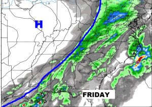
Active weather week ahead with a risk of showers and storms each day. Another strong front Friday. Then, much cooler air funnels in for the next weekend.
Will the next Front on Friday bring another round of strong storms to the state?
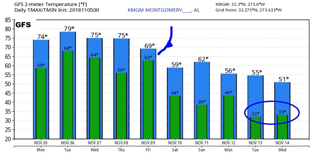
The GFS hints at the first freeze somewhere around November 13 or 14th. Maybe. Stay tuned.
