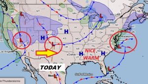
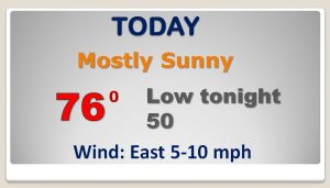
Good Morning! Enjoy today. It should be pristine, and I will be the last beautiful in a long, long time. We are headed for a very active pattern as a series of storm systems line up over the next several days. We need the rain. Will we see any severe weather? On this video, we’ll look and pick out which days will feature the stronger storms. And, I’ll show how much rain we can expect in the next week or so. We will likely put a big dent in our rainfall deficit. There’s much to talk about this morning on your action packed personal weather briefing.
Enjoy today. It will be nearly perfect. We won’t see a day like this in the foreseeable future. Ut’s about to get busy..
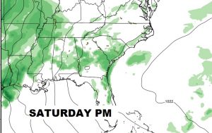
Here’s a look at Future Radar snapshots from tomorrow afternoon and tomorrow night. Active pattern. Showers and storms, some strong.
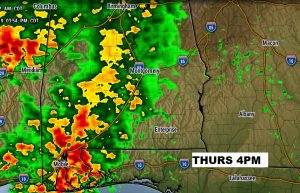

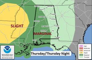
Marginal Severe Risk across a big chunk of the state later tomorrow afternoon and into Thursday night. Damaging wind gusts are the main threat.
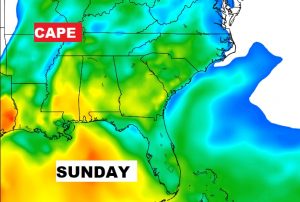
With weekend highs in the lower 80’s, the stage is set for a few strong storms Saturday and Sunday PM. There will plenty of potential energy/instability or CAPE, both days.


Wet and active pattern for the nest several days. Very warm. Highs warming into the 80’s.

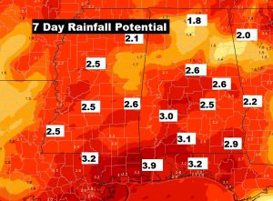
Over the next several days there’s a good chance we’ll put a big dent in our 5.5+ rainfall defect for the year.