
Some of you experienced some strong storms yesterday. Today, though, storms will be few and far between. But, get ready for a potentially stormy Monday and Monday night. A few storms could be strong, possibly severe. Much of the state is in a Marginal Severe risk Monday. A late week storm system will “brush” by the state by late Thursday, but much of the week ahead will be storm-free.
TODAY: This days will start cloudy. Then, gradually it will become mostly sunny by afternoon. High in the low to mid 80’s There will be widely scattered thunderstorms. Many towns will stay dry. The storm threat increases a bit late tonight. A few storms tonight could reach severe limits, mostly west of a Clanton/Selma line. Damaging winds are the main threat.
Here’s the severe weather threat map from the Storm Prediction Center, through 7AM Monday morning.
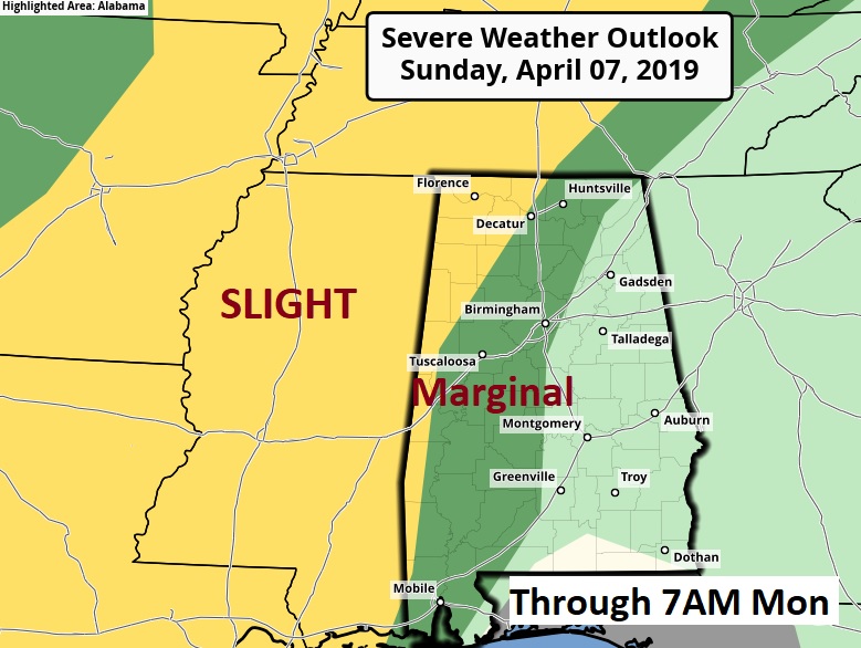
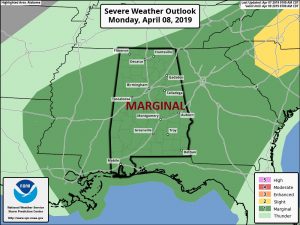
MONDAY STORM THREAT: As a front approaches, showers and thunderstorms become likely. A few storms could become strong possibly severe. Damaging wind gusts are the main threat. A marginal severe weather threat covers the entire area on Monday and Monday night.
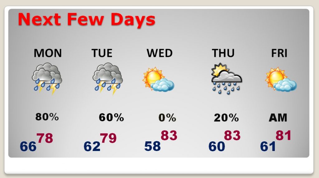
NEXT FEW DAYS: After the storms on Monday and Monday night and part of Tuesday, much of the week ahead will be storm-free. An approaching front late Thursday could bring in a line of stronger thunderstorms.
LOOKING AHEAD: Looks like our next important storm system could affect the area by late Sunday April 14. Looks like there could be a few interesting storm systems in the week that follows. It’s too early to speculate about the severe weather potential of these systems.
POLLEN FORECAST: Very high range today and tomorrow. Moderate to high Tuesday & Wednesday.
—
I’ll have a complete video update Monday morning. We’ll focus in on the details of the week ahead. Have a great day today.
–Rich