Believe it or not, it’s snowing this morning in parts of the Great Lakes and the Midwest. Meanwhile, in Alabama, we will be back in the 80’s again today, as our warming trend continues. We will tease 90° for the first time on Tuesday and Wednesday. Our string of storm-free days will continue through mid week. Showers and thunderstorms return closer to the end of the week.
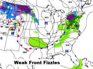
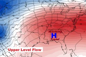
Here’s the set up today. On the Surface a weak front entering the state is fizzling. Maybe a brief shower or 2 somewhere in north Alabama. But, more important, a big Upper High (up at 20,000 ft.) builds, allowing the big warming to continue.
TODAY: Mostly Sunny and warm. High in the mid 80’s. Light westerly wind. Mostly clear tonight. Mild. Low 58.
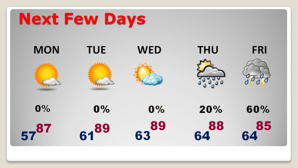
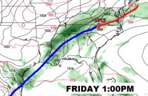
NEXT FEW DAYS: April will end on a very warm note, indeed. Monday’s high will be in the upper 80’s. (Normal high 79). Tuesday and Wednesday we will tease 90° for the first time this year. A few pop showers could show up on Thursday, but the better chance of showers and thunderstorms will arrive with a frontal system on Friday. Warm days, mild nights.
TALLADEGA RACE DAY FORECAST: As a weak approaching front approaches, there could be a brief light shower, but chances are rather remote…20%. Otherwise, a partly cloudy warm day with a high of 81 for the Geico 500 at 1PM.
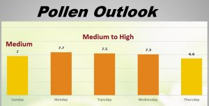
POLLEN FORECAST: Gradually, the amount of pollen in the air is going down. We peaked a few weeks ago. Pollen will be in the medium range today, and medium to high Monday and Tuesday.
—
I’ll have a complete video update Monday morning, online by 4:45AM. We’ll focus in on the details of the week ahead. Have a great Sunday!
–Rich
