
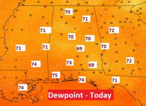
It’s back. Summer heat and humidity with the threat of a few pop up storms, will dominate our weekend forecast. Yesterday’s high in Montgomery was 94. Also creeping up, is the dewpoint. Earlier this week, we were enjoying dewpoints in the 50’s. Today, the dewpoint, sadly, will be close to, if not over 70. Ready or not, summer is back. No surprises over the next few days. Few day to day changes, and nothing to worry about in the tropics.
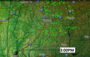
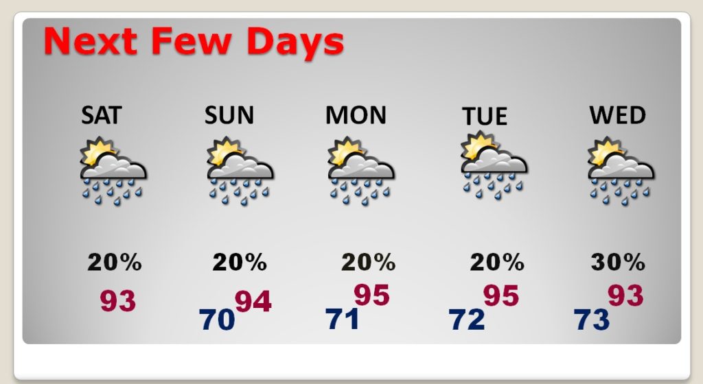
TODAY: I’m going to keep the rain chances relatively low today and tomorrow….close to 20%. Widely scattered storms will pop up here and there in the afternoon and evening. High today 93. Low tonight 70. This Future Radar snapshot will give you a general sense of the rain coverage.
NEXT FEW DAYS: Ouch. Middle 90’s daytime, lower 70’s at night. Spotty afternoon storms. July ends Tuesday. August begins Wednesday. The Dog Days of Summer continue.
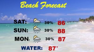
BEACH FORECAST: Routine. Very high humidity with mid 70’s dewpoint. Highs in the mid upper 80’s. Scattered thunderstorms here and there.
TROPICS: The tropics will come alive in August, but for today, the Atlantic, the Caribbean and the Gulf of Mexico are quiet as a mouse.
– -.
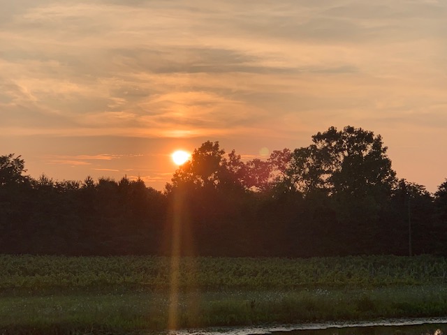
Good morning from the Cleveland, Ohio area. (Sheffield Lake) I’m here for my High School Class Reunion. Here in northern Ohio, on the shores of Lake Erie, we are still enjoying that nice airmass that Alabama had a chance to sample earlier this week. It’s a nice weekend for a reunion. Here’s a Ohio sunset from yesterday evening.
I will have another Blog update tomorrow morning. Have a nice weekend.
-Rich