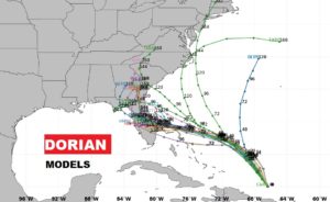
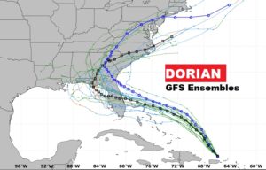
(10AM 8/29/19 Dorian Update)
Latest forecast cone from NHC is quite disturbing. It shows Dorian reaching Category 4 status Sunday in the Bahamas and reaching the Florida coast as a Extremely dangerous Category 4 hurricane with 130 mph winds on Labor Day Monday, The Cone now is as far northwest at Tallahassee.
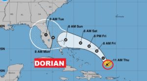 4
4
CONE Blow Up…
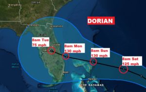
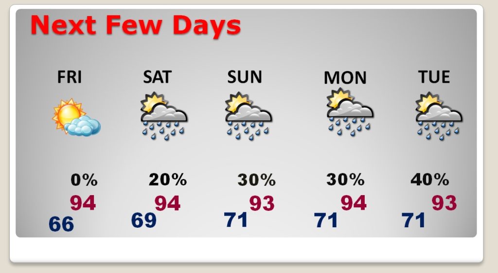
Good morning! Have you been outside yet? You can feel a NICE difference! Today will be enjoyable with the lower humidity, and tonight will feel great as we go back down to the 60’s. Summertime humidity will return of course, along with those random hit or miss storms for the Labor Day weekend. BUT, the big story continues to involve Hurricane Dorian, and the future track of this monster storm. The models simply do not agree on the details. How could Dorian effect Alabama’s weather? I have the updated track from the National Hurricane Center, and I’ll show you what could happen to Dorian after it reaches Florida. This could be an extremely serious Hurricane for the Southeastern US. All eyes on Dorian.
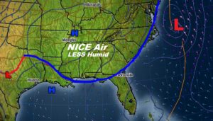
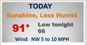
Our humidity break lasts through Friday. Humidity and hit or miss storms are back for the Labor Day weekend.
Hurricane Dorian, with 85 mph winds will become a major Hurricane Friday, and then head for the Bahamas and perhaps arriving in Florida on Labor Day.
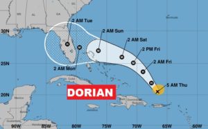
DORIAN will be a major Cat 3 hurricane when it arrives in Florida.
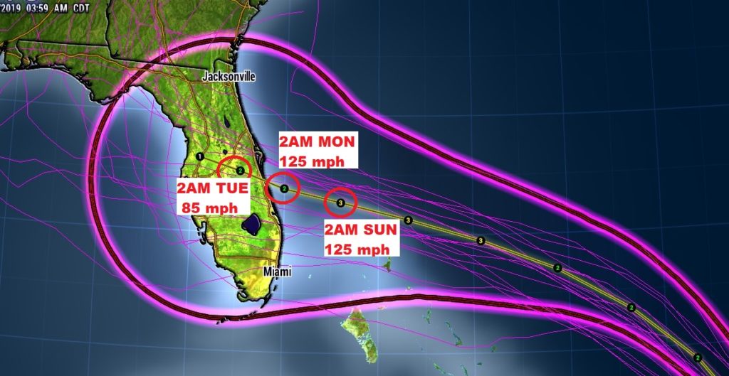
What happens to Dorian’s track after Florida? The models disagree. Stay tuned.
